From Surf Wiki (app.surf) — the open knowledge base
Areas of Edinburgh
none
.jpg)
none
This page lists residential areas in the urban area (settlement) which covers Edinburgh – the capital city of Scotland – and is located mainly in the City of Edinburgh council area and partly in East Lothian.
Localities and Neighbourhood Partnerships
The City of Edinburgh council area is divided into 17 wards, which have been combined into four operational management areas termed "localities":

The localities are further divided into Neighbourhood Partnership (NP) Areas:
Two of the Neighbourhood Partnership areas, Almond NP and Pentlands NP, extend into the rural hinterland in the west of the City of Edinburgh council area, taking in villages such as Kirkliston and Ratho which are not part of the settlement of Edinburgh (however, Juniper Green, Baberton, Currie and Balerno are considered to be contiguous and are included). For the same reason, less than 50% of the North West and the South West localities' territory is with the urban area. to the east of the city, Musselburgh and Wallyford in East Lothian are considered to be contiguous with the main Edinburgh settlement and are also included in the urban area; however, other nearby localities such as Loanhead and Danderhall are not included (this may be adjusted in the future, particularly for Danderhall where 2020s housing developments at the former Edmonstone estate on the local authority boundary with Edinburgh will almost close the gap between the localities).
Other definitions
Main areas
Residential areas can be situated inside or located across borders of the larger Neighbourhood Partnership areas or locality areas. The edges of the residential areas are generally defined by main roads, though actual lines on the ground are not defined precisely. The names of areas are often given to roads and streets in those areas, although this is not always the case.
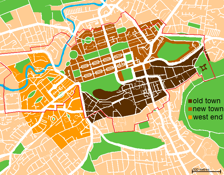
Main residential areas of the Edinburgh urban area:
Smaller areas
Smaller residential areas of the Edinburgh urban area:
- Ardmillan
- Bellevue
- Buckstone
- Bughtlin
- Caiystane
- Cameron Toll
- Church Hill
- Cleikimin
- Clerwood
- Colinton Mains
- Constitution Street
- Craigcrook
- Craighouse
- Craigmount
- Craigour
- Dalkeith Road
- Dalry Colonies
- Duddingston Village
- Dumbryden
- Eastfield
- Ferniehill
- Fettes
- Forrester
- Frogston
- Gayfield
- Gilberstoun
- Gogarloch
- Granton Harbour
- Greenside
- Hawkhill Avenue
- Haymarket
- Holy Corner
- Holyrood
- Hunter's Tryst
- Hutchison
- Hyvots
- Inglis Green
- Jock's Lodge
- Kaimes
- Lauriston
- Leith Links
- Leith Docks
- Little France
- Magdalene
- Marionville
- Maybury
- Mayfield
- Meadows
- Murrayburn
- Newcraighall
- Niddrie House
- Niddrie Mains
- Niddrie Marischal
- North Gyle
- Orchard Brae
- Parkgrove
- Powderhall
- Quartermile
- Redford
- Redhall
- Royston Mains
- Salvesen
- Saughton Mains
- Saughtonhall
- Seafield
- Shaw Colonies
- Silvermills
- St Leonard's
- Stockbridge Colonies
- Swanston
- Telford
- The Christians
- The Dudleys
- The Durhams
- The Jewel
- The Mound
- The Murrays
- The Shore
- Tynecastle
- Wardie
- Wardieburn
- West Craigs
- West Mains
- Westburn
- Wester Broom
References
References
- "Locality Improvement Plans". City of Edinburgh Council.
- "Localities - EVOC". EVOC.
- "Update on locality working - South East and City Centre". City of Edinburgh Council.
- "Localities summary and localities map". Edinburgh Voluntary Organisations’ Council (EVOC ).
- [https://www.scottish-places.info/towns/townfirst8969.html Edmonstone], [[Gazetteer for Scotland]]
- [https://www.edinburgh.gov.uk/downloads/file/23023/edmonstone 231 Edmonstone], [[City of Edinburgh Council]], October 2007
- [https://www.avanthomes.co.uk/about-avant/newsroom/avant-homes-releases-new-detached-houses-for-sale-at-the-lanes-development-in-edmonstone Avant Homes releases new detached houses for sale at The Lanes development in Edmonstone], Avant Homes, 5 December 2023
- [https://www.scarlettdev.co.uk/developments/edmonstone/ Edmonstone (Phases 1 & 2), Edinburgh], Scarlett Developments
- "Natural Neighbourhoods, City of Edinburgh Council Open Spatial Data Portal". City of Edinburgh Council.
- "statistics.gov.scot, City of Edinburgh Council Area, 2011 Intermediate Zones".
- "Musselburgh Paths Leaflet".
This article was imported from Wikipedia and is available under the Creative Commons Attribution-ShareAlike 4.0 License. Content has been adapted to SurfDoc format. Original contributors can be found on the article history page.
Ask Mako anything about Areas of Edinburgh — get instant answers, deeper analysis, and related topics.
Research with MakoFree with your Surf account
Create a free account to save articles, ask Mako questions, and organize your research.
Sign up freeThis content may have been generated or modified by AI. CloudSurf Software LLC is not responsible for the accuracy, completeness, or reliability of AI-generated content. Always verify important information from primary sources.
Report