From Surf Wiki (app.surf) — the open knowledge base
Aras (river)
River in West Asia
.jpg)
River in West Asia
| Field | Value |
|---|---|
| name | Aras |
| image | Jolfa-Aras2.jpg |
| image_caption | The Aras with Nakhchivan (Azerbaijan) to the right and Iran to the left |
| mapframe | yes |
| mapframe-zoom | 5 |
| mapframe-wikidata | yes |
| mapframe-point | none |
| map_caption | Aras River highlighted on a map of the Kura River watershed |
| source1 | Aras |
| source1_location | Bingöl Mountains, Kocagün creek (Varto), Orman Creek (Hınıs), Tekman, Erzurum, Turkey |
| source1_coordinates | |
| source1_elevation | 2288 m |
| mouth | Kura |
| mouth_location | Sabirabad, Azerbaijan |
| mouth_coordinates | |
| mouth_elevation | 0 m |
| subdivision_type1 | Countries |
| subdivision_name1 | |
| length | 1,072 km |
| basin_size | 102,000 km2 |
| discharge1_avg | 285 m3/s |
| progression | |
| name_other | , , , |
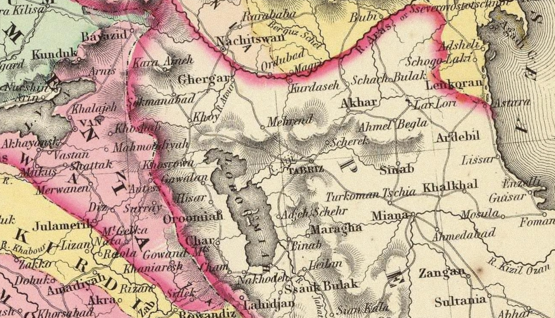
| mapframe-zoom = 5 | mapframe-wikidata = yes | mapframe-point = none The Aras is a transboundary river in the Caucasus. It rises in eastern Turkey and flows along the borders between Turkey and Armenia, between Turkey and the Nakhchivan exclave of Azerbaijan, between Iran and both Azerbaijan and Armenia, and, finally, through Azerbaijan where it flows into the Kura river as a right tributary. It drains the south side of the Lesser Caucasus Mountains, while the Kura drains the north side of the Lesser Caucasus. The river's total length is 1072 km and its watershed covers an area of 102000 km2. The Aras is one of the longest rivers in the Caucasus.
Names
In classical antiquity, the river was known to the Greeks as Araxes (). Its modern Armenian name is Arax or Araks (). Historically, it was called xcl (, hy in modern pronunciation) by Armenians and its Old Georgian name is Rakhsi (რახსი). In Azerbaijani, the river's name is Araz, in Turkish it's Aras. In Persian and Kurdish its name is ارس (Aras).
Geography
The Aras is supported by the Kocagün stream, Dallı stream and Orman stream from the Bingöl Mountains on the borders of Varto district, which merge with it around the Kırıkhan village of Tekman district. It is surrounded by the Aras Mountains from the south. The Aras meets the Akhuryan River southeast of Digor. From Digor it flows along the Armenia–Turkey border, then runs close to the corridor that connects Turkey to Azerbaijan's Nakhchivan exclave, and continues along the Iranian-Armenian and the Iranian-Azerbaijani border. The Aras is fed by several major tributaries, including the Arpa Çayı (also known as the Akhuryan), which gathers the waters from the Kars River and Lake Çıldır located in Turkey, the Hrazdan River, which empties into Lake Sevan in Armenia, and the Qareh Sū, originating from the Sabalān Mountains in northeastern Iranian Azerbaijan.
The lowest point in Armenia is a point along the Aras at an elevation of 380 m.
Tributaries
The following rivers are tributaries of the Aras, from source to mouth:
- Akhuryan (left)
- Metsamor (left)
- Hrazdan (left)
- Azat (left)
- Vedi (left)
- Arpa (left)
- Zangmar (right)
- Naxçıvançay (left)
- Qatur (right)
- Hajilarchay (right)
- Meghri (left)
- Bəsitçay (left)
- Voghji (left)
- Kaleybarchay (right)
- Hakari (left)
- Qarasu/Dareh-Rud (right)
- Köndələnçay (left)
Etymology and history
_Empire_1747_map.JPG)
In Armenian tradition, the river is named after Arast, a great-grandson of the legendary Armenian patriarch Haik. The name was later Hellenized to Araxes and was applied to the Kura–Araxes culture, a prehistoric people who flourished in the valleys of the Kura and Aras. The river is also mentioned in the last chapter of Virgil's Aeneid VIII, as "angry at the bridge," since the Romans built a bridge over it so that it is thereby conquered. The river Aras has been associated with the biblical rivers Gihon and Pishon. Robert H. Hewsen described Aras as the only "true river" of Armenia and as "Mother Araxes," a symbol of pride to the Armenian people.
According to a legend cited by Strabo, in ancient times, the Araxes river in Armenia had no outflow to the Caspian Sea, but spread out in plains and created a lake without outflow.
During Islamic times, the Araxes became known in Arabic parlance as al-Rass (not to be confused with modern-day Ar Rass) and in Perso-Turkish contexts as Aras.
In modern history, the Aras gained significance as a geographic political boundary. Under the terms of the Treaty of Gulistan and the Treaty of Turkmenchay, the river was chosen as the border limit between the Russian Empire and Qajar Iran, as the latter was forced to cede its Caucasian territories to Russia. Because of these 19th-century border changes, one modern, not widely accepted scheme draws Aras River as the line of continental demarcation between Europe and Asia.
In 1963–1970, Iran and the Soviet Union built the Aras Dam near the Azerbaijani city of Nakhchivan, creating the Aras Reservoir. In 1999–2008, Iran built the Khoda Afarin Dam near the historic Khudafarin Bridges, creating the Khoda Afarin Reservoir, and the Giz Galasi Dam 12 km down the river, creating the Giz Galasi Reservoir. Iran and Armenia are planning to build the Meghri Dam near the Armenian town of Meghri.
Aras Valley
In 2006, a bird research and education center was established by KuzeyDoğa, a Turkish non-governmental organization for nature conservation, in the Aras Valley at the village Yukarı Çıyrıklı, in the Tuzluca district of Iğdır Province, Turkey. It is one of Turkey's two bird-ringing stations that remain active yearly. Between 2006 and 2021, more than 145,000 birds of 201 species were ringed, and 306 bird species were observed at this station. Sixty-three percent of the 489 bird species found in Turkey are recorded at this wetland, making it eastern Turkey's most species-rich wetland for birds. The number of ringed and observed 306 bird species comprises 90 percent of the 340 bird species in Iğdır Province, the most bird species rich landlocked province of Turkey. Seven new bird species were observed during the bird ringing activities in 2012 alone, including the raptor Shikra, or Little Banded Goshawk (Accipiter badius), which was new to Turkey's avifauna.
A Biology professor at the University of Utah and a president of the KuzeyDoğa Society, Çağan Şekercioğlu, appealed to the Ministry of Forest and Water Management to drop the Tuzluca Dam project, which would destroy the wetland harboring bird wildlife in the Aras Valley. In 2013, the ministry granted the site the highest level of conservation status (Nature Conservation Area).
Gallery
File:Aras-02.jpg|The Aras in the Poldasht District File:Aras Nehri.jpg|The Aras in Iğdır File:Aras River, Turkey-Armenia-Iran Border Region.JPG|Photograph of the Aras from space File:Araz River.jpg|The Araz near Joulfa File:Aras River with Nagorno Karabakh-Azerbaijan at Right - Iran at Left - Iranian Azerbaijan - Iran (7421349614).jpg|Aras River with Iran to the left and (Karabakh Plains) / Azerbaijan to the right File:Aras river at Nurduz 04.jpg |Aras river at Nurduz, the border post between Iran and Armenia
Notes
References
References
- "Erzurum Mülkî İdare İl Haritası". Harita Genel Müdürlüğü.
- "Bingöl Dağları". Doğa Derneği.
- "Aras Vadisi". Doğa Derneği.
- "Araxes River". [[Encyclopædia Iranica]].
- "Aras River {{!}} river, Asia {{!}} Britannica".
- Curtis, Glenn E.. (1995). "Armenia, Azerbaijan, and Georgia : country studies". [[Federal Research Division]].
- [https://bse.sci-lib.com/article067502.html Аракс], [[Great Soviet Encyclopedia]]
- [https://www.ais.unwater.org/ais/aiscm/getprojectdoc.php?docid=773 Reducing Trans-boundary Degradation of the Kura-Aras River Basin], [[UN-Water]]
- (1997). "The Armenian People From Ancient to Modern Times. Volume I: The Dynastic Periods: From Antiquity to the Fourteenth Century". [[St. Martin's Press]].
- "Strabo, Geography, Book 11, chapter 14".
- (2 December 2014). "Russia at War: From the Mongol Conquest to Afghanistan, Chechnya, and Beyond ...". Abc-Clio.
- "Caucasus".
- (17 November 2012). "News: Meghry Power Plant Kicks off". Iran Water & Power Resources Development Co..
- (2000). "Environmental Performance Reviews - Armenia". United Nations Economic Commission for Europe.
- Bauer-Manndorff, Elisabeth. (1981). "Armenia: Past and Present". Armenian Prelacy.
- "Calumet, A. D. 1672–1757, Rosebmuller, 1768–1835, Kell, 1807–1888, and some other scholars believed the source river [for Eden] was a region of springs. The Pishon and Gihon were mountain streams. The former may have been the Phasis or Araxes, and the latter the Oxus." Duncan, George S. (October 1929) "The Birthplace of Man" ''The Scientific Monthly'' 29(4): pp. 359-362, p. 360
- (13 February 2013). "Aras Kuş Cenneti korunmalı". [[NTV (Turkey).
- "Aras Nehri'ndeki Kuşlara ABD'den El Uzattı". Akdeniz Gazete.
- (13 February 2013). "Afrikalı atmaca Türkiye'de halkalandı". [[NTV (Turkey).
- Ocak, Serkan. (28 July 2013). "Aras Kuş Cenneti müjdesi". [[Radikal]].
This article was imported from Wikipedia and is available under the Creative Commons Attribution-ShareAlike 4.0 License. Content has been adapted to SurfDoc format. Original contributors can be found on the article history page.
Ask Mako anything about Aras (river) — get instant answers, deeper analysis, and related topics.
Research with MakoFree with your Surf account
Create a free account to save articles, ask Mako questions, and organize your research.
Sign up freeThis content may have been generated or modified by AI. CloudSurf Software LLC is not responsible for the accuracy, completeness, or reliability of AI-generated content. Always verify important information from primary sources.
Report