From Surf Wiki (app.surf) — the open knowledge base
Aptos, California
Census designated place in California, United States

Census designated place in California, United States
| Field | Value |
|---|---|
| name | Aptos, California |
| settlement_type | Unincorporated community |
| Census designated place | |
| image_skyline | Seacliff at sunset.jpg |
| image_caption | Sunset at Seacliff State Beach in Aptos |
| image_map | Santa_Cruz_County_California_Incorporated_and_Unincorporated_areas_Aptos_Highlighted.svg |
| map_caption | Location in Santa Cruz County and its location in the state of California |
| pushpin_map | USA |
| pushpin_map_caption | Location in the United States |
| pushpin_relief | 1 |
| coordinates | |
| subdivision_type | Country |
| subdivision_name | United States |
| subdivision_type1 | State |
| subdivision_name1 | California |
| subdivision_type2 | County |
| subdivision_name2 | Santa Cruz |
| established_title | Rancho Aptos |
| established_date | 1833 |
| total_type | CDP |
| unit_pref | Imperial |
| area_footnotes | |
| area_total_sq_mi | 6.58 |
| area_total_km2 | 17.04 |
| area_land_sq_mi | 6.58 |
| area_land_km2 | 17.04 |
| area_water_sq_mi | 0.00 |
| area_water_km2 | 0.00 |
| area_water_percent | 0 |
| elevation_footnotes | |
| elevation_ft | 108 |
| elevation_m | 33 |
| population_as_of | 2020 |
| population_total | 6664 |
| population_density_sq_mi | 1013.07 |
| population_density_km2 | 391.15 |
| population_urban_footnotes | |
| population_urban | 21000 |
| timezone | Pacific |
| utc_offset | −8 |
| timezone_DST | PDT |
| utc_offset_DST | −7 |
| postal_code_type | ZIP codes |
| postal_code | 95001, 95003 |
| area_code_type | Area code |
| area_code | 831 |
| blank_name | FIPS code |
| blank_info | |
| blank1_name | GNIS feature IDs |
| blank1_info | , |
Census designated place
Aptos (Ohlone for "The People" or "Meeting of Two Streams") is an unincorporated community in Santa Cruz County, California, United States. The town is made up of several small villages, which together form Aptos: Aptos Hills-Larkin Valley, Aptos Village, Cabrillo, Seacliff, Rio del Mar, and Seascape. Together, they have a combined population of 24,402.
History
Aptos was traditionally inhabited by the Awaswas tribe of Ohlone people. The name is one of only three native words that have survived (in Hispanicized form) as place names in Santa Cruz County (the others are Soquel and Zayante). In the Awaswas Ohlone language, Aptos may mean "the people" according to Gudde and Bright (2004) or "meeting of two streams" according to Golla (2011).
The first European land exploration of Alta California, the Spanish Portolá expedition, passed through the area on its way north, camping at one of the creeks on October 16, 1769. The expedition diaries don't provide enough information to be sure which creek it was, but the direction of travel was northwest, parallel to the coast. Franciscan missionary Juan Crespi, traveling with the expedition, noted in his diary that, "We stopped on the bank of a small stream, which has about four varas of deep running water. It has on its banks a good growth of cottonwoods and alders; on account of the depth at which it runs it may be that it cannot be utilized to water some plains through which it runs." Crespi diary translator Herbert Bolton speculated that the location was Soquel Creek, but it could have been Aptos Creek.
In 1833 the government of Mexico granted Rafael Castro the 6656 acre Rancho Aptos. Initially Castro raised cattle for their hides, but after California became a state in 1850, Castro leased his land to Americans who built a wharf, general store, and lumber mill. The original town was located where Aptos Village Square is now. In 1853 a leather tannery was built, and the main building is a bed & breakfast inn .
In 1875, Frederick A. Hihn and Claus Spreckels partnered to build the Santa Cruz Railroad, and routed it through Aptos where they both had development interests - Hihn with the Loma Prieta Lumber Company, and Spreckels with his Aptos Hotel resort. The railroad tracks ran directly adjacent to the Santa Cruz Watsonville road, whose route was originally established by the 1769 Spanish exploratory expedition led by Gaspar de Portolá.
In 1878 Augustia Castro, daughter of Rafael Castro, and her husband José Arano built the Victorian, Bayview Hotel in Aptos village. The hotel is a Santa Cruz County landmark. It is Santa Cruz county's oldest operating hotel. It has been a State Historic Monument since 1974 and listed on the National Register of Historic Places since 1993. Since being originally built, the hotel was moved to its current location.
In the mid to late 1800s, a series of major epidemics hit the area. A particularly bad one occurred in the early winter of 1868. Cases of smallpox were reported among the poor of San Juan Bautista. Efforts were made to localize the rapidly spreading disease, such as, barricading the roads leading in and out of San Juan Bautista. These efforts failed however, and when cases appeared in Watsonville, Santa Cruz citizens attempted to again quarantine the disease by destroying the Aptos Bridge. These efforts again failed and only created a rift between the two cities. The death toll of the smallpox epidemic lead to the local press publishing of the latest remedies available for home use as well as methods to prevent the spread of smallpox and inoculations.
By 1872, Claus Spreckels, a sugar millionaire, began buying the land from Castro. He built a hotel near the beach and a summer mansion and ranch with a racetrack for his horses. A large area was fenced and stocked with deer for hunting, and became known as "the Deer Park," home of today's Deer Park Center.
From 1880 to 1920 redwood timber harvesting became the major industry, and Aptos became a boom town. The Loma Prieta Lumber Company logged all of what is now The Forest of Nisene Marks State Park. The Valencia Mill logged everything to the east. Within 40 years the hills were bare, and apples became the next industry. The Hihn Apple Barn is a historic building from that era; in 2016–2017, the building had been relocated nearby to be used as a grocery store and make way for a shopping complex.
On March 16–20, 1905, the Leonard Ranch near La Selva was the site of experiments with a new tandem-wing glider designed and built by John J. Montgomery. Hoisted aloft by hot-air balloon to considerable heights, over a series of test flights pilot Daniel J. Maloney was able to demonstrate the control and flight of the Montgomery glider design. These flights, with starting altitudes over 3,000 feet above the ground, were the first high-altitude flights in the world. A marker was placed at this location in 2005 honoring the centennial of these accomplishments.
After Spreckels' death, Seacliff Park and Rio Del Mar Country Club (today's Seacliff State Beach) were developed in the late 1920s. Rio Del Mar Country Club included a clubhouse, a grand hotel on the bluffs, a beach club, a polo field, and a golf course. The estuary was filled in (now Rio Beach Flats) and the SS Palo Alto cement ship was moored and converted into an amusement pier with restaurants, swimming pool, and a dance pavilion. Both Rio Del Mar and Seacliff were popular during Prohibition as drinking and gambling were discreetly available. These amusements were interrupted by the Great Depression and World War II.
In the early 1960s Aptos began a period of rapid development, including Cabrillo College, Rancho Del Mar Shopping Center, the Seascape Resort development, and many residential developments.
In 2023, Microsoft named a new Windows font after this community.
Geography
_(cropped).jpg)
For statistical purposes, the United States Census Bureau has defined Aptos as a census-designated place (CDP). The census definition of the area is limited in contrast to the local understanding of the area with the same name. The population of the CDP was 6,664 at the 2020 census.{{cite web | access-date = March 31, 2025}} The CDP has a total area of 6.6 sqmi, all land. The southwestern geographical boundary is Monterey Bay, while the northeast boundary is the Santa Cruz Mountains.
Aptos is bisected northwest-to-southeast by the State Route 1 freeway and includes the ZIP codes 95001 and 95003.
Demographics
|align-fn=center 1850–1870 1880–1890 1900 1910 1920 1930 1940 1950 1960 1970 1980 1990 2000 2010
Aptos first appeared as an unincorporated community in the 1970 U.S. census; and as a census-designated place in the 1980 United States census.
2020 census
The 2020 United States census reported that Aptos had a population of 6,664. The population density was 1,013.1 PD/sqmi. The racial makeup of Aptos was 76.1% White, 1.1% African American, 1.2% Native American, 3.9% Asian, 0.3% Pacific Islander, 5.7% from other races, and 11.7% from two or more races. Hispanic or Latino of any race were 16.0% of the population.
The census reported that 98.7% of the population lived in households, 1.3% lived in non-institutionalized group quarters, and no one was institutionalized.
There were 2,675 households, out of which 25.7% included children under the age of 18, 52.4% were married-couple households, 6.1% were cohabiting couple households, 25.2% had a female householder with no partner present, and 16.3% had a male householder with no partner present. 25.1% of households were one person, and 15.4% were one person aged 65 or older. The average household size was 2.46. There were 1,781 families (66.6% of all households).
The age distribution was 17.5% under the age of 18, 6.9% aged 18 to 24, 20.7% aged 25 to 44, 28.9% aged 45 to 64, and 25.9% who were 65years of age or older. The median age was 48.9years. For every 100 females, there were 95.7 males.
There were 2,847 housing units at an average density of 432.8 /mi2, of which 2,675 (94.0%) were occupied. Of these, 76.5% were owner-occupied, and 23.5% were occupied by renters.
In 2023, the US Census Bureau estimated that of the population aged 25 or older, 98.3% were high school graduates and 54.3% had a bachelor's degree. The median household income was $135,349, and the per capita income was $71,896. About 0.9% of families and 4.0% of the population were below the poverty line.
Government
In the California State Legislature, Aptos is in , and in .
In the United States House of Representatives, Aptos is in .
Parks and recreation

Aptos is home to both the Forest of Nisene Marks State Park and Seacliff State Beach California state parks. Hidden Beach has a playground and a path that leads to the ocean. Nisene Marks is popular with hikers and mountain bikers. The San Andreas Fault Zone passes nearby and the epicenter of the M6.9 1989 Loma Prieta earthquake lies within.
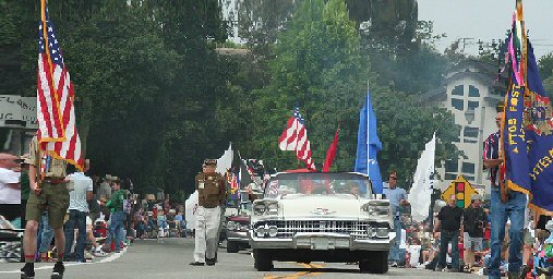
Aptos is also home to the annual Fourth of July "World's Shortest Parade," so called because the parade route is about 0.6 mi long.
Aptos Park is the site of the annual Aptos Blues Festival. Several well-known performers have performed at the festival, including B.B. King, Buddy Guy, John Lee Hooker, Ray Charles, Leon Russell, Los Lobos, Gregg Allman, the Doobie Brothers, Bonnie Raitt, and Al Green.
Education
Cabrillo College is a two-year community college in Aptos.
Aptos has three public elementary schools: Valencia Elementary, Rio Del Mar Elementary, and Mar Vista Elementary. It also has one junior high school, Aptos Junior High School, and one high school, Aptos High School. Private schools include Santa Cruz Montessori School, Orchard School, and Twin Lakes Christian School. Aptos Academy, a pre-school through eighth grade private school, closed in 2013.
Sports
The Aptos Little League baseball team made it to the Little League World Series in 2002, and was the subject of a documentary film on PBS, Small Ball: A Little League Story.
Notable people
- Terry Childs, serial killer convicted of five murders and sentenced to life without parole
- Frank Drake - SETI Founder, prominent Astronomer, Drake Equation.
- Peter Mel, Professional Surfer, attended Aptos High School, class of 1987
- Trent Dilfer, National Football League quarterback, attended Aptos High School, class of 1990
- Nikki Hiltz, professional Runner, attended Aptos Middle School
- Dave Draper, body builder, actor, motivational speaker, and author
- Mark Eichhorn, Major League Baseball pitcher
- Luke Keaschall, Major League Baseball player
- Randy Kramer, Major League Baseball pitcher, scout for the Toronto Blue Jays
- Lou Harrison, composer
- Daniel Henry Holmes Ingalls, Jr., computer scientist
- Harry Hooper, Major League Baseball player and member of the Hall of Fame, lived in Capitola, California and is buried in Aptos. Harry Hooper was one of two players traded by the Boston Red Sox, along with Babe Ruth, that created the Curse of the Bambino.
- Edmund Kemper, also known as the Co-ed Butcher or the Co-ed Killer, an American serial killer, necrophile, and cannibal
- Marisa Miller, model
- Bill Miller, Major League Baseball umpire
- John J. Montgomery, aviation pioneer
- Thomas Pynchon, author
- George Windle Read, Jr., United States Army Lieutenant General
References
References
- "2020 U.S. Gazetteer Files". United States Census Bureau.
- {{Cite GNIS. 1657939. Aptos
- Gudde, Erwin. (2004). "California Place Names". University of California Press.
- "Aptos Demographics". Aptos Chamber of Commerce.
- Golla, Victor. (2011). "Californian Indian Languages". University of California Press.
- Bolton, Herbert E.. (1927). "Fray Juan Crespi: Missionary Explorer on the Pacific Coast, 1769-1774". [[HathiTrust Digital Library]].
- Santa Cruz County History, Santa Cruz Public Library article by Ross Eric Gibson
- Gibson, Ross Eric. "The Spirit of Aptos: 116-Year-Old Hotel to Become Landmark". Santa Cruz Public Libraries.
- Hotel Bayview
- "Hotel Bayview". THE HISTORICAL MARKER DATABASE.
- "The History of Aptos". Aptos History Museum.
- Reader, Phil. "Voices of the Heart: Introduction". Santa Cruz Public Libraries.
- Harwood C.S., Fogel G.B. ''Quest for Flight: John J. Montgomery and the Dawn of Aviation in the West'' University of Oklahoma Press, 2012.
- (2010-09-19). "First High Altitude Aeroplane Flights March 1905 - Aptos, CA - E Clampus Vitus Historical Markers on". Waymarking.com.
- Valentino, Silas. (May 23, 2024). "Aptos is world famous, but nobody in the Calif. town knows why". SFGATE.
- [https://www.cnn.com/2024/02/22/us/microsoft-default-font-aptos-calibri-cec/index.html Why a small change by Microsoft was a big jolt for some users]
- "Decennial Census by Decade".
- "1870 Census of Population - Population of Civil Divisions less than Counties - California - Almeda County to Sutter County".
- "1870 Census of Population - Population of Civil Divisions less than Counties - California - Tehama County to Yuba County".
- "1890 Census of Population - Population of California by Minor Civil Divisions".
- "1900 Census of Population - Population of California by Counties and Minor Civil Divisions".
- "1910 Census of Population - Supplement for California".
- "1920 Census of Population - Number of Inhabitants - California".
- "1930 Census of Population - Number and Distribution of Inhabitants - California".
- "1940 Census of Population - Number of Inhabitants - California".
- "1950 Census of Population - Number of Inhabitants - California".
- "1960 Census of Population - General population Characteristics - California".
- "1970 Census of Population - Number of Inhabitants - California".
- "1980 Census of Population - Number of Inhabitants - California".
- "1990 Census of Population - Population and Housing Unit Counts - California".
- "2000 Census of Population - Population and Housing Unit Counts - California".
- "2010 Census of Population - Population and Housing Unit Counts - California".
- Men, Calvin. (July 4, 2017). "Aptos World's Shortest Parade offers slice of Americana, tradition". [[Santa Cruz Sentinel]].
- "Aptos CDP, California; DP1: Profile of General Population and Housing Characteristics - 2020 Census of Population and Housing".
- "Aptos CDP, California; P16: Household Type - 2020 Census of Population and Housing".
- "Aptos CDP, California; CP02: Comparative Social Characteristics in the United States - 2023 ACS 5-Year Estimates Comparison Profiles".
- "Aptos CDP, California; DP03: Selected Economic Characteristics - 2023 ACS 5-Year Estimates Comparison Profiles".
- "Final Maps {{!}} California Citizens Redistricting Commission".
- {{Cite GovTrack. CA. 20
- Stoffer, Phil. (November 27, 2005). "Chapter 4 - Forest of Nisene Marks State Park: Epicenter of the 1989 Loma Prieta Earthquake". [[United States Geological Survey]].
- "Aptos; World's Shortest 4th of July Parade". sf.funcheap.com.
- "Capitola/Aptos - The APTOS Blues Festival". Portal.clubrunner.ca.
- (21 March 2015). "The Santa Cruz Blues Festival changes its name, leadership and focus, but all else stays the same". [[Santa Cruz Sentinel]].
- "What To Do in Aptos, California (CA)". Zerve.
- (2017-06-06). "Cabrillo College".
- "Valencia Elementary School". [[Pajaro Valley Unified School District]].
- (June 26, 2021). "Search for schools and colleges: Aptos, California".
- (2016-10-19). "Aptos Junior High School".
- "Aptos High School: Home Page".
- (2016-11-04). "Santa Cruz Montessori".
- (2016-11-14). "Orchard School".
- "Twin Lakes Christian School".
- Shanna McCord. (2013-06-13). "Aptos Academy closing its doors after 14 years". Santa Cruz Sentinel.
- "SMALL BALL: A Little League Story Synopsis.". pbs.org.
This article was imported from Wikipedia and is available under the Creative Commons Attribution-ShareAlike 4.0 License. Content has been adapted to SurfDoc format. Original contributors can be found on the article history page.
Ask Mako anything about Aptos, California — get instant answers, deeper analysis, and related topics.
Research with MakoFree with your Surf account
Create a free account to save articles, ask Mako questions, and organize your research.
Sign up freeThis content may have been generated or modified by AI. CloudSurf Software LLC is not responsible for the accuracy, completeness, or reliability of AI-generated content. Always verify important information from primary sources.
Report