From Surf Wiki (app.surf) — the open knowledge base
Ankara Province
Province of Turkey

Province of Turkey
| Field | Value |
|---|---|
| type | metro province |
| name | Ankara Province |
| image_skyline | {{multiple image |
| image1 | Ankara_from_bus_station.jpg |
| perrow | 1/1 |
| border | infobox |
| total_width | 250 |
| image_caption | Ankara skyline |
| image_map | Ankara in Turkey.svg |
| map_caption | Location of the province within Turkey |
| coordinates | |
| seat | Ankara |
| leader_name1 | Vasip Şahin |
| leader_party | CHP |
| leader_name | Mansur Yavaş |
| area_total_km2 | 25632 |
| population_footnotes | |
| population_total | 5782285 |
| population_as_of | 2022 |
| area_code | 0312 |
| blank1_name | ISO code |
| blank1_info | TR-06 |
| website | |
the province of Turkey
Ankara Province (, ) is a province and metropolitan municipality of Turkey with the capital city Ankara. Its area is 25,632 km2, and its population is 5,782,285 (2022).
History
Main article: History of Ankara
The site of the modern city has been home to settlements by many historic Anatolian civilizations in antiquity and classical times, including Phrygians, Lydians, Persians and Alexander the Great, Romans, and Galatians. The city of Ankara became a fortified stronghold of the Byzantines; it fell to the Seljuk Turks and later the Ottoman Empire. It was finally chosen by Mustafa Kemal Atatürk and the Turkish National Movement as the site of the provisional government and the Turkish parliament in 1920, and in 1923 as the capital city of the newly established Republic of Turkey.
Geography
|image-width=2500
|image-left=-585
|image-top=-450
|
|
|
|
Ankara is mostly in the Central Anatolia region, and partly in the Black Sea region. Ankara has mountain forests to its north, and the dry plain of Konya to its south. The province is irrigated by the Kızılırmak and Sakarya River systems, the Sarıyar reservoir and many natural lakes and pools. 50% of the land is used for agriculture, 28% is forest and another 10% is meadow and grazing land. Lake Tuz, the second largest lake in Turkey, partly lies in the Şereflikoçhisar district of the province. The highest point of the province is the 2,015 meters tall Işık Mountain in the Kızılcahamam district.
Districts

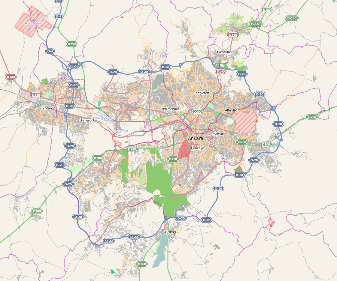
Ankara has 25 districts.
| Number Plates | ||||||
|---|---|---|---|---|---|---|
| (İlçe Kayıt) | District | Population | ||||
| (31.12.2022) | Area (km2) | Density | ||||
| (per km2) | ANKARA City (9 districts / urban) | |||||
| Altındağ, Çankaya, Etimesgut, Gölbaşı, Keçiören, Mamak, Pursaklar, Sincan, Yenimahalle | TOTAL | |||||
| 1872 | Akyurt | 40,625 | 369 | 110 | ||
| 1130 | Altındağ | 413,994 | 123 | 3,365 | ||
| 1157 | Ayaş | 12,998 | 1041 | 12 | ||
| 1167 | Bala | 20,521 | 1,851 | 11 | ||
| 1187 | Beypazarı | 48,357 | 1,697 | 28 | ||
| 1227 | Çamlıdere | 8,100 | 782 | 10 | ||
| 1231 | Çankaya | 942,553 | 483 | 1,951 | ||
| 1260 | Çubuk | 95,449 | 1,198 | 80 | ||
| 1302 | Elmadağ | 44,379 | 647 | 69 | ||
| 1922 | Etimesgut | 614,891 | 273 | 2,252 | ||
| 1924 | Evren | 2,952 | 222 | 13 | ||
| 1744 | Gölbaşı | 150,047 | 1,364 | 110 | ||
| 1365 | Güdül | 8,079 | 540 | 15 | ||
| 1387 | Haymana | 26,016 | 2,164 | 12 | ||
| 1815 | Kahramankazan | 59,123 | 547 | 108 | ||
| 1427 | Kalecik | 12,794 | 1,110 | 12 | ||
| 1745 | Keçiören | 939,279 | 159 | 5,907 | ||
| 1473 | Kızılcahamam | 26,872 | 1,623 | 17 | ||
| 1746 | Mamak | 687,535 | 321 | 2,142 | ||
| 1539 | Nallıhan | 26,553 | 2,079 | 13 | ||
| 1578 | Polatlı | 128,378 | 3,618 | 35 | ||
| 2034 | Pursaklar | 162,389 | 169 | 961 | ||
| 1747 | Sincan | 572,609 | 880 | 651 | ||
| 1658 | Şereflikoçhisar | 33,140 | 2,155 | 15 | ||
| 1723 | Yenimahalle | 704,652 | 219 | 3,218 | ||
| 5,187,949 | 3,991 | 1,300 | ||||
| 5,782,285 | 25,632 | 226 |
| District | 1965 | 1970 | 1975 | 1980 | 1985 | 1990 | 1997 | 2007 | 2012 | 2017 | 2022 | Total | 1,644,302 | 2,041,658 | 2,585,293 | 2,854,689 | 3,306,327 | 3,236,626 | 3,693,390 | 4,466,756 | 4,965,542 | 5,445,026 | 5,782,285 | |||||||||||
|---|---|---|---|---|---|---|---|---|---|---|---|---|---|---|---|---|---|---|---|---|---|---|---|---|---|---|---|---|---|---|---|---|---|---|
| City center | 130,520 | 114,419 | 94,964 | 77,168 | ||||||||||||||||||||||||||||||
| Akyurt | 12,535 | 16,229 | 23,354 | 27,201 | 32,863 | 40,625 | ||||||||||||||||||||||||||||
| Altındağ | 229,228 | 348,254 | 526,072 | 624,313 | 406,948 | 422,668 | 394,632 | 370,735 | 363,744 | 371,366 | 413,994 | |||||||||||||||||||||||
| Ayaş | 16,936 | 17,581 | 18,325 | 17,202 | 21,762 | 20,806 | 18,352 | 13,159 | 13,087 | 12,289 | 12,998 | |||||||||||||||||||||||
| Bala | 41,415 | 42,206 | 44,735 | 45,158 | 46,940 | 37,612 | 35,295 | 23,505 | 17,397 | 21,682 | 20,521 | |||||||||||||||||||||||
| Beypazarı | 34,297 | 36,435 | 37,140 | 38,568 | 42,008 | 45,977 | 46,903 | 46,884 | 46,738 | 48,476 | 48,357 | |||||||||||||||||||||||
| Çamlıdere | 19,596 | 18,982 | 19,444 | 18,521 | 18,341 | 19,365 | 20,992 | 9,329 | 6,739 | 7,389 | 8,100 | |||||||||||||||||||||||
| Çankaya | 496,953 | 683,210 | 927,809 | 968,668 | 667,351 | 714,330 | 765,354 | 792,189 | 832,075 | 921,999 | 942,553 | |||||||||||||||||||||||
| Çubuk | 47,601 | 49,539 | 53,114 | 54,616 | 57,716 | 51,964 | 63,700 | 83,826 | 82,614 | 90,063 | 95,449 | |||||||||||||||||||||||
| Elmadağ | 20,526 | 23,852 | 25,893 | 30,354 | 32,967 | 38,032 | 38,682 | 48,013 | 43,856 | 45,513 | 44,379 | |||||||||||||||||||||||
| Etimesgut | 70,800 | 127,395 | 289,601 | 425,947 | 566,500 | 614,891 | ||||||||||||||||||||||||||||
| Evren | 6,928 | 6,506 | 4,027 | 3,011 | 2,753 | 2,952 | ||||||||||||||||||||||||||||
| Gölbaşı | 31,671 | 43,522 | 49,526 | 73,670 | 110,643 | 130,363 | 150,047 | |||||||||||||||||||||||||||
| Güdül | 18,314 | 18,153 | 18,919 | 15,688 | 19,460 | 18,698 | 22,473 | 10,676 | 8,656 | 8,050 | 8,079 | |||||||||||||||||||||||
| Haymana | 48,908 | 51,256 | 53,275 | 56,171 | 60,823 | 55,527 | 49,730 | 39,310 | 31,058 | 27,277 | 26,016 | |||||||||||||||||||||||
| Kalecik | 28,665 | 29,784 | 27,871 | 28,446 | 27,349 | 25,043 | 25,870 | 17,007 | 13,648 | 12,897 | 12,794 | |||||||||||||||||||||||
| Kahramankazan | 21,837 | 26,076 | 36,147 | 43,308 | 52,079 | 59,123 | ||||||||||||||||||||||||||||
| Keçiören | 443,390 | 536,168 | 615,448 | 843,535 | 840,809 | 917,759 | 939,279 | |||||||||||||||||||||||||||
| Kızılcahamam | 42,649 | 36,645 | 36,686 | 35,513 | 32,162 | 34,456 | 37,906 | 25,288 | 24,635 | 24,947 | 26,872 | |||||||||||||||||||||||
| Mamak | 379,460 | 410,359 | 405,066 | 503,663 | 559,597 | 637,935 | 687,535 | |||||||||||||||||||||||||||
| Nallıhan | 31,141 | 32,713 | 32,769 | 34,389 | 35,718 | 36,779 | 39,952 | 31,768 | 30,299 | 28,621 | 26,553 | |||||||||||||||||||||||
| Polatlı | 63,895 | 74,366 | 75,332 | 86,865 | 95,401 | 99,965 | 104,203 | 118,454 | 119,349 | 124,464 | 128,378 | |||||||||||||||||||||||
| Pursaklar | 119,593 | 142,317 | 162,389 | |||||||||||||||||||||||||||||||
| Şereflikoçhisar | 69,201 | 75,675 | 82,207 | 79,330 | 87,893 | 60,701 | 55,443 | 34,808 | 35,042 | 33,599 | 33,140 | |||||||||||||||||||||||
| Sincan | 59,451 | 101,118 | 220,415 | 413,030 | 479,454 | 524,222 | 572,609 | |||||||||||||||||||||||||||
| Yenimahalle | 122,166 | 175,528 | 246,154 | 330,908 | 382,205 | 351,436 | 507,242 | 614,778 | 687,042 | 659,603 | 704,652 |
The population of the city center was not included after 1980, due to the fact that Ankara received the metropolitan status.
Climate
The climate is hot and dry in summer, rainy in spring and autumn, cold and snowy in winter, wetter in the north of the province than the drier plains to the south. The annual precipitation in the city of Ankara located the center of the province is 415 mm,{{cite web
Demographics
|1927|404,720 |1940|602,965 |1950|819,693 |1960|1,321,380 |1970|2,041,658 |1980|2,854,689 |1990|3,236,626 |2000|4,007,860 |2010|4,771,716 |2020|5,663,322 |2022|5,782,285
Places of interest
- The Mount Sarıçal National Park () is located next to Çulhalar village in the northeast, 25 km northwest of Nallıhan and 185 km northwest of Ankara.
- One of the most beautiful lakes of Ankara is Karagöl in Çubuk.
References
References
- "İl ve İlçe Yüz ölçümleri". General Directorate of Mapping.
- "Address-based population registration system (ADNKS) results dated 31 December 2022, Favorite Reports". [[TÜİK]].
- "Present and future Köppen-Geiger climate classification maps at 1-km resolution". Nature Scientific Data. [[Digital object identifier. DOI]]:[https://www.nature.com/articles/sdata2018214 10.1038/sdata.2018.214].
- "TURKEY: Ankara City". Citypopulation.de.
- (1965). "1965 General Census". [[Turkish Statistical Institute]].
- (1970). "1970 General Census". [[Turkish Statistical Institute]].
- (1975). "1975 General Census". [[Turkish Statistical Institute]].
- (1980). "1980 General Census". [[Turkish Statistical Institute]].
- (1986). "1985 General Census". [[Turkish Statistical Institute]].
- (1991). "1990 General Census". [[Turkish Statistical Institute]].
- (1999). "1997 Population Count". [[Turkish Statistical Institute]].
- "Population Of SRE-1, SRE-2, Provinces and Districts". [[Turkish Statistical Institute.
- "Kizilcahamam-Turkey". Weatherbase.
- "Coğrafi Yapı". Sereflikochisar.gov.tr.
- [https://biruni.tuik.gov.tr/nufusmenuapp/menu.zul Genel Nüfus Sayımları]
- [https://kutuphane.tuik.gov.tr/yordambt/yordam.php tuik]
- "The Results of Address Based Population Registration System, 2020". Turkish Statistical Institute.
- (28 October 2021). "Sarıçalı Dağı Milli Park Olarak İlan Edildi". Tarım ve Orman Bakanlığı 9. Bölge Müdürlüğü.
This article was imported from Wikipedia and is available under the Creative Commons Attribution-ShareAlike 4.0 License. Content has been adapted to SurfDoc format. Original contributors can be found on the article history page.
Ask Mako anything about Ankara Province — get instant answers, deeper analysis, and related topics.
Research with MakoFree with your Surf account
Create a free account to save articles, ask Mako questions, and organize your research.
Sign up freeThis content may have been generated or modified by AI. CloudSurf Software LLC is not responsible for the accuracy, completeness, or reliability of AI-generated content. Always verify important information from primary sources.
Report