From Surf Wiki (app.surf) — the open knowledge base
Anantnag

| Field | Value |
|---|---|
| name | Anantnag |
| native_name | |
| other_name | Islamabad |
| settlement_type | City |
| image_skyline | Anantnag_J&K.jpg |
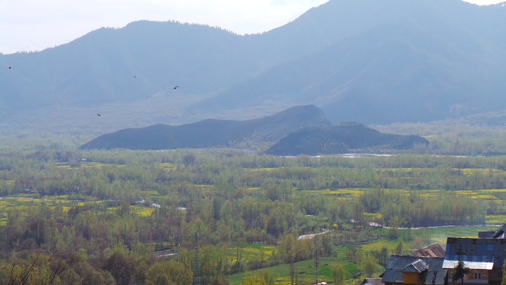
| image_caption | Panorama of Anantnag |
| coordinates | |
| mapframe | yes |
| mapframe-wikidata | yes |
| subdivision_type | Administering country |
| subdivision_name | India |
| subdivision_type1 | Union Territory |
| subdivision_type2 | District |
| subdivision_name1 | Jammu and Kashmir |
| subdivision_name2 | Anantnag |
| established_title | Settled |
| established_date | 5 BCE |
| unit_pref | Metric |
| area_total_km2 | 40.44 |
| area_footnotes | |
| elevation_m | 1601 |
| population_total | 159,838 |
| population_as_of | 2011 |
| population_footnotes | |
| population_density_km2 | auto |
| demographics_type1 | Languages |
| demographics1_title1 | Official |
| demographics1_title2 | Regional |
| demographics1_info1 | Kashmiri, Urdu, Hindi, Dogri, English |
| demographics1_footnotes | |
| demographics_type2 | Demographics |
| demographics2_title1 | Literacy |
| demographics2_info1 | 73.8% |
| demographics2_footnotes | |
| demographics2_title2 | Sex ratio |
| demographics2_info2 | 937.8 ♀/ 1000 ♂ |
| timezone1 | IST |
| utc_offset1 | +5:30 |
| postal_code | 192 101 |
| postal_code_type | PIN |
| area_code | 01932 |
| area_code_type | Telephone code |
| registration_plate | JK 03 |
| website |
| mapframe-wikidata = yes
Anantnag ( ; ), also called Islamabad ( ; ), is the administrative headquarters of Anantnag district of Indian-administered Jammu and Kashmir in the disputed Kashmir region.The application of the term "administered" to the various regions of Kashmir and a mention of the Kashmir dispute is supported by the tertiary sources (a) through (d), reflecting due weight in the coverage. Although "controlled" and "held" are also applied neutrally to the names of the disputants or to the regions administered by them, as evidenced in sources (f) through (h) below, "held" is also considered politicized usage, as is the term "occupied," (see (i) below).
(a) (subscription required) Quote: "Kashmir, region of the northwestern Indian subcontinent ... has been the subject of dispute between India and Pakistan since the partition of the Indian subcontinent in 1947. The northern and western portions are administered by Pakistan and comprise three areas: Azad Kashmir, Gilgit, and Baltistan, the last two being part of a territory called the Northern Areas. Administered by India are the southern and southeastern portions, which constitute the state of Jammu and Kashmir but are slated to be split into two union territories."; (b) (subscription required) Quote: "Aksai Chin, Chinese (Pinyin) Aksayqin, portion of the Kashmir region, at the northernmost extent of the Indian subcontinent in south-central Asia. It constitutes nearly all the territory of the Chinese-administered sector of Kashmir that is claimed by India to be part of the Ladakh area of Jammu and Kashmir state."; (c) C. E Bosworth, University of Manchester Quote: "KASHMIR, kash'mer, the northernmost region of the Indian subcontinent, administered partlv by India, partly by Pakistan, and partly by China. The region has been the subject of a bitter dispute between India and Pakistan since they became independent in 1947"; (d) Quote: "Jammu and Kashmir: Territory in northwestern India, subject to a dispute betw een India and Pakistan. It has borders with Pakistan and China." (e) Quote: "We move from a disputed international border to a dotted line on the map that represents a military border not recognized in international law. The line of control separates the Indian and Pakistani administered areas of the former Princely State of Jammu and Kashmir."; (f) (subscription required) Quote: "... China became active in the eastern area of Kashmir in the 1950s and has controlled the northeastern part of Ladakh (the easternmost portion of the region) since 1962."; (g) Quote: "J&K: Jammu and Kashmir. The former princely state that is the subject of the Kashmir dispute. Besides IJK (Indian-controlled Jammu and Kashmir. The larger and more populous part of the former princely state. It has a population of slightly over 10 million, and comprises three regions: Kashmir Valley, Jammu, and Ladakh.) and AJK ('Azad" (Free) Jammu and Kashmir. The more populous part of Pakistani-controlled J&K, with a population of approximately 2.5 million. AJK has six districts: Muzaffarabad, Mirpur, Bagh, Kodi, Rawalakot, and Poonch. Its capital is the town of Muzaffarabad. AJK has its own institutions, but its political life is heavily controlled by Pakistani authorities, especially the military), it includes the sparsely populated "Northern Areas" of Gilgit and Baltistan, remote mountainous regions which are directly administered, unlike AJK, by the Pakistani central authorities, and some high-altitude uninhabitable tracts under Chinese control." (h) Quote: "Kashmir’s identity remains hotly disputed with a UN-supervised “Line of Control” still separating Pakistani-held Azad (“Free”) Kashmir from Indian-held Kashmir."; (i) Quote:"Some politicised terms also are used to describe parts of J&K. These terms include the words 'occupied' and 'held'." It is located at a distance of 53 kilometres (33 miles) from the union territory's capital Srinagar. It is the third largest city in Jammu and Kashmir after Srinagar and Jammu with an urban agglomerate population of 159,838 and a municipal limit population of 109,433.
Name
The town has been called by both the names Islamabad and Anantnag. The latter is characterised by Marc Aurel Stein as its "Hindu name".
"Anantnag" derives from the name of the spring at the southern end of the town, whose Sanskrit name sa was mentioned in the Nilamata Purana and other texts.
The name Islamabad is believed to have derived from the name of a Mughal governor Islam Khan who built a garden in the area.
Both names are used for the town, Anantnag being preferred by the Hindus and Sikhs while Islamabad is preferred by the Muslims. The locals continue to use the name Islamabad, even though the Indian security forces deployed in the area from 1998 onwards frown on its use.
During the Dogra rule, Anantnag/Islamabad was the headquarters of one of Kashmir Valley's three districts, which was referred to as the "Anantnag wazarat". "Two of Kashmir Province's three districts, Anantnag and Baramula, roughly equated to the Kashmir Valley."
Geography
Anantnag is located at , at an elevation of 5300 ft above sea level, at a distance of 53 km from Srinagar on NH 44 (former name NH 1A before renumbering of all national highways).
| access-date = 2011-05-02 | archive-date = 26 December 2018 | archive-url = https://web.archive.org/web/20181226114950/http://www.hko.gov.hk/wxinfo/climat/world/eng/asia/india/srinagar_e.htm | url-status = dead
Demographics
|1911 | 9,019 |1921 | 9,464 |1931 | 13,752 |1941 | 15,472 |1951 | 16,536 |1961 | 21,087 |1971 | 32,414 |1981 | 40,782 |2001 | 97,896 |2011 | 159,838
There are three definitions of Anantnag:
- Anantnag Municipal Council: population in 2011: 109,433, area: 15.72 km2.
- Anantnag city including outgrowths: population in 2011: 150,592, area: 37.94 km2.
- Anantnag Urban Agglomeration: population in 2011: 159,838, area: 40.44 km2. Including outgrowths, in 2011 the city's population had 77,508 males (52%) and 72,690 females (48%).
Government and politics
The local body for Anantnag is called Municipal Council Anantnag. Anantnag has 25 wards. The local body elections in Anantnag took place in 2018 in which the party Indian National Congress won 20 wards and BJP won 3 wards. The President and Vice President are the elected heads of the Municipal Council. The elections are indirect elections. Hilal Ahmed Shah is the President of Municipal Council Anantnag.
District Development Council
Main article: District Development Council
- Chairperson: Yousuf Gorsi (JKNC)
- Vice-chairpwrson: Javaid Ahmad (JKPDP)
| S.No | Party | Alliance | No. of Members |
|---|---|---|---|
| 1. | INC | UPA | 2 |
| 2. | JKNC | PAGD | 6 |
| 3. | JKPDP | 4 | |
| 4. | Independent | 2 | |
| Total | 14 |
Sites
Masjid Baba Dawood Khaki is among the oldest mosques in the city, being built around 1400 CE.
The Martand Sun Temple is one of the important archaeological sites of Kashmir, built around 500 CE. It temple is situated at Kehribal, 9 km east-north-east of Anantnag and south of Mattan. This famous Sun Temple was destroyed by Ruler namely Sikander Buthshikan of Shahmiri Dynasty.
Economy
In 2010 Anantnag was declared as major City of Export excellence with a total GDP of $3.7 billion. The high GDP of Anantnag is due to the centralised position and presence of high concentration of troops and migrant labours in it. Anantnag has a strategic position lying on the main North-South Corridor Road and with the highest number of tourist destinations it an economic hub of Kashmir Valley. The city suffered heavily during conflict times of the 1990s; many roads, bridges, and government buildings were reduced to ash. But in the 2000s, it made a quick recovery. It has been listed among 100 fastest economically developing cities.
Transport
Road
Srinagar is 53 km from Anantnag on NH 44 (former name NH 1A before renumbering of all national highways). The distances of some other towns from Anantnag are: Achabal 10 km, Kokarnag 23 km, Doru Shahabad 20 km and Pahalgam 39 km. The city is served by National Highway 44. The city is gateway to the Kashmir valley as one side of Jawahar Tunnel opens here.
Rail

Anantnag (ANT) is a station on the 119 km (74 mi) long Banihal-Baramulla line that started in October 2009 and connects Baramulla (BRML) and Srinagar to Banihal (BAHL), Qazigund. The railway track also connects to Banihal across the Pir Panjal mountains through a newly constructed 11 km long Banihal tunnel, and subsequently to the Indian railway network after a few years. It takes approximately 9 minutes and 30 seconds for a train to cross the tunnel. It is the longest rail tunnel in India. This railway system, proposed in 2001, is not expected to connect the Indian railway network until 2017 at the earliest, with a cost overrun of 55 billion INR. The train also runs during heavy snow across the Kashmir Valley.
Education
There are numerous primary, middle secondary and higher secondary schools in the city. Of the higher education, the following establishments are notable:
- University of Kashmir South Campus, Anantnag
- Government Medical College, Anantnag
- Industrial Training Institute, Anantnag
- Government Degree College for Boys, Anantnag
- Government College for Women, Anantnag
- Government Boys Model Higher Secondary School, Brakpora, Anantnag
- Al Ahad College of Education, Anantnag
- Jamia College of Education, Anantnag
- Government Polytechnic College Anantnag
References
References
- (16 December 2020). "Govt orders establishment of official language section in GAD". [[Greater Kashmir]].
- "Anantnag City Census 2011 data".
- Stein, M. A. (1899). "Memoir on Maps Illustrating Ancient Geography of Kashmir". Baptist Mission Press.
- (1890). "Gazetteer of Kashmir and Ladak". Superintendent of Government Printing.
- (15 February 2018). "Anantnag or Islamabad? What is the actual name of this South Kashmir district?". Kashmir Watch.
- Ahmad, Khalid Bashir. (2017). "Kashmir: Exposing the Myth behind the Narrative". SAGE Publishing India.
- Bhat, M. Ashraf. (2017). "The Changing Language Roles and Linguistic Identities of the Kashmiri Speech Community". Cambridge Scholars Publishing.
- "What is in a name – Islamabad".
- [http://www.fallingrain.com/world/IN/12/Anantnag.html Falling Rain Genomics, Inc – Anantnag]. Fallingrain.com.
- "A-4 Towns And Urban Agglomerations Classified By Population Size Class In 2011 With Variation Since 1901". Office of the Registrar General & Census Commissioner, Ministry of Home Affairs, Government of India}}
{{cite report. - (July 2016). "District Census Handbook Anantnag, Part B". Census of India 2011.
- "Municipal Council Anantnag {{!}} District Anantnag, Government of Jammu & Kasmir {{!}} India".
- (19 July 2018). "Office of the Chief Electoral Officer Jammu and Kashmir – Notification".
- (2018-10-20). "J&K municipal polls: Congress wins Anantnag, sweeps Leh, BJP makes its mark in Valley".
- "President Municipal Council Anantnag awarded for his fight against COVID-19".
- (1 December 2010). "Centre declares Srinagar, Anantnag as 'Export Excellence towns'". [[The Economic Times]].
- "Anantnag Pin code". citypincode.in.
This article was imported from Wikipedia and is available under the Creative Commons Attribution-ShareAlike 4.0 License. Content has been adapted to SurfDoc format. Original contributors can be found on the article history page.
Ask Mako anything about Anantnag — get instant answers, deeper analysis, and related topics.
Research with MakoFree with your Surf account
Create a free account to save articles, ask Mako questions, and organize your research.
Sign up freeThis content may have been generated or modified by AI. CloudSurf Software LLC is not responsible for the accuracy, completeness, or reliability of AI-generated content. Always verify important information from primary sources.
Report