From Surf Wiki (app.surf) — the open knowledge base
Ambrym
Volcanic island in Vanuatu
Volcanic island in Vanuatu
| Field | Value |
|---|---|
| name | Ambrym |
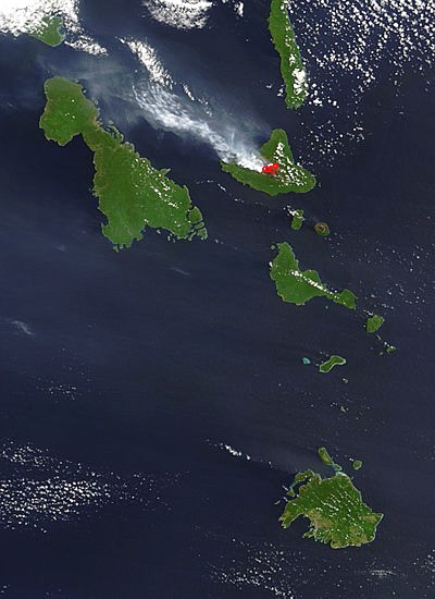
| image_name | Ambryn sentinel-2.jpg |
| map_image | Vanuatu - Ambrym.PNG |
| map_caption | Map of Ambrym |
| location | Pacific Ocean |
| coordinates | |
| archipelago | New Hebrides |
| area_km2 | 677.7 |
| elevation_m | 1334 |
| country | Vanuatu |
| country_admin_divisions_title | Province |
| country_admin_divisions | Malampa |
| population | 7,275 |
| population_as_of | 2009 |
| ethnic_groups | Ni-Vanuatu |
Ambrym is a volcanic island in Malampa Province in the archipelago of Vanuatu. Volcanic activity on the island includes lava lakes in two craters near the summit.
Etymology
Ambrym (also known as Ambrin, "ham rim" in the Ranon language) was allegedly named by Captain Cook, who is said to have anchored off there in 1774. In fact, his expedition never touched Ambrym.
Geography
Located near the center of the Vanuatuan archipelago, Ambrym is roughly triangular in shape, about 50 km wide. With 677.7 km2 of surface area, it is the fifth largest island in the country. The summit at the centre of the island is dominated by a desert-like caldera, which covers an area of 100 km2. With the exception of human settlements, the rest of the island is covered by a dense jungle.
Important Bird Area
The western part of the island, comprising 17,605 ha of forest, together with gardens around habitation, has been recognised as an Important Bird Area (IBA) by BirdLife International because it supports populations of Vanuatu megapodes, Tanna fruit doves, red-bellied fruit doves, grey-eared honeyeaters, cardinal myzomelas, fan-tailed gerygones, long-tailed trillers, streaked fantails, Melanesian flycatchers, buff-bellied monarchs and Vanuatu white-eyes.
Volcanology
Ambrym is a large basaltic volcano with a 12-km-wide caldera, and is one of the most active volcanoes of the New Hebrides volcanic arc. The caldera is the result of a huge Plinian eruption, which took place around AD 50. Its explosive force is rated 6, the third highest in the Smithsonian Institution's Volcanic Explosivity Index ranks of the largest volcanic explosions in recent geological history.
While at higher elevations cinder cones predominate, the western tip of the island is characterized by a series of basaltic tuff rings, of which the largest is about 1 km in diameter. These were produced by phreatic eruptions when magma contacted the water table and water-saturated sediments along the coast. The massive, 1900-year-old, 12 km × 8 km caldera is the site of two active volcanic cones, Benbow and Marum (also spelled Maroum). Mount Benbow was named after English Admiral John Benbow (1653–1702) by Captain Cook.
Several times a century, Ambrym volcano has destructive eruptions. Mount Benbow last erupted explosively in 1913, destroying the mission hospital at Dip Point. Volcanic gas emissions from this volcano are measured by a Multi-Component Gas Analyzer System, which detects pre-eruptive degassing of rising magmas, improving prediction of volcanic activity.
In March 2017, Google added Marum crater with its lava lakes to Google Streetview. Since the last fissure eruption on 16 Dec 2018, the lava lake has disappeared.
Demographics
With the neighbouring island of Malakula and a few smaller islands, Ambrym forms Malampa Province. The population of 7,275 inhabitants lives mainly off coconut plantations in the three corners of the island.

Languages
Like many islands in Vanuatu, Ambrym has its own Austronesian languages.
In the north:
- Fanbyak
- North Ambrym language
In the southeast:
- Vatlongos (Southeast Ambrym language)
In the southwest:
- Daakie
- Daakaka
- Dalkalaen
- Lonwolwol
- Raljago
Towns and villages
Southwest
- Fali, Craig Cove, Baiap, Sesivi, Port Vato, Bwele, Lalinda, Tow, Yaotilie, Sanesup, Emiotungan, Maranata and Pelibetakever
Southeast
- Maat, Paamal, Toak, Uléi, Utas, Tavéak, Asé, Pawé, Saméo, Endu, Pahakol and Benebo
North
- Ranuetlam, Ranon, Olal, Fanla, Linboul, Wilit, Lonwara, Fona, Nebul and Megham
Tourism
Tourists are attracted by Ambrym's active volcanoes, tropical vegetation, and the customs of the local villagers. They stay in traditional bungalows, as there are no hotels on the island.
Transportation
The island is served by two airports, Ulei Airport in the southeast and Craig Cove Airport in the southwest.
Popular culture
Ambrym is featured in the 2016 Werner Herzog documentary, Into the Inferno.
Episode two of the BBC documentary "Into the Volcano" hosted by Kate Humble was filmed on Ambrym in 2014.
References
References
- (19 Feb 2018). "Ambrym volcano". Volcano Discovery.
- "Ambrim: Vanuatu, name, geographic coordinates and map". Geographical Names.
- "Ambrim". Destination Vanuatu, South Pacific.
- "Ambrym Volcano, Vanuatu". John Seach.
- . (2021). ["Ambrym West"](http://datazone.birdlife.org/site/factsheet/ambrym-west-iba-vanuatu). *BirdLife International*.
- "Real-Time Multi-GAS sensing of volcanic gas composition: experiences from the permanent Etna and Stromboli networks, Geophysical Research Abstracts, Vol. 11, EGU2009-5839".
- (March 15, 2017). "Journey under the Earth's surface in Street View".
- "Global Volcanism Program | Ambrym".
- 2009 National Census of Population and Housing, Vanuatu National Statistics Office
- Franjieh, Michael. (January 1, 2019). "The languages of northern Ambrym, Vanuatu: A guide to the deposited materials in ELAR". Language Documentation and Conservation.
- "Ambrym".
This article was imported from Wikipedia and is available under the Creative Commons Attribution-ShareAlike 4.0 License. Content has been adapted to SurfDoc format. Original contributors can be found on the article history page.
Ask Mako anything about Ambrym — get instant answers, deeper analysis, and related topics.
Research with MakoFree with your Surf account
Create a free account to save articles, ask Mako questions, and organize your research.
Sign up freeThis content may have been generated or modified by AI. CloudSurf Software LLC is not responsible for the accuracy, completeness, or reliability of AI-generated content. Always verify important information from primary sources.
Report