From Surf Wiki (app.surf) — the open knowledge base
Alton Pancras
Village in Dorset, England
Village in Dorset, England
| Field | Value | ||
|---|---|---|---|
| official_name | Alton Pancras | ||
| country | England | ||
| region | South West England | ||
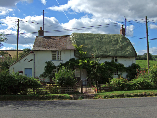
| static_image_name | Parish Church of St Pancras - Alton Pancras - geograph.org.uk - 887132.jpg | ||
| static_image_caption | Alton Pancras parish church | ||
| population | 175 | ||
| population_ref | |||
| os_grid_reference | ST699022 | ||
| coordinates | |||
| post_town | DORCHESTER | ||
| postcode_area | DT | ||
| postcode_district | DT2 | ||
| dial_code | 01300 | ||
| constituency_westminster | West Dorset | ||
| civil_parish | Alton Pancras | ||
| <!-- you can use the template {{mi to km | (enter data) | precision | 0}} to help convert miles to km automatically; both are displayed -- |
| london_distance | 130 mi | ||
| unitary_england | Dorset | ||
| lieutenancy_england | Dorset |
Alton Pancras is a small village and civil parish in Dorset, England. In the 2011 census the civil parish had a population of 175.
The village church is dedicated to Saint Pancras, which provides part of the village name. The parish was formerly a liberty, containing only the parish itself.
History
Evidence of prehistoric human activity within the parish includes two round barrows on the hills to the east of the village (one on West Hill and one on Church Hill), the remains of 'Celtic' fields and strip lynchets on many of the surrounding hills, and a possible settlement just south of the summit of Church Hill. Dating is not definite but the 'Celtic' fields were probably in use between the Bronze Age and the end of the Romano-British period. The possible settlement is probably Romano-British. Subsequent cultivation, particularly in modern times, has destroyed much of the evidence.
The village itself was likely first settled by Saxons during the expansion of the Kingdom of Wessex. The name of the village was then Awultune, meaning in West Saxon 'village at the source of the river' (the River Piddle). The village was previously two separate settlements: Barcombe and Alton, both of which had their own open field system. Local tradition believes that after conversion to Christianity, the village name incorporated the little-known St Pancras and that by the time of the Battle of Agincourt (1415), was known as Aulton Pancras. However, in Christopher Saxton's map of 1575 it is still known as 'Ælton' and in John Speed's map of 1610, it is listed as 'Alton'. In a later 1760 map by Emanuel Bowen, the village is listed as 'Alton Pancras'.
The current church was restored in the 19th century after an earlier Norman church was near collapse. All that remains of the old church is the 15th-century tower and a Norman arch. The church organ used to be a fairground organ. The floor tiles were created by Poole Pottery.
Governance
For elections to the Parliament of the United Kingdom, Alton Pancras is in the West Dorset parliamentary constituency.
In local government, Alton Pancras is in the Dorset unitary authority. For elections to Dorset Council it is in the Chalk Valleys electoral ward.
At the parish level – the lowest tier of local government – Alton Pancras is one of three parishes governed by Piddle Valley Group Parish Council. The other parishes are Piddlehinton and Piddletrenthide.

Geography
Alton Pancras civil parish covers 2280 acre at the head of the valley of the River Piddle. The underlying geology of the parish is mostly chalk, except for the Alton Common extension, which is on greensand, gault and Kimmeridge clay. All of Alton Pancras parish is within the Dorset National Landscape area. Horse Close Wood on Alton Common is a Woodland Trust wood, though it is not open to the public.
Alton Pancras village is situated on the B3143 road, which connects it to the county town of Dorchester 9 mi to the south. Other local travel links include Maiden Newton railway station 7 mi to the south-west, and Bournemouth International Airport 26 mi to the east.
Demography
In the 2011 census Alton Pancras civil parish had 72 dwellings, 71 households and a population of 175.
References
References
- "Area: Alton Pancras (Parish), Key Figures for 2011 Census: Key Statistics". Office for National Statistics.
- (1840). "The Parliamentary Gazetteer of England and Wales".
- "'Alton Pancras', in An Inventory of the Historical Monuments in Dorset, Volume 3, Central (London, 1970), pp. 1–4". University of London.
- "'Celtic' Field Groups', in An Inventory of the Historical Monuments in Dorset, Volume 3, Central (London, 1970), pp. 318–346". University of London.
- [https://books.google.com/books?id=br8xcW1f_a8C&dq=awultune&pg=PT89 Meaning of Alton]
- "Dorset A-G". domesdaybook.co.uk.
- "Place: Alton [Pancras]". opendomesday.org.
- "Various names of Alton Pancras through the ages".
- (11 November 2014). "Piddle Valley Grouped Parish Council". Dorset County Council.
- "Dorset Explorer". Natural England.
- "Horse Close Wood". Woodland Trust.
- "Area: Alton Pancras (Parish). Dwellings, Household Spaces and Accommodation Type, 2011 (KS401EW)". Office for National Statistics.
- (30 January 2013). "Area: Alton Pancras (Parish). Age Structure, 2011 (KS102EW)". Office for National Statistics.
This article was imported from Wikipedia and is available under the Creative Commons Attribution-ShareAlike 4.0 License. Content has been adapted to SurfDoc format. Original contributors can be found on the article history page.
Ask Mako anything about Alton Pancras — get instant answers, deeper analysis, and related topics.
Research with MakoFree with your Surf account
Create a free account to save articles, ask Mako questions, and organize your research.
Sign up freeThis content may have been generated or modified by AI. CloudSurf Software LLC is not responsible for the accuracy, completeness, or reliability of AI-generated content. Always verify important information from primary sources.
Report