From Surf Wiki (app.surf) — the open knowledge base
Alcalà de Xivert
| Field | Value |
|---|---|
| name | Alcalà de Xivert |
| settlement_type | Municipality |
| official_name | |
| native_name | |
| other_name | Alcalá de Chivert |
| image_skyline | Alcalá de Xivert.Iglesia Parroquial de San Juan Bautista.jpg |
| image_caption | Church of Saint John the Baptist surrounded by Alcalà de Xivert |
| image_shield | Escut d'Alcalà de Xivert oficial.svg |
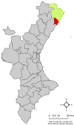
| pushpin_map | Spain |
| pushpin_map_caption | Location in Spain |
| subdivision_type | Country |
| subdivision_name | Spain |
| subdivision_type1 | Autonomous community |
| subdivision_name1 | Valencian Community |
| subdivision_type2 | Province |
| subdivision_name2 | Castelló |
| subdivision_type3 | Comarca |
| subdivision_name3 | Plana Alta |
| subdivision_type4 | Judicial district |
| subdivision_name4 | Castelló de la Plana |
| seat_type | |
| coordinates | |
| elevation_m | 155 |
| area_total_km2 | 167.5 |
| established_title | |
| population_as_of | |
| population_footnotes | |
| population_total | |
| population_demonyms | Xivertí, xivertina |
| population_density_km2 | auto |
| blank_name_sec1 | Official language(s) |
| blank_info_sec1 | Valencian |
| timezone | CET |
| utc_offset | +1 |
| timezone_DST | CEST |
| utc_offset_DST | +2 |
| postal_code_type | Postal code |
| postal_code | 12570 |
| area_code_type | Dialing code |
Alcalà de Xivert (; ) is a town and municipality in the Baix Maestrat comarca, province of Castelló, Valencian Community, Spain.
Geography
The main town is located inland in a flat valley between the two mountain ranges of Serra d'Irta and Serra de les Talaies. There is no river in the valley; instead, the water emerges in natural ponds known as basses.
History
Its castle occupied a strong position for the control of the routes along the Mediterranean coast. Here stood a Moorish castle (the name of the town derives from Arabic al-qalat = "the castle") that was captured by James I of Aragon in 1234, who also resettled the place with Christian villagers.
On 30 August 1905, scientists came from all over the world to Alcalà de Xivert to watch a total solar eclipse which covered an area from the coast of North Africa to the North-East of Spain.
In contemporary times the economy of the town is devoted mainly to tourism, with several beaches and a busy marina at the villages located on the coast, Alcossebre, Capicorb and Les Fonts.
Villages
- Alcalà de Xivert, 3,971
- Alcossebre, 2,151
- Capicorb, 260
- Les Fonts, 1,502
Sites of interest

The landmark of the town is the Esglèsia de Sant Joan Baptista (Church of Saint John the Baptist), built in 1736–1766, with a large dome, a noteworthy Baroque portal, and a 68-metre-high tower, which is visible from many miles away.
The castle of Xivert, was built by the Moors in the 12th century and later conquered by the Knights Templar.
References
References
- "Paco González Ramírez - El País Valencià, poble a poble, comarca a comarca".
- Fabricio Cardenas, [http://vieuxpapierspo.blogspot.fr/2015/03/eclipse-solaire-de-1905-perpignan.html Vieux papiers des Pyrénées-Orientales, ''Eclipse solaire de 1905 à Perpignan''], 20 March 2015
- [[Instituto Nacional de Estadística (Spain). INE]] 2008 census
This article was imported from Wikipedia and is available under the Creative Commons Attribution-ShareAlike 4.0 License. Content has been adapted to SurfDoc format. Original contributors can be found on the article history page.
Ask Mako anything about Alcalà de Xivert — get instant answers, deeper analysis, and related topics.
Research with MakoFree with your Surf account
Create a free account to save articles, ask Mako questions, and organize your research.
Sign up freeThis content may have been generated or modified by AI. CloudSurf Software LLC is not responsible for the accuracy, completeness, or reliability of AI-generated content. Always verify important information from primary sources.
Report