From Surf Wiki (app.surf) — the open knowledge base
Airton
Village and civil parish in North Yorkshire, England
Village and civil parish in North Yorkshire, England
| Field | Value |
|---|---|
| official_name | Airton |
| country | England |
| region | Yorkshire and the Humber |
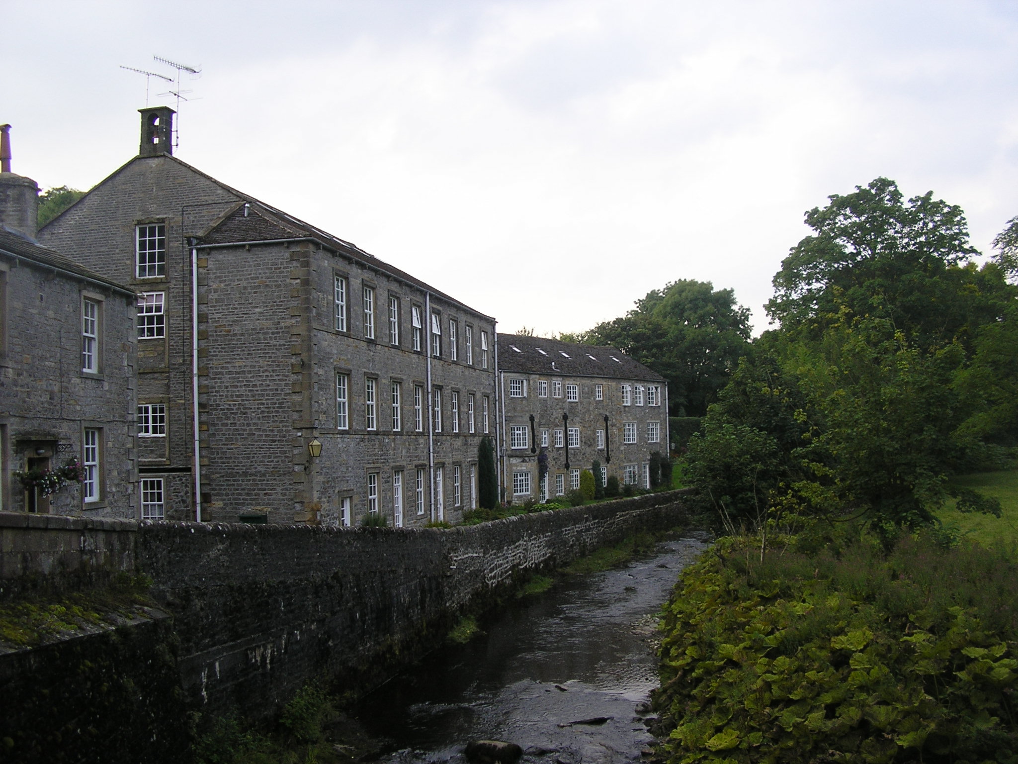
| static_image_name | Airton Andh.JPG |
| static_image_caption | Airton |
| population | 227 |
| population_ref | (Including Otterburn. 2021 census) |
| os_grid_reference | SD902592 |
| coordinates | |
| post_town | SKIPTON |
| postcode_area | BD |
| postcode_district | BD23 |
| dial_code | 01729 |
| constituency_westminster | Skipton and Ripon |
| civil_parish | Airton |
| london_distance | 234 mi |
| unitary_england | North Yorkshire |
| lieutenancy_england | North Yorkshire |
Airton (also known as Airton-in-Craven) is a small village and civil parish in North Yorkshire, England, situated 10 mi north-west of Skipton. The village had a population of 175 according to the 2001 Census, 228 at the 2011 Census, decreasing to 227 at the 2021 Census.
Until 1974 it was part of the West Riding of Yorkshire. From 1974 to 2023 it was part of the district of Craven, it is now administered by the unitary North Yorkshire Council.
History
Listed as Airtone in the Domesday Book, the village takes its name from the River Aire which runs along its eastern edge. In the late 1600s a significant Quaker community developed in the village around Airton Quaker Meeting House. In use for the majority of its history, this building was restored between 2010 and 2012 and continues to host an active Quaker meeting.
Other significant buildings in Airton include a squatter's cottage on the village green, a former Methodist Chapel (now closed) and an old mill on the River Aire which is in use as a private residence. The old cotton mill was given listed status in 1989. There is no pub or Post Office in the village; however there is a Farm Shop and Tea Room at Town End Farm on the road to Malham.
Airton lies in the Ecclesiastical Parish of St. Michael and All Angels, Kirkby Malham.
Transport
There is a bus stop in the village with daily links to Malham and Skipton. Also, the local roads link the village to the A65.
Tourism
The village is in the Yorkshire Dales National Park and lies on the tourist route to Malham Cove and Malham Tarn. The Pennine Way passes around the edge of the village, alongside the river. The Way of the Roses cycle route passes through the village on the road between Settle and Grassington.
References
References
- "Airton Parish".
- "Airton (Parish, United Kingdom) - Population Statistics, Charts, Map and Location".
- "History of Airton, in Craven and West Riding".
- "Airton".
- "Aighton - Akenham".
- Laurel, Phillipson. (2017). "Hidden in plain sight : history and architecture of the Airton Meeting House". Quacks Books.
- "Quaker house appeal launched". Craven Herald.
- "The Green - Airton - North Yorkshire - England".
- "Hydroelectricity in Malhamdale".
- "River Walk - Airton - North Yorkshire - England".
- "Town End Farm Shop and Tearoom, Airton". Craven Herald.
- "Town End Farm Shop".
- "Parishes Adjoining Kirkby in Malhamdale".
- "St Michael the Archangel Church, Kirkby Malham".
- "Pennine Way National Trail".
This article was imported from Wikipedia and is available under the Creative Commons Attribution-ShareAlike 4.0 License. Content has been adapted to SurfDoc format. Original contributors can be found on the article history page.
Ask Mako anything about Airton — get instant answers, deeper analysis, and related topics.
Research with MakoFree with your Surf account
Create a free account to save articles, ask Mako questions, and organize your research.
Sign up freeThis content may have been generated or modified by AI. CloudSurf Software LLC is not responsible for the accuracy, completeness, or reliability of AI-generated content. Always verify important information from primary sources.
Report