From Surf Wiki (app.surf) — the open knowledge base
Acklins
Island in The Bahamas
Island in The Bahamas
| Field | Value |
|---|---|
| name | Acklins |
| map_image | Acklins in Bahamas (zoom).svg |
| location | Atlantic Ocean |
| 239 mi Southeast of Nassau | |
| coordinates | |
| archipelago | Bahamas |
| area_km2 | 389 |
| area_sqmi | 150 |
| country | Bahamas |
| population | 692 |
| population_as_of | 2022 |
239 mi Southeast of Nassau
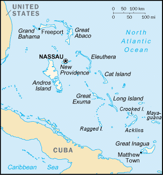
Acklins is an island and district of the Bahamas.
It is one of a group of islands arranged along a large, shallow lagoon called the Bight of Acklins, of which the largest are Crooked Island (76 sqmi) in the north and Acklins (120 sqmi) in the southeast, and the smaller are Long Cay (once known as Fortune Island, (8 sqmi)) in the northwest, and Castle Island in the south.
Etymology
The indigenous Lucayan people called the Acklins as Yabaque, meaning "large western land".
History
The islands were settled by American Loyalists in the late 1780s who set up cotton plantations maintained by over 1,000 slaves. After the abolition of slavery in the British Empire the plantations became uneconomical, and the replacement income from sponge diving has now dwindled as well with the rest of the natural sponge industry after the advent of synthetics. The inhabitants now live by fishing and small-scale farming.
Although Acklins Island has relatively few historical landmarks, there are some noteworthy places. Acklins is home to numerous Lucayan people sites. An ancient site, thought to be one of the largest Lucayan settlements in The Bahamas, sits along Pompey Bay Beach, just south of Spring Point. Ten ancient Lucayan sites have been unearthed by National Geographic Society archeologists on Samana Cay alone, which is northeast of Spring Point in Acklins.
Plana Cays, also northeast of Spring Point, is a protected reserve for endangered great iguanas and the very rare Bahamian hutia (a guinea pig-like rodent), the only native mammal of The Bahamas.

The population of Acklins was 565 at the 2010 census, with the largest populations at Lovely Bay in the northwestern tip of the island and in Salina Point in the southernmost area of the island.
Transportation
The island is served by Spring Point Airport.
Politics
The island is part of the MICAL constituency for elections to the House of Assembly of the Bahamas.
References
References
- "Census population and housing".
- Ahrens, Wolfgang P.. (2015). "Naming the Bahamas Islands: History and Folk Etymology". Onomastica Canadiana.
- "Acklins population by settlement and total number of occupied dwellings: 2010 census". Bahamas Department of Statistics.
- Scott, Rachel. (2021-05-31). "Moultrie: MICAL should be two seats".
This article was imported from Wikipedia and is available under the Creative Commons Attribution-ShareAlike 4.0 License. Content has been adapted to SurfDoc format. Original contributors can be found on the article history page.
Ask Mako anything about Acklins — get instant answers, deeper analysis, and related topics.
Research with MakoFree with your Surf account
Create a free account to save articles, ask Mako questions, and organize your research.
Sign up freeThis content may have been generated or modified by AI. CloudSurf Software LLC is not responsible for the accuracy, completeness, or reliability of AI-generated content. Always verify important information from primary sources.
Report