From Surf Wiki (app.surf) — the open knowledge base
A9 road (Scotland)
Major road in Scotland

Major road in Scotland
| Field | Value | |||
|---|---|---|---|---|
| country | SCT | |||
| type | A | |||
| route | 9 | |||
| map | [[File:A9 road map.png | 200px]] | ||
| map_custom | yes | |||
| length_mi | 268.5 | |||
| length_ref | ||||
| direction_a | South | |||
| direction_b | North | |||
| terminus_a | in Polmont | |||
| terminus_b | Scrabster | |||
| destinations | Stirling, Perth, Inverness, Thurso | |||
| e-road | [[File:Tabliczka E15.svg | 40px]] E15 | ||
| junction | in Larbert | |||
| in Bannockburn | ||||
| in Perth | ||||
| near Kingussie | ||||
| {{Jct | country | GBR | A | 96}} in Inverness |
| in Inverness | ||||
| previous_route | 8 | |||
| next_type | A | |||
| next_route | 10 | |||
| previous_type | A |
| e-road = [[File:Tabliczka E15.svg|40px]] E15 in Bannockburn in Perth near Kingussie
in Inverness in Inverness
The A9 is a major road in Scotland running from the Falkirk council area in central Scotland to Scrabster Harbour, Thurso in the far north, via Stirling, Bridge of Allan, Perth and Inverness. At 273 miles, it is the longest road in Scotland and the fifth-longest A-road in the United Kingdom. Historically it was the main road between Edinburgh and John o' Groats, and has been called the spine of Scotland. It is one of the three major north–south trunk routes linking the Central Belt to the Highlands – the others being the A82 and the A90.
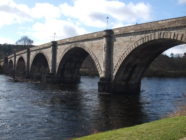
The road's origins lie in the military roads building programme of the 18th century, further supplemented by the building of several bridges in later years. The A9 route was formally designated in 1923, and originally ran from Edinburgh to Inverness. The route was soon extended north from Inverness up to John O'Groats. By the 1970s the route was hampered by severe traffic congestion, and an extensive upgrading programme was undertaken on the 138 miles section between Bridge of Allan and Inverness. This involved the bypassing of numerous towns and villages on the route, and the building of several new bridges, notably the Kessock Bridge which shortened the route north out of Inverness by 14 miles.
In the south the road's importance has been eclipsed by:
- the M90 motorway across the Queensferry Crossing, which now links Edinburgh more directly with Perth, bypassing Stirling and Bridge of Allan as formerly important bridge points, and
- the M9, which is now the main road between Edinburgh and Stirling/Bridge of Allan.
Between Edinburgh and Falkirk the old A9 route has been reclassified into the A803 and the B9080 amongst others; part of the route between Kirkliston and Maybury no longer exists as the area is now part of Edinburgh Airport. Between Falkirk and Bridge of Allan, the A9 survives as a more or less parallel road to the M9.
The link between the M9 and the A9, by Bridge of Allan, is the Keir Roundabout.
A major project is underway to upgrade the A9 between Perth and Inverness by 2035.
History
However, Wade had still to bridge the River Tay at Aberfeldy. Construction began in 1733 to a design by William Adam. The bridge, named Wade's Bridge, was completed within the year, but Wade wrote "The Bridge of Tay... was a work of great difficulty and also much more expensive than was calculated." At a cost of over £4,000, the bridge became the most expensive item on Wade's road building programme. For most of its length between Perth and Inverness, the route was identical to the A9 prior to the commencement of the major upgrading works in the 1970s.

The formal scheme of classification of roads in Great Britain (England, Scotland, and Wales) was first published on 1 April 1923. The original route of the designated A9 began in Edinburgh at the Corstorphine junction in the west of the city, branching north off the A8. The route went through Kirkliston and onwards to Polmont and Falkirk. The road then followed the now familiar route to Stirling and then up to Perth and onwards to Inverness, going through numerous villages en route. The original A9 terminated at Inverness, but in the years that followed it was extended to include the roadway all the way up to John O'Groats. By the 1970s, the A9 went north-west out of Inverness in what had originally been classified as the A88, following the Beauly Firth coast westwards through Kirkhill, Beauly and Muir of Ord. Continuing north through Dingwall, the road then began to follow the Cromarty Firth coast, where it followed largely the modern alignment, going through Alness and Tain (both now bypassed). The A9 from here followed west along the south side of the Dornoch Firth coast before reaching Bonar Bridge where the road turned sharply eastwards on the north side of the Dornoch Firth. On reaching the village of Dornoch, the A9 headed north along the coast, going through several villages before reaching the town of Wick. The final stretch continued north along the coast before it finally reached John O'Groats.
Improvements
A9 dualling Perth to Inverness
Main article: A9 dualling project
Announced in 2011, a project is underway to upgrade the remaining single carriageway sections of the A9 to a dual carriageway between Perth and Inverness. This started in 2015 and was due to be finished in 2025, but delays to the project meant that meeting the original deadline was going to be impossible and has been delayed to 2035. Only 11 out of 80 miles had been converted as of December 2023. In October 2024, preparatory works began on the six mile section between Tomatin and Moy. Full construction work began in early 2025 and due to finish in 2028.
Hairpin turn
In 2014, Transport Scotland has announced a plan to improve Berriedale Braes' hairpin turn. A fatal collision occurred on that turn in September 2014 due to brake failure from a lorry. One month earlier, a lorry caught fire, causing a 77-mile (123-km) diversion, though no one was hurt. The improved hairpin turn opened to traffic on 21 August 2020.
Route

The original starting section of the A9 between Edinburgh and Polmont no longer exists as such, having been reclassified over the years in a variety of ways; part of the original route between Kirkliston and Maybury no longer exists at all as the area is now part of Edinburgh Airport. The modern A9 begins at the M9 junction 5 (Cadgers Brae) on the outskirts of Polmont, just east of Falkirk, and continues through Falkirk itself and on though Larbert, Stirling and Bridge of Allan. It then becomes a primary route dual carriageway at the Keir Roundabout, just south of Dunblane, and continues north as a dual carriageway to Perth bypassing Dunblane, Blackford and Auchterarder.
At Broxden Junction on the outskirts of Perth, the A9 meets the M90 motorway which carries traffic from Fife and the Forth Road Bridge. Broxden Junction is one of the busiest and most important road junctions in Scotland, with links to all eight Scottish cities.
The section between Perth and Inverness is often cited as being the most dangerous section of the road, and regularly appears in lists of Scotland's most dangerous roads. This portion of the road is mostly single-carriageway, however there are intermittent short sections of dual carriageway from Perth to Birnam, Pitlochry to Killiecrankie, south of Drumochter Summit, Slochd Summit to Tomatin and south of Inverness as well as shorter three lane overtaking sections to reduce frustration and accidents. All the towns on this section of the route have now been bypassed.
The section from Keir Roundabout to Inverness had average speed cameras installed in 2014 and at the same time the single carriageway speed limit for HGVs was increased from 40 mph to 50 mph.
In the north, beyond Inverness, the A9 designation has been transferred in response to construction of new bridges across the Moray Firth (the Kessock Bridge), the Cromarty Firth and the Dornoch Firth; and so that the A9 leads not to John o' Groats but to Scrabster Harbour, Thurso, where a government-supported ferry service takes traffic to and from Stromness in Orkney. Therefore, various towns and villages which were on the A9 are now seriously distanced from this trunk road.Towns and villages which were on the A9 but now quite remote from it:
- Beauly: now on the A862.
- Ardgay and Bonar Bridge: now on the A836. Bonar Bridge is also on the A949.
- Wick and John o' Groats: now on the A99.
Between Perth and Inverness, the A9 forms part of Euroroute E15. Inverness is the northern terminus of this route.
From Falkirk to Bridge of Allan the A9 runs through or near Camelon, Larbert, Torwood, Plean, Bannockburn and Stirling.

From Bridge of Allan to Inverness the A9 runs through or near Lecropt, Dunblane, Blackford, Gleneagles, Auchterarder, Aberuthven, Broxden Junction, Perth, Luncarty, Bankfoot, Birnam, Dunkeld, Ballinluig, Pitlochry, Loch Faskally, Killiecrankie, Blair Atholl, Pass of Drumochter, the Grampian Mountains, Dalwhinnie, Newtonmore, Kingussie, Aviemore, Carrbridge, Tomatin and Moy.
From Inverness the A9 runs across, through or near the Moray Firth, the Black Isle, Tore, Conon Bridge, the Cromarty Firth, Easter Ross, Dingwall, Evanton, Alness, Invergordon, Nigg Bay, Fearn, Tain, the Dornoch Firth, Dornoch, The Mound, Golspie, Dunrobin Castle, Brora, Helmsdale, Badbea, Berriedale, Dunbeath, Latheron, Mybster, Georgemas and Thurso. The road ends at Scrabster Harbour, Thurso.
From the A96 in the Raigmore area of Inverness the A9 has junctions with other classified roads as follows:
- In the Inverness area:
- The A96 at Raigmore interchange (Ordnance Survey ).
- The A82 at Longman roundabout in the Longman area (). Just north of this junction the Kessock Bridge () carries the A9 over the Moray Firth to the Black Isle.
- The B865 at Inshes

- On the Black Isle:
- The B9161 ().
- At Tore, near Muir of Ord and Conon Bridge:
- The A832 and the A835 (). The A832 and the A835 meet the A9 at the same roundabout, at Tore. The A832 links Muir of Ord with the A9. The A835 links Conon Bridge.
- The B9169 ().
- The B9163 (). Just north of this junction the A9 bridges the Cromarty Firth () to reach Easter Ross.
- In Easter Ross:
- Near Dingwall:
- The A862 ().
- In the Evanton, Alness, Invergordon area:
- The B817 (). The B817 runs through Evanton, Alness and Invergordon. The A9 alignment here is more west–east than south–north. Evanton and Alness are north of the A9. Invergordon is to the south.
- The B9176 (). The B9176 road runs to A836 near Bonar Bridge.
- The B817 ().
- The B817 ().
- Near Nigg Bay
- The B9175 () – for Nigg Ferry and, in the summer, a vehicle ferry for Cromarty.
- Near Hill of Fearn:
- The B9165 (). Fearn railway station is on the B9165, about one mile (1.6 km) east of the A9.
- Near Tain:
- The B9174 ().
- The B9174 ).
- The A836 (). Just north of this junction the A9 bridges the Dornoch Firth ().
- Near Dingwall:

- In Sutherland:
- The A949 (). Skibo Castle is on the A949 which is the 3rd and final junction that runs through to Bonar Bridge
- Near Dornoch:
- The A949 ().
- The B9168 ().
- At The Mound, near Rogart:
- The A839 (). Rogart railway station is on the A839. From the Mound the A9 runs through or past Golspie (), Dunrobin Castle () and Brora () before meeting another classified road, in Helmsdale.
- In Helmsdale:
- The A897 (). From Helmsdale the A9 runs through Berriedale () and Dunbeath () before meeting another classified road, at Latheron, Caithness.


- In Caithness:
- At Latheron:
- The A99 ().
- At Mybster:
- B870 ().
- In the Georgemas area:
- The A882 ().
- The B874 ().
- In Thurso:
- The A836 ().
- The B874 ().
- The A836 ().
- At Latheron:
The A9 ends in Thurso, at Scrabster Harbour ().
Junction list
References
References
- Dr. James Fenton. "Woodlands and Wildness". Scottish Wild Land Group.
- "The Military Roads of Scotland".
- "History – General Wade's Roads".
- "Thomas Telford and Dunkeld Bridge".
- "Thomas Telford's Bridge".
- "Sheet 20 – Central Ross Publication date: 1934".
- "Delivery plan for remaining A9 dualling projects announced".
- (16 October 2024). "Cost of upgrading six miles of A9 near Inverness rises to £308m". BBC News.
- "Works programme confirmed for A9 Dualling: Tomatin to Moy with preparatory works set to start on 21 October {{!}} Transport Scotland". www.transport.gov.scot.
- (18 November 2014). "Plan for A9's Berriedale Braes hairpin bend to be displayed". BBC News.
- (9 March 2016). "Catastrophic brake failure before fatal crash on A9".
- (5 August 2014). "A9 lorry fire at Berriedale Braes causes 77-mile diversion". BBC News.
- "A9 Berriedale Braes Improvement Project".
- "Bad junctions – A9 – M90 – A93".
- Duffy, Judith. (25 March 2012). "Scotland's most dangerous roads". Herald Scotland.
- (26 January 2015). "A9 average speed cameras 'have reduced speeding'". BBC News.
- "Safety Cameras".
- "Road Traffic Infrastructure – European agreement on main international traffic arteries (AGR)". United Nations Economic & Social Council.
- "Scothighlands – Drive from Inverness to Scrabster, Scotland".
- "Grangemouth, United Kingdom to CamperKing Scotland, Unit 11, Abbotsford Business Park, Lammermoor Avenue, Falkirk FK2 7ZS, United Kingdom to A9, Stirling, UK to 40B Bannockburn Rd, Stirling FK7 0BP, UK to Strathallan Games Park, 7 Airthrey Ave, Bridge of Allan, Stirling FK9 4QY, United Kingdom to A9, Dalwhinnie PH19 1AE, UK". [[Google Maps]].
- "A9, Dalwhinnie PH19 1AE, UK to A9, Dornoch IV25 3HZ, UK". [[Google Maps]].
- "A9, Dornoch IV25 3HZ, UK to The Harbour Takeaway and Diner, The Harbour, Scrabster KW14 7UJ, United Kingdom". [[Google Maps]].
This article was imported from Wikipedia and is available under the Creative Commons Attribution-ShareAlike 4.0 License. Content has been adapted to SurfDoc format. Original contributors can be found on the article history page.
Ask Mako anything about A9 road (Scotland) — get instant answers, deeper analysis, and related topics.
Research with MakoFree with your Surf account
Create a free account to save articles, ask Mako questions, and organize your research.
Sign up freeThis content may have been generated or modified by AI. CloudSurf Software LLC is not responsible for the accuracy, completeness, or reliability of AI-generated content. Always verify important information from primary sources.
Report