From Surf Wiki (app.surf) — the open knowledge base
50th Street station (BMT West End Line)
New York City Subway station in Brooklyn

New York City Subway station in Brooklyn
| Field | Value | ||
|---|---|---|---|
| name | 50 Street | ||
| image | 50th_Street_BMT_Station.JPG | ||
| image_caption | View of the Brooklyn-bound platform | ||
| address | 50th Street, 12th Avenue & New Utrecht Avenue | ||
| Brooklyn, New York | |||
| borough | Brooklyn | ||
| locale | Borough Park | ||
| coordinates | |||
| division | BMT | ||
| line | BMT West End Line | ||
| service | West End local | ||
| other | {{Unbulleted list | ||
| platforms | 2 side platforms | ||
| tracks | 3 (2 in regular service) | ||
| structure | Elevated | ||
| opened | |||
| services | {{Adjacent stations | system=New York City Subway | |
| line | West End local | left=Fort Hamilton Parkway | right=55th Street |
| note-row2 | and do not stop here}} | ||
| footnotes | |||
| route_map | {{NYCS 3-tracked local station | inline=y | |
| 1 | Fort Hamilton Parkway | ||
| 2 | 55th Street | ||
| code | BMT West End Line | ||
| unused | right | ||
| deg | 345 |
Brooklyn, New York | NYCT Bus: | Private Transportation Co.: |note-row2= and do not stop here}}
The 50th Street station is a local station on the BMT West End Line of the New York City Subway, located at the intersection of 50th Street, 12th Avenue and New Utrecht Avenue in Borough Park, Brooklyn. It is served by the D train at all times. The station opened in 1916, and had its platforms extended in the 1960s.
History
50th Street station opened on June 24, 1916, along with the first portion of the BMT West End Line from 36th Street on the BMT Fourth Avenue Line to 18th Avenue station. The line was originally a surface excursion railway to Coney Island, called the Brooklyn, Bath and Coney Island Railroad, which was established in 1862, but did not reach Coney Island until 1864. Under the Dual Contracts of 1913, an elevated line was built over New Utrecht Avenue, 86th Street and Stillwell Avenue.
The platforms at the station were extended in the 1960s to 615 feet to accommodate ten-car trains.
Station layout
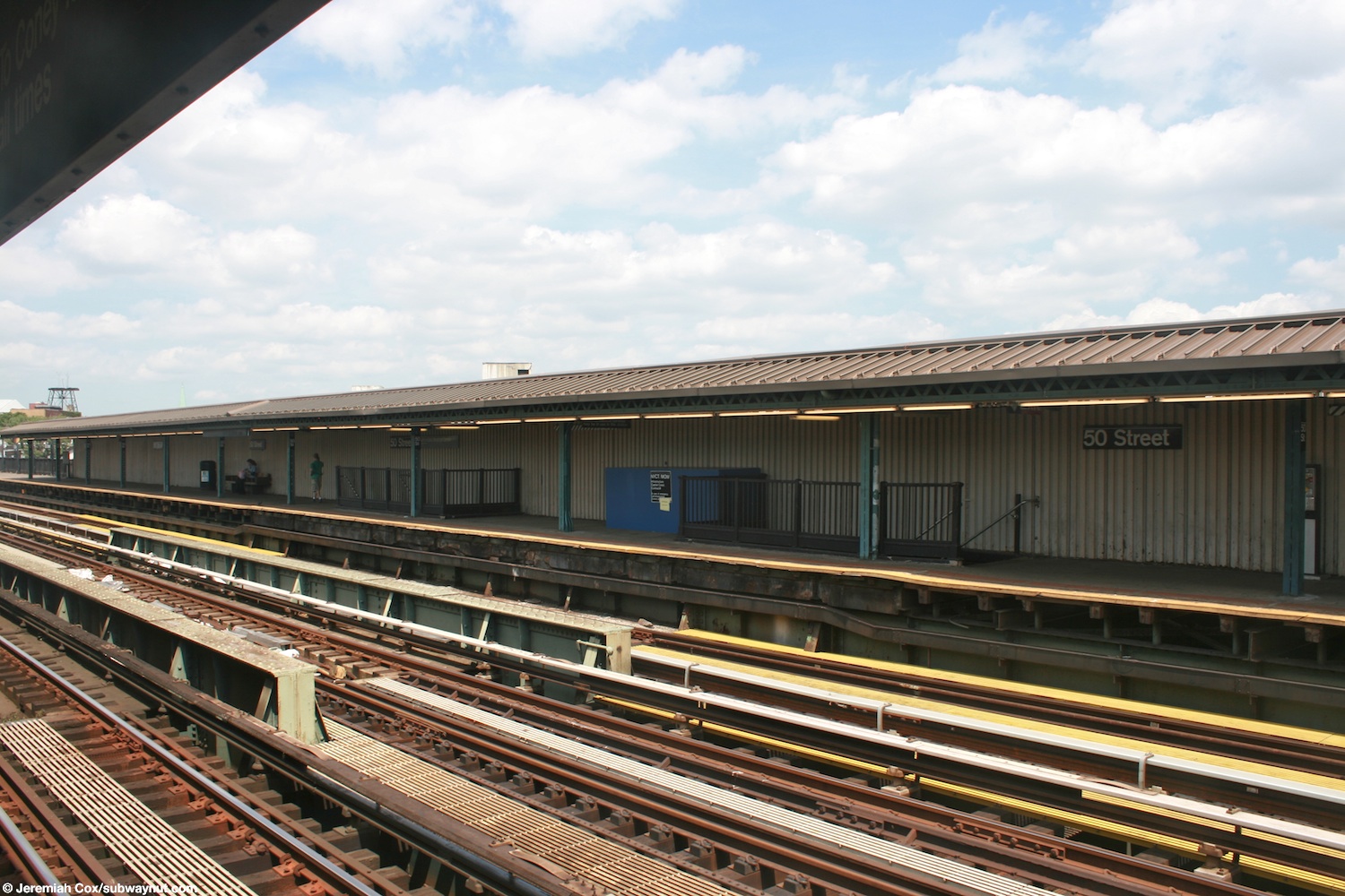
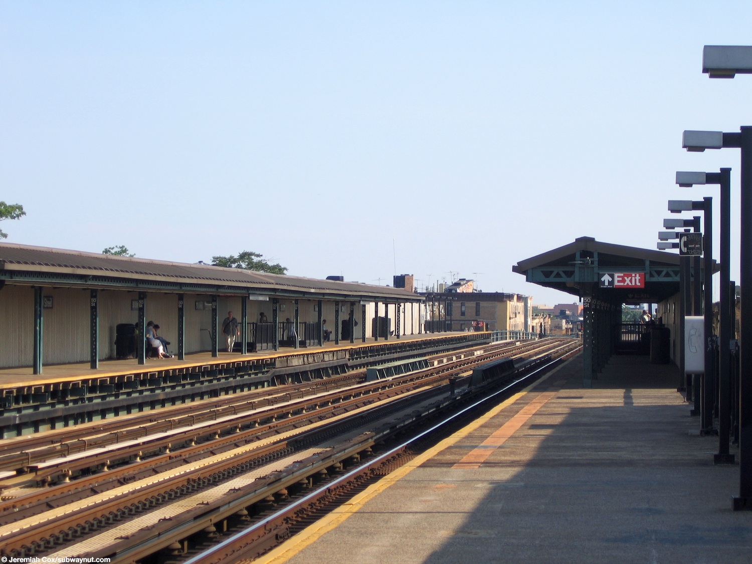
This elevated station has three tracks and two side platforms. The D train stops here at all times, and the center express track is not normally used in service.
The platforms have beige windscreens and brown canopies with green frames at their center and waist-high black steel fences at either end. They are offset; the Manhattan-bound platform is more to the north than the Coney Island-bound one and both have electrical distribution rooms at either end.
Exits
The station's only entrance is via an elevated station house beneath the tracks that has four street stairs, two to either side of New Utrecht Avenue between 49th and 50th Streets. The station house has cherry red doors, a clad wood trim exterior, and beige interior. There are also glass block windows and heaters. The fare control consists of a token booth, turnstile bank, waiting area and two staircases to each platform at their center.
References
References
- (June 24, 1916). "Parade, Pageant Mark Celebration". The Brooklyn Daily Eagle.
- (June 24, 1916). "Realty Boom Is Predicted for Borough Park Section". The Brooklyn Daily Eagle.
- (June 9, 1864). "Opening of the Brooklyn, Bath and Coney Island Railroad". [[The New York Times]].
- (September 1912). "The Dual System of Rapid Transit". New York State Public Service Commission.
- (August 3, 1913). "618 Miles of Track In The Dual System; City Will Have Invested $226,000,000 When Rapid Transit Project Is Completed.". The New York Times.
- (January 10, 1917). "Report of the Public Service Commission For The First District Of The State of New York For The Year Ending December 31, 1916 Vol. 1". New York State Public Service Commission.
- (July 12, 1964). "For Release Sunday, July 12, 1964". New York City Office of the Mayor.
- {{NYCS const. trackref. trackbook
- {{NYCS const. timetable. d
- Cox, Jeremiah. (August 11, 2009). "The two staircases down to the station house and exit".
- Cox, Jeremiah. (June 8, 2005). "Approaching the middle canopied section of the platforms where the only exit is".
- (2018). "50th Street Neighborhood Map". Metropolitan Transportation Authority.
This article was imported from Wikipedia and is available under the Creative Commons Attribution-ShareAlike 4.0 License. Content has been adapted to SurfDoc format. Original contributors can be found on the article history page.
Ask Mako anything about 50th Street station (BMT West End Line) — get instant answers, deeper analysis, and related topics.
Research with MakoFree with your Surf account
Create a free account to save articles, ask Mako questions, and organize your research.
Sign up freeThis content may have been generated or modified by AI. CloudSurf Software LLC is not responsible for the accuracy, completeness, or reliability of AI-generated content. Always verify important information from primary sources.
Report