From Surf Wiki (app.surf) — the open knowledge base
1982 Marion tornado outbreak
Natural disaster in southern Illinois, United States in 1982

Natural disaster in southern Illinois, United States in 1982
| Field | Value |
|---|---|
| name | Marion, Illinois tornado outbreak |
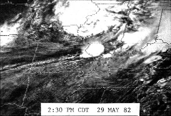
| caption | The F4 Marion tornado crossing Interstate 57 near Illinois Route 13 |
| duration | May 29, 1982 |
| archive-url = https://web.archive.org/web/20120207193749/https://www.nssl.noaa.gov/divisions/forecast/mag/tornadodamage.html | archive-date = February 7, 2012 | access-date = September 12, 2021 The Marion tornado outbreak was a small, severe tornado outbreak that affected southern portions of the Midwestern United States on May 29, 1982.
Tornadoes touched down in the states of Illinois, Missouri, and Indiana, with Marion, Illinois, being the hardest hit. Ten fatalities occurred there after the town took a direct hit from an F4 tornado.{{cite web | archive-url = https://web.archive.org/web/20121015213717/http://www.crh.noaa.gov/pah/?n=1982_Track | archive-date = October 15, 2012 | access-date = September 12, 2021
Meteorological synopsis
On the 12:00 UTC surface chart, a cold front was draped from Minnesota southwest across Iowa, Kansas, Oklahoma, and into Texas. A triple point was found just south of Des Moines, Iowa, with a warm front positioned east across northern Illinois and Indiana. Morning dew points ranged from 65 F at Saint Louis, Missouri, and Louisville, Kentucky, to 72 F at Memphis, Tennessee. 70 or dew points were found in Fort Smith, Arkansas, Springfield and Cape Girardeau, Missouri, and Fort Campbell, Kentucky. An outflow boundary was draped over Central Illinois and Missouri from overnight convection that was decaying as it tracked east across the two states.{{cite web | archive-url = https://web.archive.org/web/20121025073440/http://www.crh.noaa.gov/pah/?n=1982_Weather | archive-date = October 25, 2012 | access-date=September 12, 2021 | archive-url = https://web.archive.org/web/20090530003102/http://www.srh.noaa.gov/oun/severewx/glossary3.php | archive-date = May 30, 2009 | access-date = September 12, 2021 By mid-afternoon, temperatures at Carbondale, Illinois, and Marion had risen to the middle and upper 80s°F with dew points near 70 F. At 1:03 p.m., a tornado watch was issued for the region. Later in the afternoon the National Weather Service in Saint Louis, Missouri, issued several severe weather warnings for Williamson County and surrounding counties. At 2:58 p.m. a severe thunderstorm warning was issued for Jackson County and Williamson County. At 3:00 p.m, a tornado was observed near Carterville, Illinois, prompting a tornado warning at 3:19 p.m.{{cite web | archive-url = https://web.archive.org/web/20121025080746/http://www.crh.noaa.gov/pah/?n=1982_20years | archive-date = October 25, 2012 | access-date = September 12, 2021
Confirmed tornadoes
| F# | Location | County / Parish | State | Start Coord. | Time (CST) | Path length | Max width | Summary | |||||||
|---|---|---|---|---|---|---|---|---|---|---|---|---|---|---|---|
| cat1}} | F1 | SE of Columbia | Boone | MO | 03:00 | 0.06 mi | 20 yd | title=Storm Data: May 1982 Volume 24 No. 5 | url=https://www.ncei.noaa.gov/pub/orders/IPS/IPS-02F72373-7DF7-4A5A-8E07-ECC2EB20D2E6.pdf | website=National Centers for Environmental Information | publisher=National Oceanic and Atmospheric Administration | access-date=20 April 2022 | archive-url=https://web.archive.org/web/20220420033531/https://www.ncei.noaa.gov/pub/orders/IPS/IPS-02F72373-7DF7-4A5A-8E07-ECC2EB20D2E6.pdf | archive-date=20 April 2022 }} | |
| cat1}} | F1 | Caesarscreek Township | Greene | OH | 12:30 | 0.25 mi | 50 yd | title=Ohio Event Report: F1 Tornado | url=https://www.ncdc.noaa.gov/stormevents/eventdetails.jsp?id=10096825 | publisher=National Oceanic and Atmospheric Administration | work=National Climatic Data Center | accessdate=April 20, 2022}} | |||
| cat3}} | F3 | N of Percy to WNW of Conant | Randolph, Perry | IL | 13:05–13:20 | 10 mi | 200 yd | title=Illinois Event Report: F3 Tornado | url=https://www.ncdc.noaa.gov/stormevents/eventdetails.jsp?id=10005663 | publisher=National Oceanic and Atmospheric Administration | work=National Climatic Data Center | accessdate=April 20, 2022}} | |||
| cat4}} | F4 | NW of Carterville to E of Marion | Williamson | IL | 14:05–14:32 | 17 mi | 400 yd | 10 deaths – See section on this tornado – 181 people were injured. | |||||||
| storm}} | F0 | SE of Harrisburg | Saline | IL | 15:26 | unknown | unknown | title=Illinois Event Report: F0 Tornado | url=https://www.ncdc.noaa.gov/stormevents/eventdetails.jsp?id=10005667 | publisher=National Oceanic and Atmospheric Administration | work=National Climatic Data Center | accessdate=April 20, 2022}} | |||
| storm}} | F0 | NE of Carrier Mills | Saline | IL | 15:46 | unknown | unknown | title=Illinois Event Report: F0 Tornado | url=https://www.ncdc.noaa.gov/stormevents/eventdetails.jsp?id=10005668 | publisher=National Oceanic and Atmospheric Administration | work=National Climatic Data Center | accessdate=April 20, 2022}} | |||
| cat1}} | F1 | Princeton | Gibson | IN | 16:10 | unknown | unknown | title=Indiana Event Report: F1 Tornado | url=https://www.ncdc.noaa.gov/stormevents/eventdetails.jsp?id=10017962 | publisher=National Oceanic and Atmospheric Administration | work=National Climatic Data Center | accessdate=April 20, 2022}} |
Marion, Illinois
The Marion tornado touched down near Carterville, at 3:00 p.m. resulting in damage to a subdivision near John A. Logan College. It then tracked into downtown Carterville then tracked southeast into Crainville, Illinois, after which it caused moderate damage to the area surrounding Williamson County Regional Airport.{{cite web | archive-url = https://web.archive.org/web/20090628000233/http://www.wpsdlocal6.com/news/local/story/Top-5-Most-Severe-Tornadoes/cRIPpinaJkOi7mdLUUcFtw.cspx | archive-date = June 28, 2009 | access-date = September 12, 2021 | archive-url = https://web.archive.org/web/20110520001911/http://www4.ncdc.noaa.gov/cgi-win/wwcgi.dll?wwevent~ShowEvent~32040 | archive-date = May 20, 2011 | access-date = September 12, 2021
References
References
- "Storm Data: May 1982 Volume 24 No. 5". National Oceanic and Atmospheric Administration.
- "Missouri Event Report: F1 Tornado". National Oceanic and Atmospheric Administration.
- "Ohio Event Report: F1 Tornado". National Oceanic and Atmospheric Administration.
- "Illinois Event Report: F3 Tornado". National Oceanic and Atmospheric Administration.
- "Illinois Event Report: F3 Tornado". National Oceanic and Atmospheric Administration.
- (1993). "Significant tornadoes, 1680-1991: A Chronology and Analysis of Events". Environmental Films.
- "Illinois Event Report: F4 Tornado". National Oceanic and Atmospheric Administration.
- "Illinois Event Report: F0 Tornado". National Oceanic and Atmospheric Administration.
- "Illinois Event Report: F0 Tornado". National Oceanic and Atmospheric Administration.
- "Indiana Event Report: F1 Tornado". National Oceanic and Atmospheric Administration.
This article was imported from Wikipedia and is available under the Creative Commons Attribution-ShareAlike 4.0 License. Content has been adapted to SurfDoc format. Original contributors can be found on the article history page.
Ask Mako anything about 1982 Marion tornado outbreak — get instant answers, deeper analysis, and related topics.
Research with MakoFree with your Surf account
Create a free account to save articles, ask Mako questions, and organize your research.
Sign up freeThis content may have been generated or modified by AI. CloudSurf Software LLC is not responsible for the accuracy, completeness, or reliability of AI-generated content. Always verify important information from primary sources.
Report