From Surf Wiki (app.surf) — the open knowledge base
1916 Irondale earthquake
Earthquake in Alabama on October 18, 1916
Earthquake in Alabama on October 18, 1916
| Field | Value |
|---|---|
| title | 1916 Irondale earthquake |
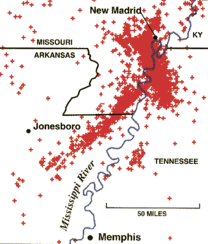
| map | 1916_Irondale_epicenter_map.png |
| timestamp | 1916-10-18 22:04:00 |
| anss-url | ushis600 |
| local-date | |
| local-time | 16:04 CST |
| magnitude | 5.1 |
| location | |
| intensity | |
| casualties | None |
| map_alt | Map showing epicenter of the earthquake and major cities near it |
| affected | Alabama, United States |
| isc-event = | anss-url = ushis600 | local-date = | local-time = 16:04 CST
The 1916 Irondale earthquake struck in the north-central region of the U.S. state of Alabama on October 18. The strongest earthquake in state history, it registered an estimated Richter scale magnitude of 5.1 and resulted in minor damage. Damage was limited to Shelby and Jefferson counties and reached its maximum severity near the epicenter in the city of Irondale, including cracked windows, fallen chimneys, and dried-up wells. While there were no fatalities, the earthquake spawned widespread panic, prompting alarmed workers to evacuate tall buildings.
The earthquake originated in the Eastern Tennessee seismic zone, a fault noted for earthquakes of moderate magnitude. Faulting in the area is strike-slip-oriented, probably because of the Alabama-New York Lineament, which runs adjacent to the seismic zone. Several scientists believe that small earthquakes from the zone indicate the reactivation of deep, ancient faults. Alabama has seen roughly 20 earthquakes since the beginning of the 20th century. The earthquakes have been moderate, never reaching above magnitude 5.1, and they tend to cause damage only near their epicenters while reaching areas much further away. Major events include those in 1916, 1997, and 2003. Despite the lack of powerful seismic events in Alabama, earthquakes from nearby fault zones, including the New Madrid seismic zone, pose a serious threat to infrastructure. An earthquake similar in size to the 1916 Irondale event today could damage thousands of buildings and cause up to $1 billion in damage.
Background
Regional
Seismicity in the south-central United States is moderately powerful. The energy from a mid-continent earthquake extends over as much as ten times the area of a similarly sized earthquake in the western United States. A magnitude 4.0 earthquake west of the Rocky Mountains reaches up to 60 mi from its epicenter, while a magnitude 5.5 earthquake in the eastern US can be felt 300 mi from its epicenter.
Local
Report in Press-Register, February 1886|align= right|width=300px}}
Earthquakes in Alabama are sporadic, and tend to cause little to no damage. During a 91-year period, there were 19 earthquakes, varying from near-imperceptible to damaging.
Following minor events in 1917, 1927, 1931, and 1939, threatening activity resumed in the late 1950s, when, in 1957, an earthquake near Birmingham extended from northern Alabama to Georgia and Tennessee, cracking and displacing small objects. A 1959 event in Huntsville, although smaller, damaged chimneys, wrecked plaster, and threw objects from shelves and tables. More recently, events occurred in Escambia County in 1997 and in 2003 in Fort Payne, registering magnitudes of 4.9 and spawning shaking. The Fort Payne earthquake spread over 13 states and wrought structural cracks.
Geology
While earthquakes have taken place throughout Alabama, the northern part of the state is associated with the greatest number of earthquakes because it lies near the Appalachian Mountains. Three major fault zones lie near Alabama: the New Madrid, Eastern Tennessee, and South Carolina seismic zones.
The New Madrid seismic zone (NMSZ) lies particularly close and has produced large earthquakes, such as those in 1811 and 1812. Because the fault zone lies in a densely populated area, a major earthquake from the zone could be catastrophic. The Geological Survey of Alabama predicts a 90 percent chance of an earthquake of 6.0 or greater in the area by 2040. The shaking from such an earthquake would spread again into the northern segment of Alabama. The Southern Appalachian system, which extends into Alabama, poses a moderate threat to eastern and central Alabama and is responsible for most of the state's earthquakes. The South Carolina seismic zone has produced earthquakes as powerful as 7.3 on the Richter scale, and a large earthquake originating from it could easily reach Alabama. The 1886 Charleston earthquake, for example, was felt as far as 750 mi from its epicenter. Another more recently active zone in eastern Tennessee has produced small earthquakes, including one in Alabama in 1997.
The earthquake originated in the Eastern Tennessee seismic zone, among the most active seismic areas in the Southeastern United States and one capable of producing moderately strong earthquakes, a few of which have caused damage. The frequency for non-damaging earthquakes from this zone measures out to about one per year, and it has produced many faint earthquakes recorded on seismographs. Such earthquakes have been helpful in highlighting the activity of faults below the Paleozoic detachment. Fault-plane solutions of multiple earthquakes throughout the area confirmed strike-slip faulting between two steeply declining planes. Both right and left-lateral movement occurs in the area, most movement being associated with north-to-south planes (right-lateral) and east-to-west planes (left-lateral). All of these mechanisms indicate reactivation of basement faults below more-recent faults. These basement faults probably converge on one another, and one being strong and the other being weak, produce earthquakes.
Near its epicenter, the 1916 Irondale earthquake produced intensities measuring VI (Strong) and VII (Very strong) on the Mercalli intensity scale. Further away, its intensities ranged from III (Weak) to IV (Light).
Damage
The earthquake originated near the city of Irondale, 3 mi north of Birmingham, striking just after 4 P.M. local time. Because the earthquake took place before Alabama had a seismograph network, its Richter scale magnitude of 5.1 is an estimate, but it is still considered the most powerful earthquake in state history, affecting seven other states.
Although there were no deaths, structural damage, including cracked windows, occurred. The most serious damage was in Irondale, where chimneys were toppled. In a two-block area, shaking wrecked fourteen chimneys, including six chimneys at one brick store which collapsed. Throughout the city, oscillation collapsed many other chimneys or damaged them beyond repair. In other cities, chimneys lost bricks and light damage occurred. In Birmingham, a few "poorly built" chimneys sustained damage. Other damage reports included extensive damage to wells; five wells in Irondale were cut off from their underground supplies. Lower water levels were common in both Irondale and Pell City, where one well was lowered by as much as 12 in.
In Birmingham, the shaking prompted the evacuation of office buildings. A news article at the time reported that "The sensation on the upper floors of buildings was similar to that of standing on the deck of a vessel in a slight sea. There was the slight pitch, with the suggestion of a roll".
Threat

The United States Geological Survey at the Center for Earthquake Research and Information (CERI) at the University of Memphis, along with a seismic station in Birmingham which is part of the Advanced National Seismic System facilitate monitoring of inter-state earthquakes, which tend to be moderate and often originate in the NMSZ and other, smaller fault zones.
Andrew Goodlife, a professor of geological sciences at the University of Alabama, believes the state is at "high" risk from earthquakes. He claims that "If there is an earthquake in one of the zone areas, North Alabama is certainly going to feel it. There's going to be damage and some perhaps major. If one occurred in the zone close to Memphis, it would be devastating because buildings are not made to withstand earthquakes. Places like San Francisco are aware of earthquake risks and structures are built to withstand them."
The impact of the 1916 earthquake was minor, but if a similarly sized earthquake were to occur, damage could be extensive. A 2007 United States Geological Survey study estimates that up to $1 billion in damage might result should a fairly powerful earthquake occur in a heavily populated area.
References
References
- (May 28, 2010). "San Andreas-like fault found in eastern U.S.". [[MSN]].
- (November 10, 1980). "Severe quake here unlikely". Tuscaloosa News.
- (2007). "Earthquakes". [[MCEMA]].
- (October 26, 2009). "Alabama: Earthquake History". United States Geological Survey.
- "Geological Survey of Alabama: Earthquake Hazards". Geological Survey of Alabama.
- (April 29, 2003). "Magnitude 4.6 ALABAMA: 29 April 2003 08:59:39 UTC". United States Geological Survey.
- (June 13, 2003). "M4.6 Fort Payne, Alabama Earthquake of 29 April 2003".
- Chapman, Martin C.. (2002). "The Eastern Tennessee Seismic Zone: Small Earthquakes Illuminating Major Basement Faults?". Geological Society of America.
- Powell, Christina A.. (1994). "A Seismotectonic Model for the 300-Kilometer-Long Eastern Tennessee Seismic Zone". [[Science (journal).
- Ebersole, Sandy. (2007). "Earthquake History of Alabama and the Southeast". Geological Survey of Alabama.
- (October 26, 2009). "Historic Earthquakes: Irondale, Jefferson County, Alabama". United States Geological Survey.
- Marsh, Sheryl. (December 7, 2008). "12 counties in Alabama vulnerable to earthquakes". The Decatur Daily.
- Sims, Bob. (April 12, 2009). "Birmingham earthquake 93 years ago would cause more damage today". Birmingham News.
This article was imported from Wikipedia and is available under the Creative Commons Attribution-ShareAlike 4.0 License. Content has been adapted to SurfDoc format. Original contributors can be found on the article history page.
Ask Mako anything about 1916 Irondale earthquake — get instant answers, deeper analysis, and related topics.
Research with MakoFree with your Surf account
Create a free account to save articles, ask Mako questions, and organize your research.
Sign up freeThis content may have been generated or modified by AI. CloudSurf Software LLC is not responsible for the accuracy, completeness, or reliability of AI-generated content. Always verify important information from primary sources.
Report