From Surf Wiki (app.surf) — the open knowledge base
Santa Lucía de Tirajana
| Field | Value |
|---|---|
| name | Santa Lucía de Tirajana |
| translit_lang1_type | Spanish |
| translit_lang1_info | Santa Lucía de Tirajana |
| settlement_type | Municipality |
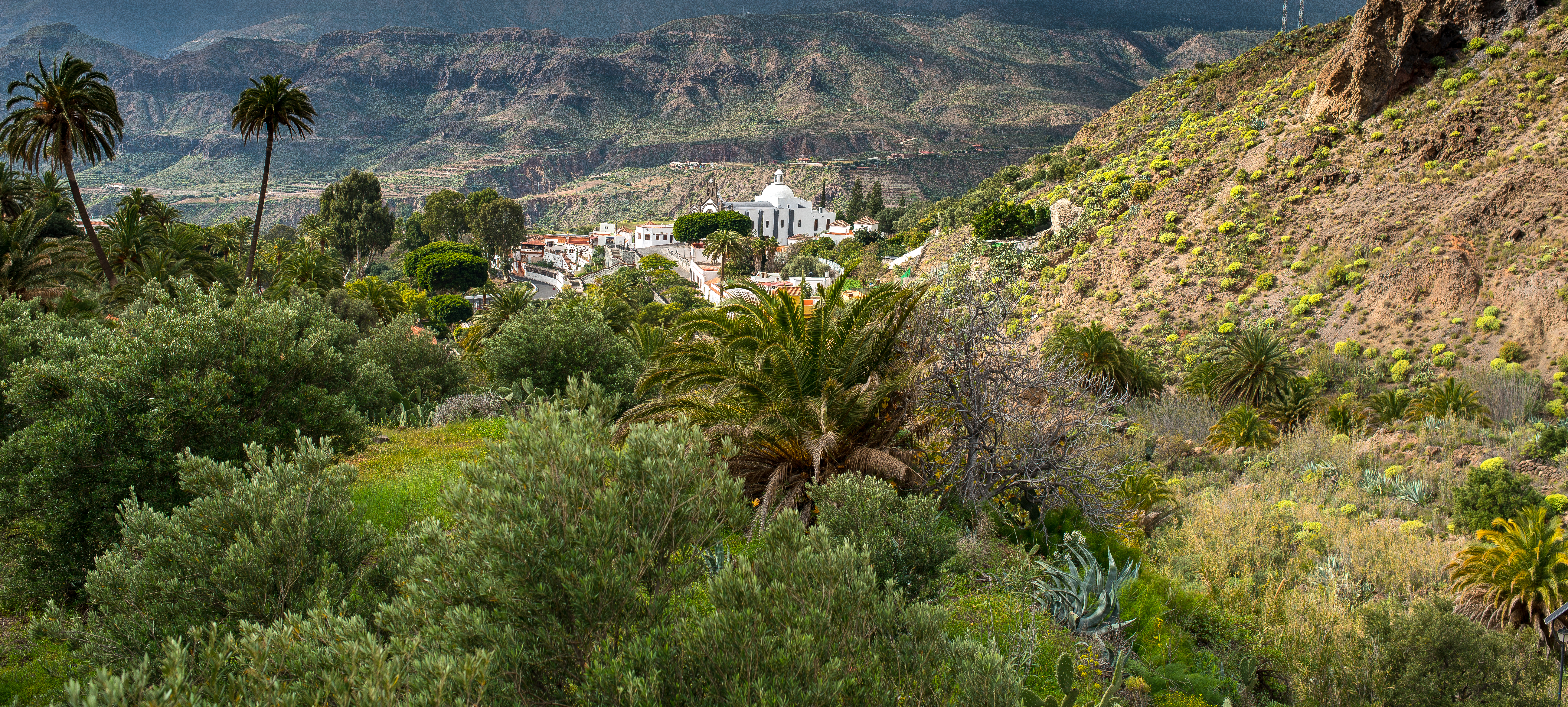
| image_skyline | File:Church in santa lucia de tirajana.JPG |
| image_caption | Santa Lucía church |
| image_flag | Bandera de Santa Lucía de Tirajana.svg |
| image_shield | Emblem of Santa Lucía de Tirajana.svg |
| image_map | Gran Canaria municipio Santa Lucía de Tirajana.svg |
| map_caption | Municipal location in Gran Canaria |
| pushpin_map | Spain Province of Las Palmas#Canary Islands#Spain with Canary Islands |
| pushpin_map_caption | Location in the province of Las Palmas |
| coordinates | |
| subdivision_type | Country |
| subdivision_name | Spain |
| subdivision_type1 | Region |
| subdivision_name1 | Macaronesia |
| subdivision_type2 | Autonomous Community |
| subdivision_name2 | Canary Islands |
| subdivision_type3 | Province |
| subdivision_name3 | Las Palmas |
| subdivision_type4 | Island |
| subdivision_name4 | Gran Canaria |
| leader_party | NC |
| leader_title | Mayor |
| leader_name | Dunia González Vega |
| area_footnotes | |
| area_total_km2 | 61.56 |
| elevation_footnotes | (AMSL) |
| elevation_m | 680 |
| population_as_of | |
| population_footnotes | |
| population_total | |
| population_density_km2 | auto |
| timezone1 | WET |
| utc_offset1 | +0 |
| timezone1_DST | WEST (GMT +1) |
| utc_offset1_DST | +1 |
| postal_code_type | Postal code |
| postal_code | 35110 |
| area_code | +34 (Spain) + 928 (Las Palmas) |
| website | *santaluciagc.com* |
Santa Lucía de Tirajana is a town and a Spanish municipality in the south-eastern part of the island of Gran Canaria, in the Province of Las Palmas, in the Canary Islands.
Geography
The town of Santa Lucía de Tirajana is situated in the mountains, 27 km south-west of Las Palmas. Its population is (2013), and the area is 61.56 km².
The municipality includes the larger towns Cruce de Sardina, El Doctoral and Vecindario, located near the coast.
The GC-1 passes through the south-eastern part of the municipality.
Population
| 1991 | 33059 | 1996 | 40127 | 2001 | 47652 | 2002 | 49902 | 2003 | 52684 | 2004 | 53820 | 2013 | 68506
Heritage sites
.jpg)

The archaeological site La Fortaleza is listed as a Property of cultural interest.
There are nine water mills dating from the 19th century, built on the Riego de la Zarcilla river. Most of them kept working up to the 1970s. Since then, many fell into disrepair. Ownership may be public or private. On the municipality, the two mills of El Valle (olive oil for one and gofio**Gofio is roasted maize meal often stirred into coffee. for the other) were declared properties of cultural interest in 2003. D. Benjamín González Araña, who owns the olive oil mill, had its restoration completed in 2004. The council of Gran Canaria had the gofio mill repaired in 2003.
Gallery
Iglesia Santa Lucía de Tirajana
File:Iglesia Santa Lucía de Tirajana.jpg File:Iglesia Santa Lucía de Tirajana - Interior.jpg Iglesia Santa Lucía de Tirajana - Santa Lucía.jpg
Public art
File:Lucy and Star Boy.jpg|Lucy and Star Boy File:El Matriarcado - Santa Lucía de Tirajana.jpg|El Matriarcado File:Romeria de los Labradores - Santa Lucía de Tirajana.jpg|Romeria de los Labradores File:Antonius Maria Claret y Clará - Santa Lucía de Tirajana.jpg|Saint Anthony Mary Claret
Notes
References
References
- [http://www.gobiernodecanarias.org/istac/jaxi-istac/menu.do?uripub=urn:uuid:fbc0bdc8-cacb-43b8-a5cb-a93f745dcff6 Instituto Canario de Estadística], area
- link. (2014-04-22 , population)
- {{in lang. es José Mercado Soria, Antonio Toledo de León and Juan Manuel Febles Suárez, arquitectos; Jordi Noguera López, diseñador industrial. [http://www.grancanariapatrimonio.com/documents/251793/287894/Bolet%C3%ADn+de+Patrimonio+Hist%C3%B3rico+N%C2%BA%202.pdf/0c3a5480-33e2-4a32-9473-6ea8c6e0a979 ''Rehabilitación del Molino de Gofio en El Valle y del Sendero de los Molinos en El Riego de la Heredad de La Zarcilla (Santa Lucía de Tirajana)''] {{Webarchive. link. (2017-02-14 ("Rehabilitation of the ''gofio'' mill in El Valle and of the Mills path in the ''Riego de la Heredad of La Zarcilla river''"). In ''Boletín de Patrimonio Histórico'', 2004, nr. 2, pp. 32-36.)
This article was imported from Wikipedia and is available under the Creative Commons Attribution-ShareAlike 4.0 License. Content has been adapted to SurfDoc format. Original contributors can be found on the article history page.
Ask Mako anything about Santa Lucía de Tirajana — get instant answers, deeper analysis, and related topics.
Research with MakoFree with your Surf account
Create a free account to save articles, ask Mako questions, and organize your research.
Sign up freeThis content may have been generated or modified by AI. CloudSurf Software LLC is not responsible for the accuracy, completeness, or reliability of AI-generated content. Always verify important information from primary sources.
Report