From Surf Wiki (app.surf) — the open knowledge base
Rondón, Boyacá
| Field | Value |
|---|---|
| name | Rondón |
| other_name | San Rafael |
| settlement_type | Municipality and town |
| image_flag | Flag of Rondón (Boyacá).svg |
| image_seal | Escudo de Rondón (Boyacá).svg |
| image_map | Colombia - Boyaca - Rondon.svg |
| mapsize | 250px |
| map_caption | Location of the municipality and town of Rondón in the Boyacá Department of Colombia |
| pushpin_mapsize | 300 |
| pushpin_map_caption | Location in Colombia |
| subdivision_type | Country |
| subdivision_name | Colombia |
| subdivision_type1 | Department |
| subdivision_name1 | Boyacá Department |
| subdivision_type2 | Province |
| subdivision_name2 | Márquez Province |
| leader_title | Mayor |
| leader_name | Sandro Rodolfo Borda Rojas |
| (2020-2023) | |
| established_title | Founded |
| established_date | 30 June 1904 |
| founder | Ignacio Aristides Medina Ávila |
| area_total_km2 | 258 |
| area_urban_km2 | 0.8 |
| population_as_of | 2015 |
| population_note | |
| population_total | 2934 |
| population_density_km2 | auto |
| coordinates | |
| timezone | Colombia Standard Time |
| utc_offset | -5 |
| elevation_m | 2075 |
| website |
(2020-2023) Rondón is a town and municipality in the Márquez Province, part of Boyacá Department, Colombia. The urban centre of Rondón is situated at an altitude of 2075 m on the Altiplano Cundiboyacense in the Colombian Eastern Ranges of the Andes. It is 61 km away from the departmental capital Tunja. Rondón borders Viracachá and Siachoque in the north, Zetaquirá and Ramiriquí in the south, Pesca in the east and Ramiriquí and Ciénega in the west.
Etymology
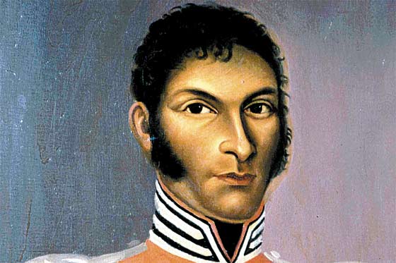
Rondón was previously known as San Rafael, and earlier, the area of Rondón was referred to as La Galera, a forested terrain. It received the name Rondón honouring the independence hero of the Battle of Vargas Swamp Juan José Rondón.
History
The terrain of Rondón was completely forested until the mid 19th century, when the lands passed through various families of land owners. The newly founded settlement was populated by people coming from Ramiriquí, Ciénega, Viracachá and Pesca. The town received the status of municipality on June 30, 1904, by Ignacio Aristides Medina Ávila.
Economy
Main economic activities in Rondón are livestock farming and agriculture. Among the products cultivated are lulo, sugarcane, coffee, bananas, oranges, yuca, arracacha, beans, peas, avocadoes, guayaba, chirimoya, guanábana, potatoes and maize.
Climate
|archive-url=https://web.archive.org/web/20160815025712/http://www.ideam.gov.co/documents/21021/553571/Promedios%2BClimatol%C3%B3gicos%2B%2B1981%2B-%2B2010.xlsx/f28d0b07-1208-4a46-8ccf-bddd70fb4128 |archive-date=15 August 2016 |access-date=3 June 2024 |url-status=dead}}
References
References
- {{in lang. es [http://www.municipios.com.co/boyaca/rondon Rondón]
- {{in lang. es [http://www.rondon-boyaca.gov.co/informacion_general.shtml Official website Rondón]
This article was imported from Wikipedia and is available under the Creative Commons Attribution-ShareAlike 4.0 License. Content has been adapted to SurfDoc format. Original contributors can be found on the article history page.
Ask Mako anything about Rondón, Boyacá — get instant answers, deeper analysis, and related topics.
Research with MakoFree with your Surf account
Create a free account to save articles, ask Mako questions, and organize your research.
Sign up freeThis content may have been generated or modified by AI. CloudSurf Software LLC is not responsible for the accuracy, completeness, or reliability of AI-generated content. Always verify important information from primary sources.
Report