From Surf Wiki (app.surf) — the open knowledge base
Poncey–Highland

| Field | Value |
|---|---|
| name | Poncey–Highland |
| settlement_type | Neighborhoods of Atlanta |
| image_skyline | Poncey Highland corner.JPG |
| imagesize | 300px |
| image_caption | Corner of North Avenue and Highland Avenue |
| mapsize | 300px |
| map_caption | Poncey–Highland location in central Atlanta |
| pushpin_map | |
| pushpin_label_position | |
| pushpin_map_caption | |
| pushpin_mapsize | 250 |
| subdivision_type | Country |
| subdivision_name | United States |
| subdivision_type1 | State |
| subdivision_name1 | Georgia |
| subdivision_type2 | County |
| subdivision_name2 | Fulton County |
| subdivision_type3 | City |
| subdivision_name3 | City of Atlanta |
| subdivision_type4 | |
| subdivision_name4 | |
| subdivision_type5 | NPU |
| subdivision_name5 | N |
| population_as_of | 2000 |
| population_footnotes | |
| population_total | 8478 |
| demographics_type1 | Demographics (2000) |
| demographics1_footnotes | |
| demographics1_title1 | White/other |
| demographics1_info1 | % |
| demographics1_title2 | Black |
| demographics1_info2 | % |
| demographics1_title3 | Asian |
| demographics1_info3 | % |
| demographics1_title4 | Hispanic |
| demographics1_info4 | % |
| coordinates | |
| postal_code_type | ZIP Code |
| postal_code | 30306 |
| website | Poncey–Highland Neighborhood Association |
Poncey–Highland is an intown neighborhood on the east side of Atlanta, Georgia, located south of Virginia–Highland. It is so named because it is near the intersection of east/west Ponce de Leon Avenue and north/southwest North Highland Avenue. This Atlanta neighborhood was established between 1905 and 1930, and is bordered by Druid Hills and Candler Park across Moreland Avenue to the east, the Old Fourth Ward across the BeltLine Eastside Trail to the west, Inman Park across the eastern branch of Freedom Parkway to the south, and Virginia Highland to the north across Ponce de Leon Avenue. The Little Five Points area sits on the border of Poncey–Highland, Inman Park, and Candler Park.

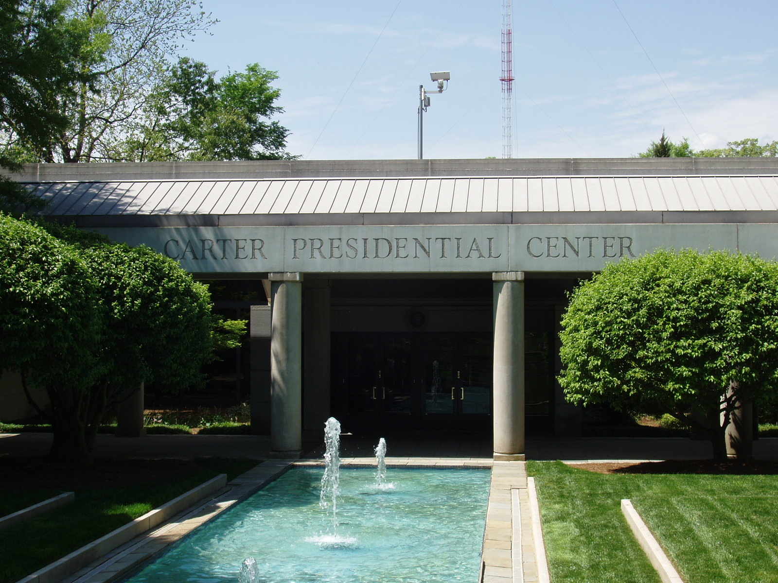
Poncey–Highland is home to the Jimmy Carter Presidential Library, established in 1982. The Carter Center occupies an area of land that was originally the neighborhood of Copenhill, and which was razed to build an interchange between eight-lane highways: Interstate 485 (now Stone Mountain Freeway) east and west, and Georgia 400 and Interstate 675 north and south. The development was successfully stopped by the surrounding neighborhoods, leaving Freedom Parkway in the area where GDOT had already demolished over 500 homes.
Poncey–Highland has numerous historic buildings, including:
- Ford Motor Company Assembly Plant (c. 1916)
- Western Electric Company building at 820 Ralph McGill
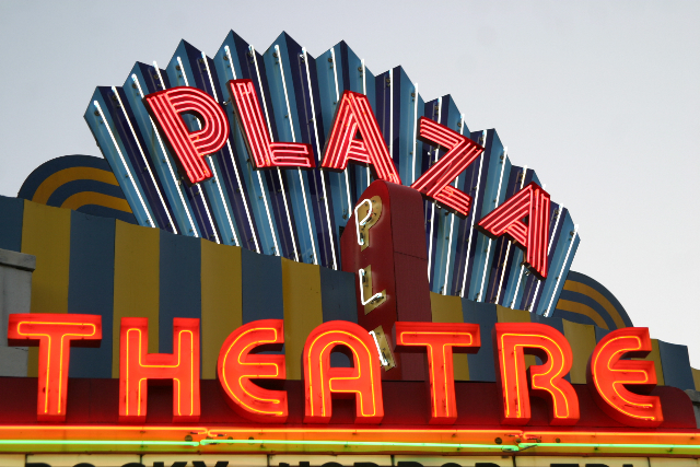
- Briarcliff Plaza, containing the Majestic Diner (c. 1929) and the Plaza Theatre (1939), an art-deco cinema hosting numerous film events and the focal point of independent cinema in Atlanta
- Hotel Clermont (c. 1924), and its basement Clermont Lounge, a landmark strip club open since 1965.{{cite web|url=https://www.cnn.com/travel/article/clermont-lounge-hotel-atlanta/index.html |access-date=2019-10-28|title=Clermont Lounge: Strip club meets boutique hotel in Atlanta |publisher=CNN|date=2019-02-04}}
The BeltLine, a multi-use corridor of walking and biking paths and eventually a light rail line, built on the old Southern Railway tracks that form the western boundary of Poncey–Highland. The BeltLine Eastside Trail borders Poncey–Highland.
Around the intersection of North Avenue and North Highland are:
- Manuel's Tavern, a local political hangout and one of Atlanta's oldest taverns
- The Highland Inn (1927), one of Atlanta's only independent hotels
The so-called Murder Kroger at 725 Ponce de Leon Ave. was razed in 2016 and replaced by 725 Ponce, a mixed-use development with a new Kroger store.
References
References
- "Virginia-Highland".
- "City of Atlanta Online".
- (2019-04-23). "Where to Stay: Spotlight on Hotel Clermont". Atlanta Magazine.
- (2019-10-15). "With second reboot, Kroger on Beltline looks to shed 'murder' from store's moniker". Decaturish.
This article was imported from Wikipedia and is available under the Creative Commons Attribution-ShareAlike 4.0 License. Content has been adapted to SurfDoc format. Original contributors can be found on the article history page.
Ask Mako anything about Poncey–Highland — get instant answers, deeper analysis, and related topics.
Research with MakoFree with your Surf account
Create a free account to save articles, ask Mako questions, and organize your research.
Sign up freeThis content may have been generated or modified by AI. CloudSurf Software LLC is not responsible for the accuracy, completeness, or reliability of AI-generated content. Always verify important information from primary sources.
Report