From Surf Wiki (app.surf) — the open knowledge base
Ōmaha
Locality in Auckland Region, New Zealand

Locality in Auckland Region, New Zealand
| Field | Value | |
|---|---|---|
| official_name | Ōmaha | |
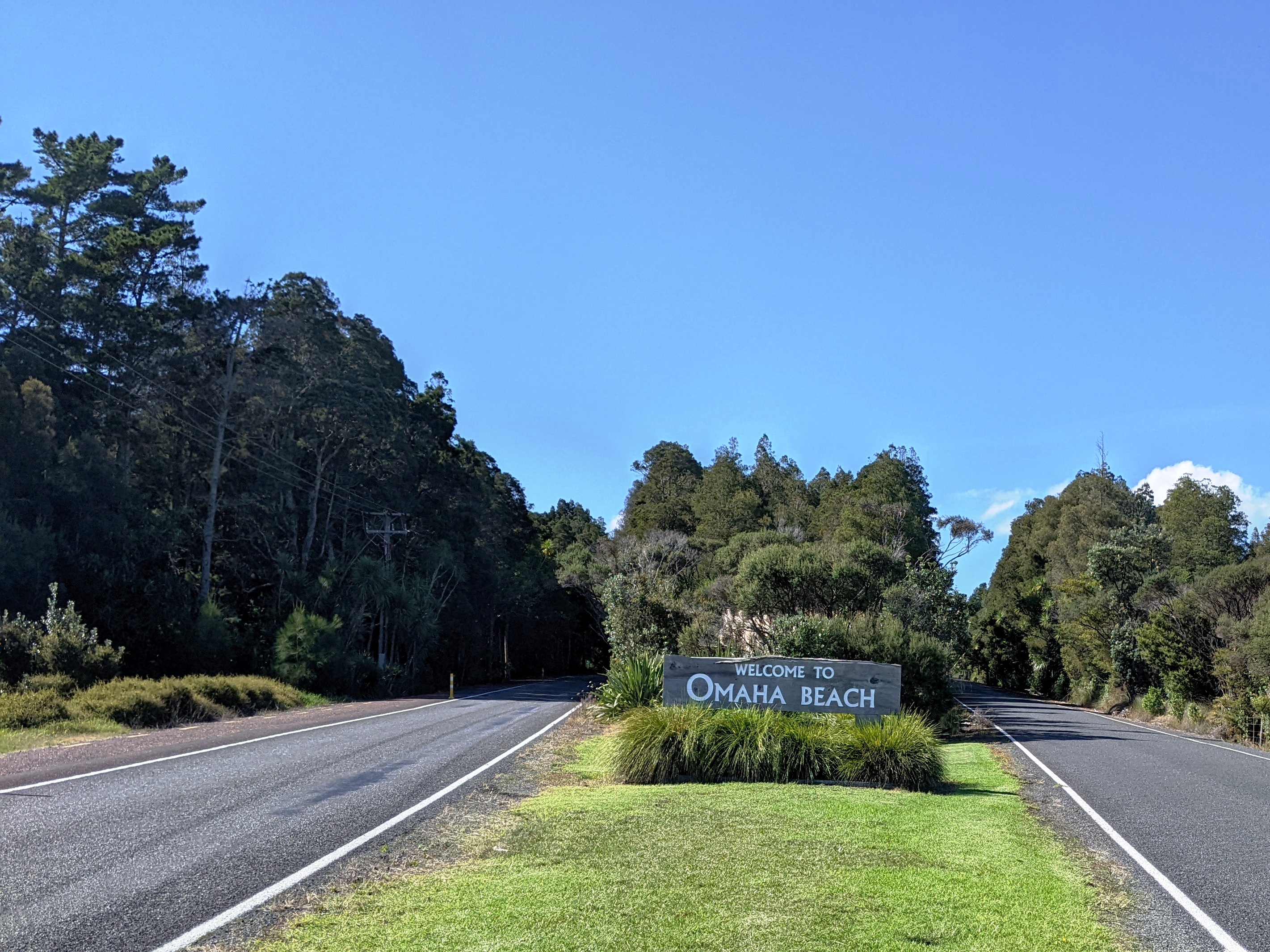
| image_skyline | [[File:Omaha_Beach_vista.jpg | 280px]] |
| image_caption | Ōmaha Beach in mid-summer | |
| area_total_km2 | 4.85 | |
| area_footnotes | ||
| population_footnotes | ||
| population_as_of | ||
| population_total | ||
| population_density_km2 | auto | |
| subdivision_type | Country | |
| subdivision_name | New Zealand | |
| subdivision_type1 | Region | |
| subdivision_name1 | Auckland Region | |
| subdivision_type2 | Ward | |
| subdivision_name2 | Rodney ward | |
| subdivision_type3 | Community board | |
| subdivision_name3 | Rodney Local Board | |
| subdivision_type4 | Subdivision | |
| subdivision_name4 | Warkworth subdivision | |
| leader_title | Territorial Authority | |
| leader_name | Auckland Council | |
| leader_title2 | Mayor of Auckland | |
| leader_name2 | ||
| leader_title3 | Kaipara ki Mahurangi MP | |
| leader_name3 | ||
| leader_title4 | Te Tai Tokerau MP | |
| leader_name4 | ||
| seat_type | Electorates | |
| seat | ||
| mapframe | yes | |
| mapframe-zoom | 11 | |
| coordinates |
| mapframe-zoom = 11
Ōmaha is a small beach town on Ōmaha Bay in the Auckland Region, in the north of New Zealand. It is located 74.7 km north of central Auckland. It is on a sandspit that adjoins Tāwharanui Peninsula and separates Whangateau Harbour from Ōmaha Bay. The nearest sizeable town is Warkworth which is situated 16.8 km south west of Ōmaha.
History
Ōmaha was a Marutūāhu settlement until 1841, when it was bought by the Crown. Early European settlement took place at Sandspit.
The Māori name Ōmaha means 'bountiful food' or 'great resources'. Nearby Leigh was historically named Ōmaha by Māori, and Ōmaha Beach was called Mangatawhiri by Ngāti Manuhiri.
The Omaha Road Board was formed 26 September 1867 and administered the area until 1903, when it was dissolved.
Omaha saw growth during the 1970s when a bridge to Ōmaha was constructed by Broadlands Properties, who then subdivided the land and built housing.
To prevent erosion a wooden barrier was constructed. Despite these efforts on the 19th of July, 1978 a strong storm destroyed the barrier and caused damage to several beach front properties. To solve the issue of erosion and flooding with high tides three groynes were constructed to divert currents from Ōmaha. Alongside these groynes the harbour would be dredged with sand taken to the beach.
Following the work to protect the foreshore more building permits were permitted; however, most came with a caveat requiring them to be raised slightly above the ground.
Geography
The sandspit of Ōmaha was formed during the last glacial period, approximately 5000 to 6000 years BP. The beach sediment composition is over 70% quartz sand, which gifted Ōmaha the natural "white" appearance. There are three artificial groynes had been placed at northern part of the sandspit, to accumulate sediment from longshore drift. Local council in last two decades had been placing various groups of plant to stabilize the dunes, including Spinifex, pingao, iceplant and marram grass.
Ōmaha Spit has also been identified by the Department of Conservation as a "significant breeding site for the endangered New Zealand dotterel. As a result, The Omaha Shorebird Protection Trust was established in 2009 to monitor the dotterel population at Ōmaha. Fundraising of $162,000 by the Trust saw construction of a predator-proof fence completed in August 2012 helping to protect the birds, their chicks and eggs from predation by cats, rats, stoats, wessels and hedgehogs.{{cite web|title=Rodney Times | Predator-proof fence nearly finished
Demographics
In the early 1980s the population was less than 100. By the start of the 1990s it had increased to 300.
Statistics New Zealand describes Ōmaha as a rural settlement, which covers 4.85 km2 and had an estimated population of as of with a population density of people per km2. Ōmaha is part of the larger Tawharanui Peninsula statistical area.


Ōmaha had a population of 744 in the 2023 New Zealand census, a decrease of 9 people (−1.2%) since the 2018 census, and an increase of 120 people (19.2%) since the 2013 census. There were 339 males and 405 females in 318 dwellings. 0.8% of people identified as LGBTIQ+. The median age was 60.7 years (compared with 38.1 years nationally). There were 87 people (11.7%) aged under 15 years, 60 (8.1%) aged 15 to 29, 297 (39.9%) aged 30 to 64, and 300 (40.3%) aged 65 or older.
People could identify as more than one ethnicity. The results were 96.4% European (Pākehā); 6.0% Māori; 2.0% Pasifika; 0.8% Asian; 0.4% Middle Eastern, Latin American and African New Zealanders (MELAA); and 2.4% other, which includes people giving their ethnicity as "New Zealander". English was spoken by 99.2%, Māori language by 0.8%, Samoan by 0.4%, and other languages by 7.3%. No language could be spoken by 0.8% (e.g. too young to talk). New Zealand Sign Language was known by 0.4%. The percentage of people born overseas was 17.3, compared with 28.8% nationally.
Religious affiliations were 34.7% Christian, and 0.8% other religions. People who answered that they had no religion were 56.5%, and 7.3% of people did not answer the census question.
Of those at least 15 years old, 141 (21.5%) people had a bachelor's or higher degree, 381 (58.0%) had a post-high school certificate or diploma, and 99 (15.1%) people exclusively held high school qualifications. The median income was $45,100, compared with $41,500 nationally. 117 people (17.8%) earned over $100,000 compared to 12.1% nationally. The employment status of those at least 15 was that 225 (34.2%) people were employed full-time, 111 (16.9%) were part-time, and 3 (0.5%) were unemployed.
Community
Ōmaha has a boat ramp, surf club, an 18 hole golf course, tennis courts, bowling club and children's playgrounds.
From 2018 it has been served by 7 buses a day to Warkworth.
References
References
- "Google Maps".
- (2022-01-19). "First names hold history and whakapapa for Ngāti Manuhiri".
- Bloomfield, Gerald Taylor. (1973). "The Evolution of Local Government Areas in Metropolitan Auckland, 1840-1971". Auckland University Press.
- Bioletti, Harry. (1992). "Rodney Coast to Coast".
- "Department of Conservation, New Zealand".
- "Omaha Shorebird Protection Trust".
- "ArcGIS Web Application".
- {{NZ census place summary 2018. tawharanui-peninsula. Tawharanui Peninsula
- {{NZ census 2018. 7001243–7001247
- "Totals by topic for dwellings, (RC, TALB, UR, SA3, SA2, Ward, Health), 2013, 2018, and 2023 Censuses". Stats NZ – Tatauranga Aotearoa – Aotearoa Data Explorer.
- "Totals by topic for individuals, (RC, TALB, UR, SA3, SA2, Ward, Health), 2013, 2018, and 2023 Censuses". Stats NZ – Tatauranga Aotearoa – Aotearoa Data Explorer.
- "Auckland District Council".
- "Omaha Surf Club".
- "Omaha Beach Community Inc.".
- (30 September 2018). "Warkworth Kowhai Coast Northern Bus Timetable".
This article was imported from Wikipedia and is available under the Creative Commons Attribution-ShareAlike 4.0 License. Content has been adapted to SurfDoc format. Original contributors can be found on the article history page.
Ask Mako anything about Ōmaha — get instant answers, deeper analysis, and related topics.
Research with MakoFree with your Surf account
Create a free account to save articles, ask Mako questions, and organize your research.
Sign up freeThis content may have been generated or modified by AI. CloudSurf Software LLC is not responsible for the accuracy, completeness, or reliability of AI-generated content. Always verify important information from primary sources.
Report