From Surf Wiki (app.surf) — the open knowledge base
Langøya
Island in Nordland, Norway
Island in Nordland, Norway
| Field | Value |
|---|---|
| name | Langøya |
| Langøy | |
| location | Nordland, Norway |
| coordinates | |
| archipelago | Vesterålen |
| area_km2 | 850.2 |
| rank | 3rd largest in Norway |
| length_km | 50 |
| width_km | 40 |
| elevation_m | 763 |
| highest_mount | Snøkolla |
| country | Norway |
| country_admin_divisions_title | County |
| country_admin_divisions | Nordland |
| country_admin_divisions_title_1 | Municipalities |
| country_admin_divisions_1 | Bø, Hadsel, Sortland, and Øksnes |
| population | 15,791 |
| population_as_of | 2016 |
| density_km2 | 18.6 |
Langøy
Langøya is the third largest island of Norway (outside of Svalbard), with an area of 850.2 km2. The island is a part of the Vesterålen archipelago in Nordland county, Norway. The island includes Bø Municipality and Øksnes Municipality as well as parts of Sortland Municipality and Hadsel Municipality.
Geography

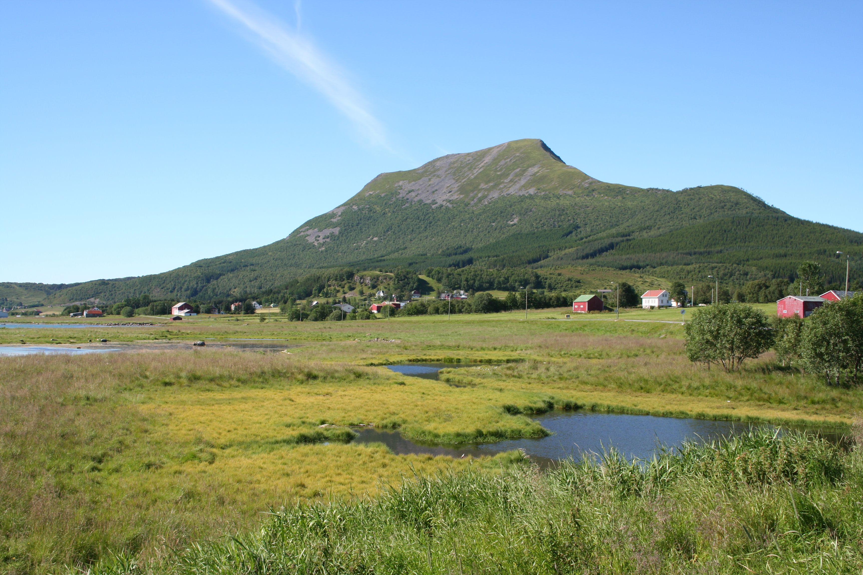
Langøya is mountainous, with mountains reaching 400-700 m above sea level, the highest is the 763 m tall Snykolla. There are also lowland near the coasts around the island, and in some valleys, some of it is bogs. The treeline is around 300 m above sea level on Langøya.
The total population on the island is about 15,600 and the largest population center is the town of Sortland (population: 5,600) and the next largest population centre is the village of Myre. Langøya has been settled since the stone age.
The larger island Hinnøya lies to the east (on the other side of the Sortlandssundet). The island of Andøya lies to the northeast. The small island of Skogsøya lies to the northwest. The island of Hadseløya lies to the south. The 69th parallel north crosses Langøya, as does the 15th meridian east.
There are several lakes on the island including Alsvågvatnet. The Eidsfjorden divides the island almost in half. The island has two road bridges connecting it to Hadseløya and Hinnøya via the Hadsel Bridge and Sortland Bridge.
Important Bird Area
A tract of about 3000 ha of low-lying land in central and south-eastern coastal Langøya, consisting mainly of grassland and mudflats, and including the Vikosen nature reserve, has been designated an Important Bird Area (IBA) by BirdLife International (BLI) because it supports populations of several thousand pink-footed and barnacle geese on passage migration.
Climate
Langøya has a subpolar oceanic climate (Cfc), with very mild winter for the location north of the Arctic Circle. The warmest temperature recorded on the island by an official weather station is 31 °C at Kleiva in Sortland municipality in July 2018. The weather station near Stokmarknes Airport, Skagen is located on the southern part of the island and has recorded temperature since June 1972. Data for extremes available since 2004, there might be warmer or colder temperatures recorded before 2004.
|Jan record high C = 10 | Jan record low C = -13.9 |Feb record high C = 8.4 | Feb record low C = -13.9 |Mar record high C = 9.4 | Mar record low C = -14.4 |Apr record high C = 17.3 | Apr record low C = -10.5 |May record high C = 26.4 | May record low C = -5.6 |Jun record high C = 27.5 | Jun record low C = -0.1 |Jul record high C = 29 | Jul record low C = 3.2 |Aug record high C = 27.2 | Aug record low C = 1.2 |Sep record high C = 22.2 | Sep record low C = -2.9 |Oct record high C = 16.9 | Oct record low C = -7.6 |Nov record high C = 12.3 | Nov record low C = -13 |Dec record high C = 10.3 | Dec record low C = -11.1
Media gallery
Fv915 Nordland c.jpg|The rugged western part of Langøya near Nykvåg. IMG 1578a - Lifjorden.jpg|Lifjorden; many small fjords dissect Langøya Fra Frøskeland mot Ræka - IMG 0316a.jpg|View near Frøskeland towards Ræka mt File:Map-of-Lofoten-and-Vesteraalen.svg|Map of the area
References
References
- "Informasjon om stadnamn". [[Norwegian Mapping Authority.
- Store norske leksikon. "Langøya – øy i Nordland".
- . (2021). ["Langøya"](http://datazone.birdlife.org/site/factsheet/lang%C3%B8ya-iba-norway). *BirdLife International*.
- "eKlima Web Portal". Norwegian Meteorological Institute.
- "Max. Temperature - Stokmarknes - Climate Robot Norway".
This article was imported from Wikipedia and is available under the Creative Commons Attribution-ShareAlike 4.0 License. Content has been adapted to SurfDoc format. Original contributors can be found on the article history page.
Ask Mako anything about Langøya — get instant answers, deeper analysis, and related topics.
Research with MakoFree with your Surf account
Create a free account to save articles, ask Mako questions, and organize your research.
Sign up freeThis content may have been generated or modified by AI. CloudSurf Software LLC is not responsible for the accuracy, completeness, or reliability of AI-generated content. Always verify important information from primary sources.
Report