From Surf Wiki (app.surf) — the open knowledge base
Kantō region
Region of Japan

Region of Japan
| Field | Value |
|---|---|
| name | Kantō region |
| native_name | 関東地方 |
| native_name_lang | ja |
| settlement_type | Region |
| image_skyline | Kanto Region in Japan.svg |
| image_alt | Map showing location of Kantō region within Japan |
| image_caption | The Kantō region in comparison to the rest of Japan |
| mapframe | yes |
| mapframe-zoom | 5 |
| mapframe-point | none |
| map_alt | = |
| subdivision_type | Country |
| subdivision_name | Japan |
| unit_pref | Metric |
| area_total_km2 | 32,423.9 |
| population_total | 43,653,441 |
| population_as_of | October 1, 2020 |
| population_density_km2 | auto |
| timezone1 | JST |
| utc_offset1 | +09:00 |
| demographics_type1 | GDP (2022) |
| demographics1_footnotes | |
| demographics1_title1 | Total |
| demographics1_info1 | JP¥248.036 trillion |
| US$1.832 trillion |
| mapframe-zoom = 5 | mapframe-point = none US$1.832 trillion
The Kantō region is a geographical region of Honshu, the largest island of Japan. In a common definition, the region includes the Greater Tokyo Area and encompasses seven prefectures: Chiba, Gunma, Ibaraki, Kanagawa, Saitama, Tochigi, and Tokyo. Slightly more than 45 percent of the land area within its boundaries is the Kantō Plain. The rest consists of the hills and mountains that form land borders with other regions of Japan.
As the Kantō region contains Tokyo, the capital and largest city of Japan, the region is considered the center of Japan's politics and economy. According to the official census on October 1, 2010, by the Statistics Bureau of Japan, the population was 42,607,376, amounting to approximately one third of the total population of Japan.
Other definitions
The Kantō regional governors' association assembles the prefectural governors of Ibaraki, Tochigi, Gunma, Saitama, Chiba, Tokyo, Kanagawa, Yamanashi, Nagano, and Shizuoka.
The Kantō Regional Development Bureau of the Ministry of Land, Infrastructure, Transport and Tourism in the national government is responsible for eight prefectures generally (Ibaraki, Tochigi, Gunma, Saitama, Chiba, Tokyo, Kanagawa, Yamanashi) and parts of the waterways in two others (Nagano and Shizuoka).
The Kantō Bureau of Economy, Trade and Industry is responsible for eleven prefectures: Ibaraki, Tochigi, Gunma, Saitama, Chiba, Tokyo, Kanagawa, Niigata, Yamanashi, Nagano and Shizuoka.
In the police organization of Japan, the National Police Agency's supervisory office for Kantō is responsible for the Prefectural police departments of Ibaraki, Tochigi, Gunma, Saitama, Chiba, Kanagawa, Niigata, Yamanashi, Nagano and Shizuoka. Tokyo is not part of Kantō or any NPA region, its police has a dedicated liaison office with the national agency of its own.
Geography

The surface geology of the Kantō Plain is the Quaternary alluvium and diluvium. The low mountain vegetation at an altitude of about 500 to 900 m in and around the plain is an evergreen broad-leaved forest zone. The distribution height range of laurel forests is 900 m in Hakone, about 800 m in Tanzawa and Takao, about 700 m in Okutama, Oku Musashi and Oku Chichibu, about 600 m in Nishijoshu, Akagiyama, Ashio Mountains and Tsukuba Mountains and about 500 m in Kitage and Nasu Mountains.
Over the evergreen broad-leaved forest are deciduous broad-leaved forests such as beech, birch, and Quercus crispula. In addition, coniferous forests such as Abies veitchii and Betula ermanii spread above the deciduous broad-leaved forest from an altitude of about 1100 m higher than the lower limit of the deciduous broad-leaved forest.
Mountains are spread out such as the Taishaku Mountains, Mt. Takahara, Mt. Nasu, and Mt. Yamizo. The Kantō Plain, which is the largest plain in Japan. Just north of the Enna Hills is Japan's largest alluvial fan Nasuno at the foot of Mt. The Kujukuri Plain. The southern part of Chiba Prefecture is the Boso hills. The area around Kasumigaura in Ibaraki Prefecture is the Joso plateau and Hitachi plateau. Gunma Prefecture and the Chichibu region of Saitama Prefecture are basins. Rivers such as the Arakawa and Edo rivers pour into Tokyo Bay, and the Kinugawa and Tone rivers flow into the Pacific Ocean in Inubōsaki.
Tokyo Bay is surrounded by the Boso Peninsula and the Miura Peninsula, facing the west side of Chiba Prefecture, a part of Tokyo and the east side of Kanagawa Prefecture, and borders the Pacific Ocean from Uraga Suido. The coastal area is an industrial area. The south side of Kanagawa Prefecture faces Sagami Bay and Sagami Nada. The southern coast of Ibaraki Prefecture faces Kashima Nada. The Sagami Trough, which was the epicenter of the two Kantō earthquakes, passes through Sagami Bay. Efforts are being made to take safety measures against earthquakes in various places.
The highest point is the summit of Mt. Nikko-Shirane (Mt. Oku-Shirane) on the border between Nikko City, Tochigi Prefecture and Katashina Village, Gunma Prefecture. It is the eighth highest point in Japan's prefectures. It is also the highest point north of Kantō (Kantō, Tōhoku, Hokkaido). The highest points of the prefectures are Mt. Sanpo (2,483 m) in Saitama, Mt. Kumotori (2,017 m) in Tokyo, Mt. Hiru (1,673 m) in Kanagawa, Mt. Yamizo (1,022 m) in Ibaraki, and Mt. Atago (408 m) in Chiba. Atagoyama in Chiba Prefecture is the lowest among the highest peaks in each prefecture.
The region experiences a humid subtropical climate with a summer to fall precipitation maximum (Cfa/Cwa).
History
The name Kantō literally means "East of the Barrier". The name Kantō is nowadays generally considered to mean the region east (東) of the Hakone Barrier (箱根関). The antonym of Kantō is the Kansai region meaning "West of the Barrier", which lies in western Honshu and was the center of feudal Japan.

Kamakura was the political capital during the Kamakura period and it served as the seat of the Kamakura shogunate from 1185 to 1333, established by Minamoto no Yoritomo.
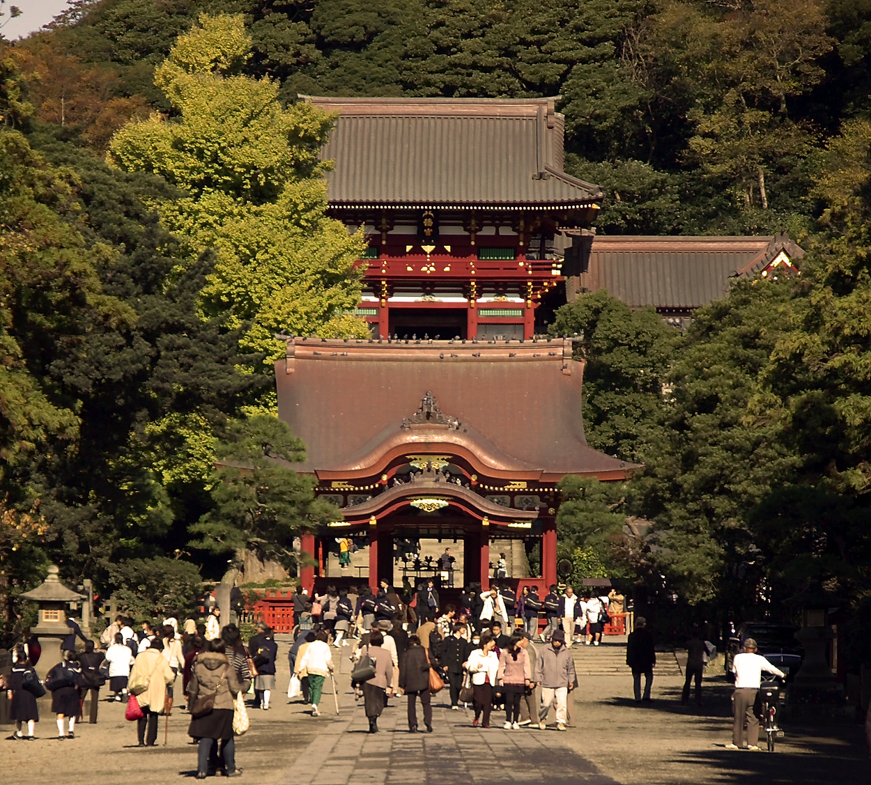
This was the first military government in Japan's history. Kamakura flourished until the fall of the Kamakura Shogunate, and its political functions returned to Kyoto in 1392.
In 1591, Tokugawa Ieyasu gave up control of his five provinces (Mikawa, Tōtōmi, Suruga, Shinano, and Kai) and moved all his soldiers and vassals to his new eight provinces in the Kantō region. The proclamation of this decision happened on the same day Toyotomi Hideyoshi, the de facto ruler of Japan at that time, entered Odawara castle following the surrender of the Hōjō clan after the Siege of Odawara (1590). The moment Ieyasu was appointed to rule Kantō, he immediately assign his premier vassals such as Ii Naomasa, Honda Tadakatsu, Sakakibara Yasumasa, and Sakai Ietsugu, son of Sakai Tadatsugu, each to control large area of the former Hōjō clan territories in Kantō. Historian such as Kawamura saw this step was meant to bring order the newly subdued population of the area, while also guarding the eastern domains from the influence or threat from the Satomi clan which had not yet submit to the rule of Toyotomi at that time. The governors of Kantō region under Ieyasu rule:
| Province | Territory | Koku | Daimyo | Notes | Kōzuke Province | Minowa (later Takasaki Domain) | Tatebayashi Domain | Maebashi Domain | Shiroi Domain | Miyazaki (Obata Domain) | Fujioka | Ogo Domain | Yoshii Domain | Sōja Domain | Naba Domain | Shimotsuke Province | Minagawa Domain | Shimōsa Province | Yūki Domain & Tsuchiura Castle | Yahagi Domain | Usui Domain | Koga Domain | Sekiyado Domain | Yamasaki Domain | Ashido Domain | Moriya Domain | Tako Domain | Sakura Domain | Iwatomi Domain | Musashi Province | Iwatsuki Domain | Kisai Domain | Kawagoe Domain | Musashi Komuro Domain | Musashi Matsuyama Domain | Oshi Domain | Hanyu Domain | Fukaya Domain | Tōhō Domain | Honjō Domain | Aho Domain | Hachimanyama Domain | Kazusa Province | Ōtaki Domain | Kururi Domain | Sanuki Domain | Naruto Domain | Sagami Province | Odawara Domain | Tamanawa Domain | Izu Province | Nirayama Domain | ||||||||
|---|---|---|---|---|---|---|---|---|---|---|---|---|---|---|---|---|---|---|---|---|---|---|---|---|---|---|---|---|---|---|---|---|---|---|---|---|---|---|---|---|---|---|---|---|---|---|---|---|---|---|---|---|---|---|---|---|---|---|---|---|
| 120,000 | author1=高崎市史編さん委員会 | title=高崎市史 Volume 1 | date=1968 | publisher=高崎市 | page=151 | url=https://books.google.com/books?id=hdwNAAAAMAAJ | access-date=9 May 2024 | language=Ja}} | ||||||||||||||||||||||||||||||||||||||||||||||||||||
| 100,000 | Sakakibara Yasumasa | |||||||||||||||||||||||||||||||||||||||||||||||||||||||||||
| 33,000 | Hiraiwa Chikayoshi | |||||||||||||||||||||||||||||||||||||||||||||||||||||||||||
| 20,000 | Honda Yasushige | The total domain revenue was 33,000. However, the 13,000 of its koku revenue were controlled by the father of Yasushige instead, Honda Hirotaka. | ||||||||||||||||||||||||||||||||||||||||||||||||||||||||||
| 30,000 | Papinot, Edmond]]. (2003). *Nobiliare du Japon* -- Okudaira, p. 47; Papinot, Jacques Edmond Joseph. (1906). Dictionnaire d’histoire et de géographie du Japon. (in French/German). | |||||||||||||||||||||||||||||||||||||||||||||||||||||||||||
| 30,000 | Yoda Yasukatsu (依田康勝) | |||||||||||||||||||||||||||||||||||||||||||||||||||||||||||
| 20,000 | Makino Yasunari | |||||||||||||||||||||||||||||||||||||||||||||||||||||||||||
| 20,000 | Suganuma Sadatsugu | |||||||||||||||||||||||||||||||||||||||||||||||||||||||||||
| 12,000 | title=上 野 国 ・ 戦 国 時 代 そ の 5 戦 国 末 期 か ら 徳 川 政 権 へ | url=https://www.water.go.jp/kanto/gunma/sozoro%20walk/the%20age%20of%20civil%20wars%205.pdf | website=water.go.jp/ | publisher=Incorporated Administrative Agency Japan Water Agency Gunma Canal | access-date=8 June 2024 | language=Ja | date=2012}} | |||||||||||||||||||||||||||||||||||||||||||||||||||||
| 10,000 | Matsudaira Ienobu | |||||||||||||||||||||||||||||||||||||||||||||||||||||||||||
| 10,000 | Minagawa Hiroteru | |||||||||||||||||||||||||||||||||||||||||||||||||||||||||||
| 101,000 | Yuki Hideyasu | |||||||||||||||||||||||||||||||||||||||||||||||||||||||||||
| 40,000 | Torii Mototada | |||||||||||||||||||||||||||||||||||||||||||||||||||||||||||
| 30,000 | Sakai Ietsugu | |||||||||||||||||||||||||||||||||||||||||||||||||||||||||||
| 30,000 | Ogasawara Hidemasa | |||||||||||||||||||||||||||||||||||||||||||||||||||||||||||
| 20,000 koku | Matsudaira Yasumoto | |||||||||||||||||||||||||||||||||||||||||||||||||||||||||||
| 12,000 | Okabe Nagamori | |||||||||||||||||||||||||||||||||||||||||||||||||||||||||||
| 10,000 | Kiso Yoshimasa | |||||||||||||||||||||||||||||||||||||||||||||||||||||||||||
| 10,000 | Suganuma Sadamasa | |||||||||||||||||||||||||||||||||||||||||||||||||||||||||||
| 10,000 | Hoshina Masamitsu | |||||||||||||||||||||||||||||||||||||||||||||||||||||||||||
| 10,000 | Miura Shigenari (三浦重成) | |||||||||||||||||||||||||||||||||||||||||||||||||||||||||||
| 10,000 | Hōjō Ujikatsu | |||||||||||||||||||||||||||||||||||||||||||||||||||||||||||
| 20,000 | Kōriki Kiyonaga | |||||||||||||||||||||||||||||||||||||||||||||||||||||||||||
| 20,000 | Matsudaira Yasushige | |||||||||||||||||||||||||||||||||||||||||||||||||||||||||||
| 10,000 koku | Sakai Shigetada | |||||||||||||||||||||||||||||||||||||||||||||||||||||||||||
| 10,000 | Ina Tadatsugu | |||||||||||||||||||||||||||||||||||||||||||||||||||||||||||
| 10,000 | Matsudaira Iehiro (松平家広) | |||||||||||||||||||||||||||||||||||||||||||||||||||||||||||
| 10,000 | Matsudaira Ietada | |||||||||||||||||||||||||||||||||||||||||||||||||||||||||||
| 20,000 | author1=Shigeru Suda | title=武蔵国藩史総覧 | date=1989 | publisher=聚海書林 | isbn=4915521443 | pages=101–102 | url=https://books.google.com/books?id=RNTTAAAAMAAJ | access-date=24 May 2024 | language=Ja}} | |||||||||||||||||||||||||||||||||||||||||||||||||||
| 10,000 | Matsudaira Yasutada | |||||||||||||||||||||||||||||||||||||||||||||||||||||||||||
| 10,000 | Matsudaira Yasunaga | |||||||||||||||||||||||||||||||||||||||||||||||||||||||||||
| 10,000 | Ogasawara Nobumine (小笠原信嶺) | |||||||||||||||||||||||||||||||||||||||||||||||||||||||||||
| 10,000 | Suganuma Sadamitsu | |||||||||||||||||||||||||||||||||||||||||||||||||||||||||||
| 10,000 | Matsudaira Kiyomune (松平清宗) | |||||||||||||||||||||||||||||||||||||||||||||||||||||||||||
| 100,000 | Honda Tadakatsu | Initially the capital of Domain were in Mangi castle | ||||||||||||||||||||||||||||||||||||||||||||||||||||||||||
| 30,000 | Ōsuga Tadamasa | |||||||||||||||||||||||||||||||||||||||||||||||||||||||||||
| 20,000 | Naitō Ienaga | |||||||||||||||||||||||||||||||||||||||||||||||||||||||||||
| 20,000 | Ishikawa Yasumichi | |||||||||||||||||||||||||||||||||||||||||||||||||||||||||||
| 45,000 | Ōkubo Tadayo | |||||||||||||||||||||||||||||||||||||||||||||||||||||||||||
| 10,000 | Honda Masanobu | |||||||||||||||||||||||||||||||||||||||||||||||||||||||||||
| 10,000 | Naitō Nobunari |
Ieyasu established his personal new seat of power on Edo town, which at that time was an underdeveloped town in Kantō.
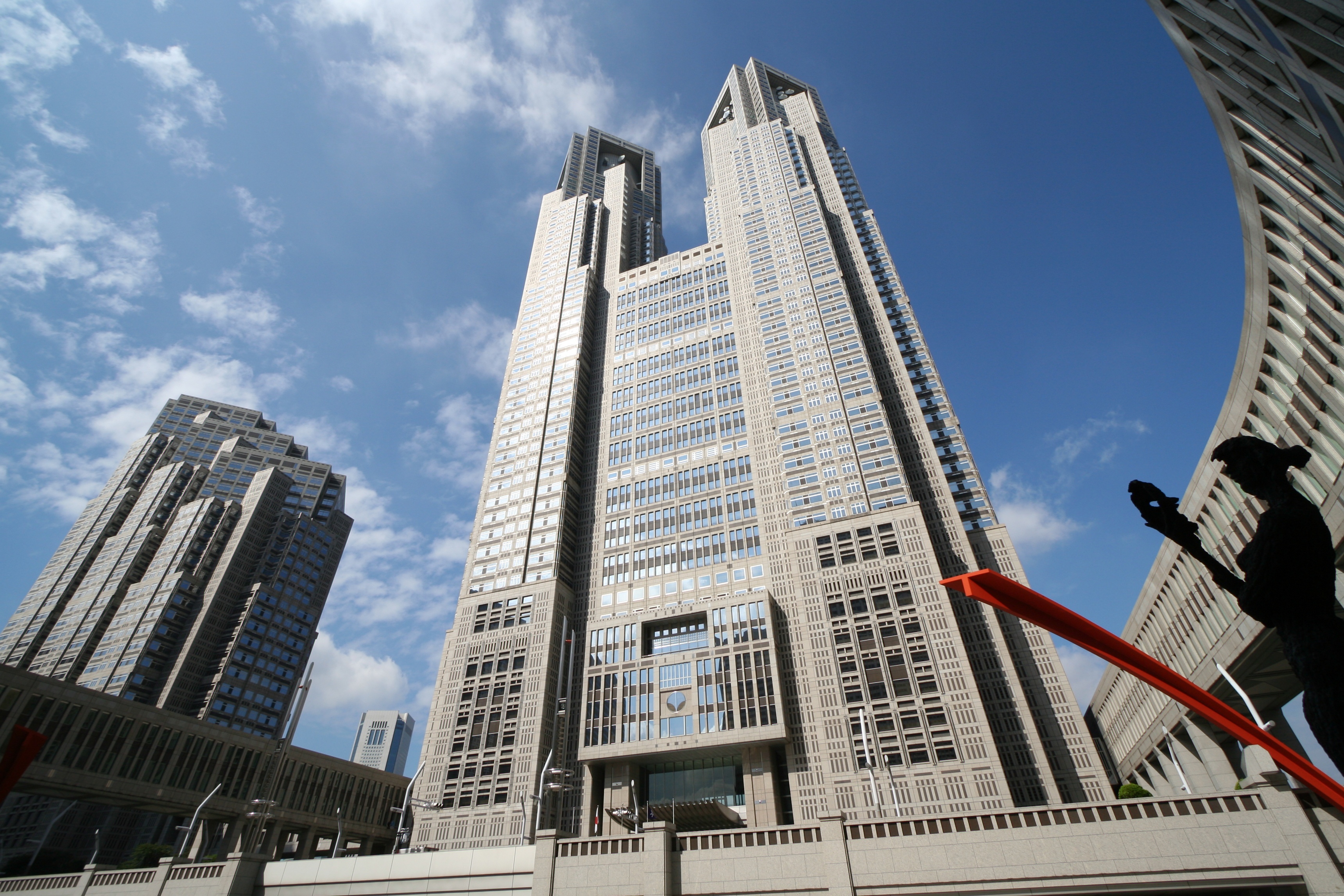
In the Edo period, Kantō became the center of modern development. Within the Greater Tokyo Area and especially the Tokyo-Yokohama metropolitan area, the Kantō plain houses not only Japan's seat of government but also the nation's largest group of universities and cultural institutions, the greatest population and a large industrial zone. Although most of the Kantō plain is used for residential, commercial or industrial construction, some land is still farmed. Rice is the principal crop, although the zone around Tokyo and Yokohama has been landscaped to grow garden produce for the metropolitan market.
A watershed moment of Japan's modern history took place in the late Taishō period: the Great Kantō earthquake of 1923. The quake, which claimed more than 100,000 lives and ravaged Greater Tokyo area, occurred at a time when Japan was still reeling from the economic recession in reaction to the high-flying years during World War I.
After the earthquake, many people in Kantō started creating art with different varieties of colors. They made art of earthquake and small towns to symbolize the small towns destroyed in the quake.
Operation Coronet, part of Operation Downfall, the proposed Allied invasion of Japan during World War II, was scheduled to land on the Kantō Plain.
Subdivisions
North and south
The most often used subdivision of the region is dividing it to "North Kantō", consisting of Ibaraki, Tochigi, and Gunma prefectures, and "South Kantō", consisting of Saitama (sometimes classified North), Chiba, Tokyo Metropolis (sometimes singulated), and Kanagawa prefectures. South Kantō is often regarded as synonymous with the Greater Tokyo Area. As part of Japan's attempts to predict earthquakes, an area roughly corresponding to South Kantō has been designated an 'Area of Intensified Observation' by the Coordinating Committee for Earthquake Prediction.
The Japanese House of Representatives' divides it into the North Kantō electorate which consists of Ibaraki, Tochigi, Gunma, and Saitama prefectures, Tokyo electorate, and the South Kantō electorate which consists of Chiba, Kanagawa, and Yamanashi prefectures (note that Yamanashi is out of the Kantō region in the orthodox definition).
Keirin's South Kantō consists of Chiba, Kanagawa, and Shizuoka prefectures.
East and west
This division is not often but sometimes used.
- East Kantō: Ibaraki, Tochigi, and Chiba prefectures.
- West Kantō: Gunma, Saitama, Tokyo, Kanagawa (and sometimes Yamanashi) prefectures.
Inland and coastal
This division is sometimes used in economics and geography. The border can be modified if the topography is taken for prefectural boundaries.
- Inland Kantō: Tochigi, Gunma, Saitama (and sometimes Yamanashi) prefectures.
- Coastal Kantō: Ibaraki, Chiba, Tokyo, and Kanagawa prefectures.
Greater Kantō
The Japanese national government defines the National Capital Region as the Kantō region plus Yamanashi Prefecture. Japan's national public broadcaster NHK uses Kantō-kō-shin-etsu involving Yamanashi, Nagano, and Niigata prefectures for regional programming and administration.
Cities
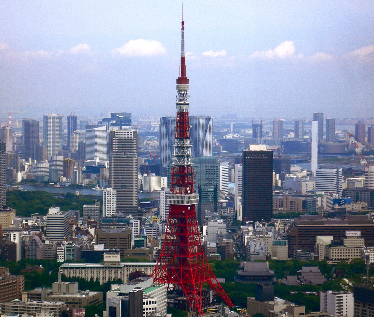
The Kantō region is the most highly developed, urbanized, and industrialized part of Japan. Tokyo and Yokohama form a single industrial complex with a concentration of light and heavy industry along Tokyo Bay. Other major cities in the area include Kawasaki (in Kanagawa Prefecture); Saitama (in Saitama Prefecture); and Chiba (in Chiba Prefecture). Smaller cities, farther away from the coast, house substantial light and automotive industries. The average population density reached 1,192 persons per square kilometer in 1991.
Economy
The Kantō region largely corresponds to the Tokyo Metropolitan Area with the exception that it does not contain Yamanashi prefecture.
The Tokyo Metropolitan Area has the largest city economy in the world and is one of the major global center of trade and commerce along with New York City, Los Angeles, Shanghai, Paris, Seoul, and London.
Greater Tokyo Area 2005
- 2005 average exchange rate (1 U.S. Dollar = 110.22 Yen)
| Prefecture | Gross Prefecture Product | |
|---|---|---|
| (in billion Yen) | Gross Prefecture Product | |
| (in billion US$) | ||
| Tokyo | 92,269 | 837 |
| Kanagawa | 31,184 | 282 |
| Saitama | 20,650 | 187 |
| Chiba | 19,917 | 180 |
| Ibaraki | 10,955 | 99 |
| Tochigi | 8,195 | 74 |
| Gunma | 7,550 | 68 |
Source平成19年度県民経済計算
GDP (purchasing power parity)
The agglomeration of Tokyo is the world's largest economy, with the largest gross metropolitan product at purchasing power parity (PPP) in the world according to a study by PricewaterhouseCoopers.
Kanto Region Metropolitan Employment Area
| Year | 2010 | 1995 | 1980 | Employed Persons 000's | Production (billion USD) | Production Manufacturing (billion USD) | Private Capital Stock (billion USD) | Social Overhead Capital (billion USD) | 1 U.S. Dollar (Japanese yen) |
|---|---|---|---|---|---|---|---|---|---|
| 16,234 | 16,381 | 12,760 | |||||||
| 1,797 | 1,491 | 358 | |||||||
| 216 | 476 | 159 | |||||||
| 3,618 | 2,631 | 368 | |||||||
| 1,607 | 1,417 | 310 | |||||||
| 87.780 | 94.060 | 226.741 |
Population
| 1920 | 11,127,000 | 1930 | 13,773,000 | 1940 | 16,866,000 | 1950 | 18,241,000 | 1960 | 23,003,000 | 1970 | 29,496,000 | 1980 | 34,896,000 | 1990 | 38,542,000 | 2000 | 40,433,711 | 2010 | 42,604,085 |2020|43,653,441| align = right The population of Kantō region is very similar to that of the Greater Tokyo Area except that it does not contain Yamanashi Prefecture and contains the rural populations throughout the region.
Per Japanese census data, and the Kantō region's data, population has continuously grown but the population growth rate has slowed since early 1992.
The Kantō region at the 2020 census had a population of 43.65 million people.
References
- "県民経済計算(平成23年度 - 令和2年度)(2008SNA、平成27年基準計数)<47都道府県、4政令指定都市分>".
- Nussbaum, Louis-Frédéric. (2005). "''Kanto''" in {{Google books. p2QnPijAEmEC. ''Japan Encyclopedia'', pp. 478–479
- "政府統計の総合窓口". E-stat.go.jp.
- Saitama prefectural government: [https://www.pref.saitama.lg.jp/a0101/kanto/index.html Kantō regional governors' association] (in Japanese)
- Chiba prefectural government: [https://www.pref.chiba.lg.jp/seisaku/kouiki/kantouchiji.html Kantō regional governors' association] (in Japanese)
- MLIT: [https://www.ktr.mlit.go.jp/index.htm Kanto Regional Development Bureau] (in Japanese)
- METI: [https://www.kanto.meti.go.jp/ Kanto Bureau of Economy, Trade and Industry], [https://www.kanto.meti.go.jp/annai/annai_index.html Organizational overview] {{Webarchive. link. (June 6, 2020 (in Japanese))
- National Police Agency: [https://www.kanto.npa.go.jp/ Kantō regional police supervision office], [https://www.kanto.npa.go.jp/about/syoukai08.html Jurisdiction] (in Japanese)
- "徳川家康の新領国に対する家臣団配置―小田原落城直後の上総の一動向―". 歴史手帳.
- (1991). "大多喜町史".
- (1968). "高崎市史 Volume 1". 高崎市.
- 館林市史編さん委員会. (2016). "館林市史 通史編2 近世館林の歴史". 館林市.
- (2000). "日本史要覧". 山川出版社.
- "旧子持村地区の文化財". 渋川市.
- [[Edmond Papinot. Papinot, Edmond]]. (2003). [http://www.unterstein.net/Toyoashihara-no-Chiaki-Nagaioaki-no-Mitsuho-no-Kuni/NobiliaireJapon.pdf ''Nobiliare du Japon'' -- Okudaira, p. 47]; Papinot, Jacques Edmond Joseph. (1906). ''Dictionnaire d’histoire et de géographie du Japon''. (in French/German).
- (2002). "南佐久郡誌". 南佐久郡誌刊行会.
- (2019). "牧野駿河守家(まきのするがのかみけ)". 前橋市.
- (2023). "菅沼定利墓碑". Takasaki City.
- (2012). "上 野 国 ・ 戦 国 時 代 そ の 5 戦 国 末 期 か ら 徳 川 政 権 へ". Incorporated Administrative Agency Japan Water Agency Gunma Canal.
- (1978). "角川日本地名大辞典: 栃木県". 角川書店.
- (2007). "関ヶ原合戦と大坂の陣". 吉川弘文館.
- (2008). "[新訳]名将言行録: 大乱世を生き抜いた192人のサムライたち". PHP研究所.
- Papinot, [http://www.unterstein.net/Toyoashihara-no-Chiaki-Nagaioaki-no-Mitsuho-no-Kuni/NobiliaireJapon.pdf p. 50.]
- (1980). "小山市史: Kinsei". 小山市.
- (1996). "千葉県の歴史: 別編, Volume 6". 千葉県.
- (1969). "真田幸村". グーテンベルク.
- "土岐氏の経歴".
- (1978). "角川日本地名大辞典: 千葉県". 角川書店.
- "佐倉藩 日本大百科全書(ニッポニカ)".
- "佐倉藩 世界大百科事典 第2版". 平凡社.
- "家康の関東支配と上総武士の去就 (2) 三浦監物の町域支配 大網村(大網白里町史) 大網白里市/大網白里市デジタル博物館(ADEAC所収)".
- (1988). "図說笠間市史: 市制三十周年記念". 笠間市.
- (1997). "利根川の歴史: 源流から河口まで". 近代文芸社.
- (1978). "幕藩制国家成立過程の硏究: 寬永期を中心に". 吉川弘文館.
- (1987). "新編埼玉県史: Kinsei". 埼玉県.
- (1989). "武蔵国藩史総覧". 聚海書林.
- (1974). "町田市史, Volume 1". 町田市.
- (2001). "地方都市の風格: 歴史社会学の試み". 東京創元社.
- (1983). "日本史文献年鑑". 柏書房.
- [[#Adam. Sadler]], p. 164.
- (2023). "徳川家康は泣く泣く江戸に行ったのではなく、実は前向きだった". 渡邊大門 無断転載を禁じます。 © LY Corporation.
- (2022). "だから織田と豊臣はあっさり潰れた…徳川家康が「戦国最後の天下人」になれた本当の理由". PRESIDENT Inc.
- [http://cidbimena.desastres.hn/docum/crid/Mayo2004/pdf/spa/doc11817/doc11817.htm Avances en prevención de desastres sísmicos en Japón. Outline of countermeasures for the Tōkai earthquake (Section B)] {{webarchive. link. (2011-07-20 N Honda, published March 1994, accessed 2011-03-25)
- "The Kanto region {{!}} Japan Experience".
- "Annual Average Exchange Rate".
- "City Mayors reviews the richest cities in the world in 2005".
- Yoshitsugu Kanemoto. "Metropolitan Employment Area (MEA) Data". Center for Spatial Information Science, The [[University of Tokyo]].
- [[Greater Tokyo Area. Tokyo MEA]]
- "Tōkyō (Japan): Prefecture, Major Cities & Towns - Population Statistics, Maps, Charts, Weather and Web Information".
- "Japan Prefectures Population from 1920 and Area".
- "Population Census 2020".
This article was imported from Wikipedia and is available under the Creative Commons Attribution-ShareAlike 4.0 License. Content has been adapted to SurfDoc format. Original contributors can be found on the article history page.
Ask Mako anything about Kantō region — get instant answers, deeper analysis, and related topics.
Research with MakoFree with your Surf account
Create a free account to save articles, ask Mako questions, and organize your research.
Sign up freeThis content may have been generated or modified by AI. CloudSurf Software LLC is not responsible for the accuracy, completeness, or reliability of AI-generated content. Always verify important information from primary sources.
Report