From Surf Wiki (app.surf) — the open knowledge base
Gwinear–Gwithian
Coastal civil parish in west Cornwall, England
Coastal civil parish in west Cornwall, England
| Field | Value |
|---|---|
| official_name | Gwinear–Gwithian |
| civil_parish | Gwinear–Gwithian |
| country | England |
| region | South West England |
| coordinates | |
| unitary_england | Cornwall |
| shire_county | Cornwall |
| population | 3668 |
| population_ref | (2021 census) |
| static_image | Sands at Gwithian - geograph.org.uk - 186462.jpg |
| static_image_caption | Beach at Gwithian |
Gwinear–Gwithian () is a coastal civil parish in west Cornwall, England, United Kingdom. It includes the villages of Connor Downs, Gwinear, Gwithian, Reawla and Rosewarne. The parish is situated approximately two miles (3 km) east of Hayle two miles (3 km) west of Camborne.
For the purposes of local government Gwinear–Gwithian has a parish council and elects councillors every four years. The principal local authority is Cornwall Council. The population of the parish was 3032 in the 2001 census. This included Fraddam and increased to 3,261 at the 2011 census. An electoral ward also exists with St. Erth added to the name. The population here in 2011 was 4,642.
Notable buildings in Gwinear
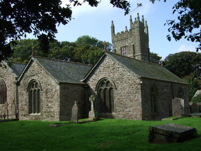
The parish church of St Gwinear is a Grade I listed building. It dates from the 13th and 14th centuries, the tower being mid-fifteenth century, built in three stages out of granite stone. There are three aisles: the south aisle which is shorter than the nave, an inner north aisle, and further north the Arundell Aisle. The chancel was restored in 1870 and further restoration occurred between 1878 and 1879. The aisle and roofs were restored, with the four new roofs costing £689. A new window was added at the west end of the south aisle. The chancel screen was repaired and re-erected in its original position, enclosing the western bay of the chancel. New seating of pitch pine was provided. The church was reopened on 25 November 1879 and the new ring of bells were rung for the first time two months later.
Lanyon Farm and Polkinghorne Farm (both less than a mile from Gwinear Road Station) are both of the 17th century.
Language
Gwinear was surveyed for the Survey of English Dialects.
References
References
- Ordnance Survey: Landranger map sheet 203 ''Land's End'' {{ISBN. 978-0-319-23148-7
- 2001 UK census
- "Combined civil parish population 2011 census".
- "Electoral ward population census 2011".
- {{National Heritage List for England entry
- (22 May 1879). "Gwinear". The Cornishman.
- (4 December 1879). "Re-opening of Gwinear Church". The Cornishman.
- (29 January 1880). "Gwinear". The Cornishman.
- Pevsner, N. (1970) Cornwall, 2nd ed. Penguin Books; pp. 78-79
- (8 September 1970). "Eighty-eight ways of saying left-handed". The Times.
This article was imported from Wikipedia and is available under the Creative Commons Attribution-ShareAlike 4.0 License. Content has been adapted to SurfDoc format. Original contributors can be found on the article history page.
Ask Mako anything about Gwinear–Gwithian — get instant answers, deeper analysis, and related topics.
Research with MakoFree with your Surf account
Create a free account to save articles, ask Mako questions, and organize your research.
Sign up freeThis content may have been generated or modified by AI. CloudSurf Software LLC is not responsible for the accuracy, completeness, or reliability of AI-generated content. Always verify important information from primary sources.
Report