From Surf Wiki (app.surf) — the open knowledge base
Gulf of Cádiz
Arm of the Atlantic Ocean

Arm of the Atlantic Ocean
| Field | Value |
|---|---|
| name | Gulf of Cádiz |
| image | NATO Special Operations Forces jump to a submarine, Gulf of Cadiz, Trident Juncture 15 (22128988483).jpg |
| image_bathymetry | Golfo de Cádiz.jpg |
| caption_bathymetry | Map showing the Gulf of Cádiz. |
| location | Atlantic Ocean |
| depth | 200 to |
| coords | |
| countries | Spain and Portugal |
|max-depth=
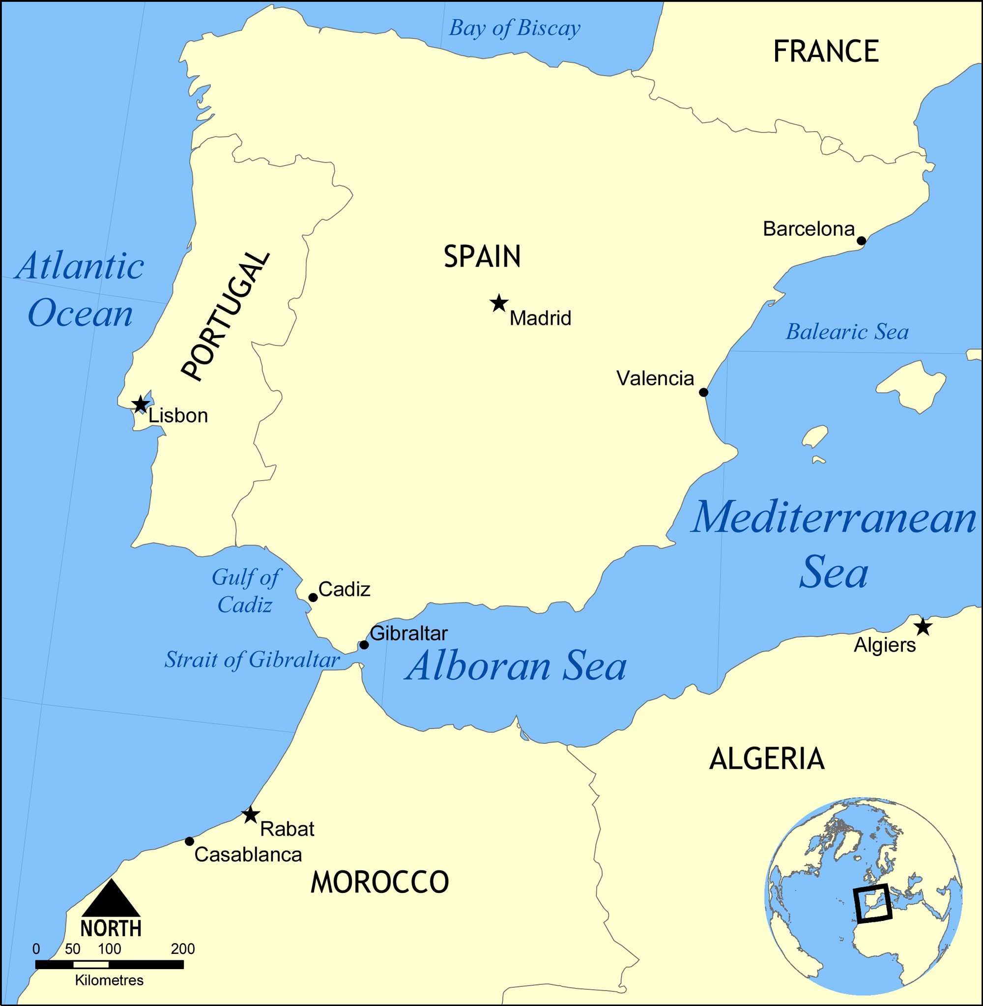
The Gulf of Cádiz (, ) is the arm of the Atlantic Ocean between Cabo de Santa Maria, the southernmost point of mainland Portugal; and Cape Trafalgar on the Spanish coast at the western end of the Strait of Gibraltar. Two major rivers, the Guadalquivir and the Guadiana, as well as smaller rivers, like the Odiel, the Tinto, and the Guadalete, reach the ocean here.
The Gulf of Cádiz is located in the north-eastern Atlantic Ocean between 34°N and 37°15′N and 6°W to 9°45′W. It is enclosed by the southern Iberian and northern Moroccan margins, west of Strait of Gibraltar.
Geology
The geological history of the Gulf of Cádiz is intimately related to plate tectonic interaction between Southern Eurasia and North Africa and is driven by two major mechanisms:
- subduction associated with the westward emplacement of the Gibraltar Arc and formation of the Gulf of Cádiz accretionary wedge. The current activity of the subduction is unclear, with some advocating ongoing active subduction. Others suggest that subduction is inactive and that a new plate boundary has recently formed along a series of prominent WNW–ESE trending lineaments acting as a dextral strike-slip (transform) plate boundary.
- oblique lithosphere collision between Iberia and Nubia. Oblique convergence between Africa (Nubia) and Iberia (Eurasia) occurs here at about 4 mm per year in a NW–SE direction. Some have suggested this may also be causing active thrusting in the Gulf of Cádiz.

It is now well established that the whole area is under compressive deformation and that mud volcanism and processes associated with the escape of hydrocarbon-rich fluids sustain a broad diversity of chemosynthetic assemblages. The accretionary wedge formed by subduction represents an extensive area which encompasses over forty mud volcanoes (a type of cold seep), at depths ranging from 200 to (confirmed by coring), and active methane seepage has been documented on several locations.
Biota
The occurrence of chemosymbiotic biota in the extensive mud volcano fields of the Gulf of Cádiz was first reported in 2003. There were found mainly pogonophoran worms, but also gastropods and bivalves, polychaetes, crustaceans and echinoderms. There were also recorded dead corals of genera Madrepora and Lophelia. The chemosymbiotic bivalves collected from the mud volcanoes of the Gulf of Cádiz were reviewed in 2011. There were reported the following species of chemosymbiotic bivalves of Solemyidae: Acharax gadirae, Solemya elarraichensis; Mytilidae: Bathymodiolus mauritanicus, Idas sp.; Lucinidae: Lucinoma asapheus; Thyasiridae: Thyasira vulcolutre, Spinaxinus sentosus; Vesicomyidae: Isorropodon perplexum, Isorropodon megadesmus, Callogonia cyrili, Christineconcha regab, Laubiericoncha chuni and Pliocardia sp. There is high degree of endemism within chemosymbiotic bivalve assemblages.
References
References
- (2011). "Chemosymbiotic bivalves from the mud volcanoes of the Gulf of Cadiz, NE Atlantic, with descriptions of new species of Solemyidae, Lucinidae and Vesicomyidae". [[ZooKeys]].
- (2012). "The Gibraltar subduction: A decade of new geophysical data". Tectonophysics.
- (2002). "Evidence for active subduction beneath Gibraltar". Geology.
- (2009). "The quest for NW Africa–SW Eurasia plate boundary west of Gibraltar". Earth and Planetary Science Letters.
- (2006). "Kinematics of the Iberia– Maghreb plate contact from seismic moment tensors and GPS observations". Tectonophysics.
- (2011). "New GPS constraints on active defor- mation along the Africa–Iberia plate boundary". Earth and Planetary Science Letters.
- (2012). "Evidence for active strike-slip faulting along the Eurasia-Africa convergence zone: Implications for seismic hazard in the southwest Iberian margin". Geology.
- (2003). "Mud volcanism in the Gulf of Cadiz: results from the TTR-10 cruise". Marine Geology.
This article was imported from Wikipedia and is available under the Creative Commons Attribution-ShareAlike 4.0 License. Content has been adapted to SurfDoc format. Original contributors can be found on the article history page.
Ask Mako anything about Gulf of Cádiz — get instant answers, deeper analysis, and related topics.
Research with MakoFree with your Surf account
Create a free account to save articles, ask Mako questions, and organize your research.
Sign up freeThis content may have been generated or modified by AI. CloudSurf Software LLC is not responsible for the accuracy, completeness, or reliability of AI-generated content. Always verify important information from primary sources.
Report